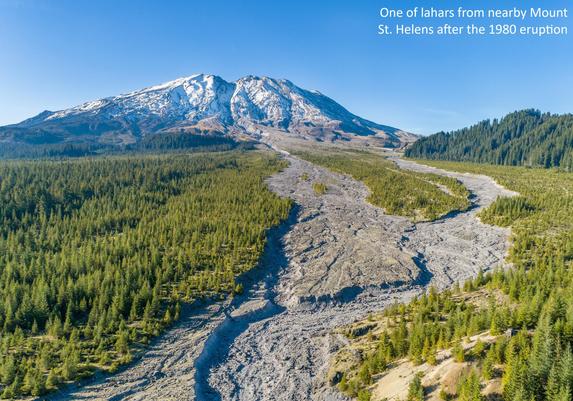
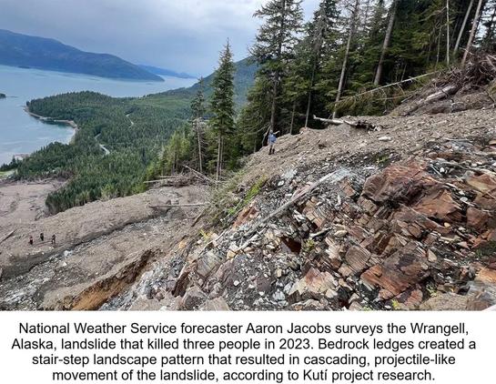
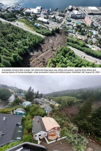
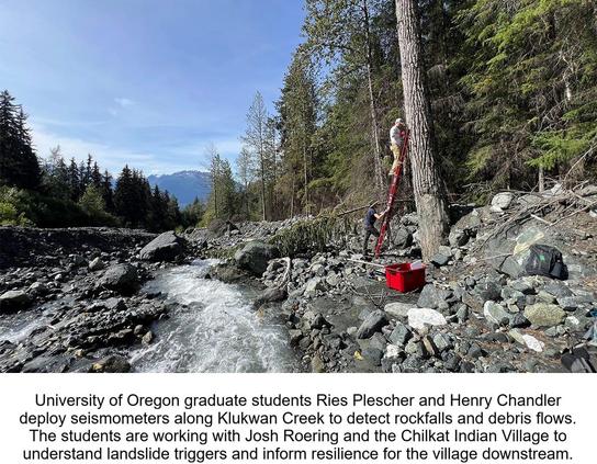
WILDFIRES SCAR LANDSCAPES, LEAVING BEHIND A HAUNTING THREAT OF MUD AND ROCK

Wildfires make land unstable, leading to mudslides and rock flows when it rains. This affects homes and roads near burned forests.

#WildfireAftermath, #MudslideRisk, #ForestFires, #ClimateChangeImpact, #DebrisFlow

https://newsletter.tf/wildfires-cause-mudslides-after-rain-in-burned-areas/

Wildfires Cause Mudslides After Rain in Burned Areas

Wildfires make land unstable, leading to mudslides and rock flows when it rains. This affects homes and roads near burned forests.

NewsletterTF

After wildfires, rain can cause dangerous mudslides. This is a bigger problem now because wildfires are happening more often.

#WildfireAftermath, #MudslideRisk, #ForestFires, #ClimateChangeImpact, #DebrisFlow
https://newsletter.tf/wildfires-cause-mudslides-after-rain-in-burned-areas/

Wildfires Cause Mudslides After Rain in Burned Areas

Wildfires make land unstable, leading to mudslides and rock flows when it rains. This affects homes and roads near burned forests.

NewsletterTF
Influence Of Modeling Assumptions On Pedestrian Evacuation Success For Non-Eruptive Lahar Hazards At Mount Rainier, Washington
--
https://doi.org/10.1016/j.ijdrr.2026.106132 <-- shared paper
--
https://www.sciencebase.gov/catalog/item/697ba3e5b66b0197c3043d2f <-- shared, related open data source
--
[I still remember working on and being fascinated by lahars being an engineering geologist in Washington State (and from my time studying in New Zealand), although (of course) not to this level of detail/focus]
#volcano #lahar #evacuation #exposure #model #modeling #engineeringeology #risk #hazard #naturalhazard #MountRainer #Washington #USA #spatialanalysis #spatiotemporal #emergencymanagement #GIS #spatial #mapping #publicsafety #hazardzone #vulcanism #downstream #debrisflow #massmovement #monitoring #detection #geostatistics #demographics #atrisk #fedscience #publicgood #fedservice #opendata
@USGS