🚨 talk announcement! 🚨

How does the geological record form?

We can observe modern depositional environments using advanced remote sensing and direct sampling.
We can observe geological strata through seismics, drillcores, and direct sampling.

What happens in between?

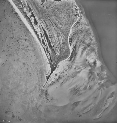
Xianyi Liu in my team is trying to find out, using the oldest known aerial photographs of the #Bahamas, and comparing them with today's facies distribution. It's a journey through #carbonate #sedimentology, #GIS, modelling and #MachineLearning. If you'd like a sneak peek, join his talk coming Tuesday at 17:00 CET at PaleoPERCS.
Please register at https://paleopercs.com/ - you get a Zoom link when you've registered.
#EarthScience #geoscience #RemoteSensing #geology
If anyone can share or link to an example of the current best practice for creating a standard median image composite with #python from a STAC API, I'd really appreciate it! Things move so fast in this space and I'm not sure if I'm up to date with the current best practice. I want to do some benchmarking and see how my spaghetti code stacks up 🤣. #gis #remotesensing

A colleague of mine is offering a funded PhD position (4 years) in #Metrology of #Skyglow in Switzerland: https://live.solique.ch/metas/de/internet/jobs/PhD-Position-in-Metrology-for-Skyglow-Measurement-and-Monitoring-(4-years-%E2%80%93-100-)--3891747/

And at the same time I'm offering a PhD on #RemoteSensing using nighttime lights: https://jobs.ruhr-uni-bochum.de/jobposting/62065e5be70a916f65edd647cd1b1740b04cd72e0

It's great to see #LightPollution and #Night research being taken seriously by funding agencies!

#AcademicJobs #PhysicsJobs #GeographyJobs #fedihired #getFedihired

PhD Position in Metrology for Skyglow Measurement and Monitoring (4 years – 100%)

The Swiss Federal Institute of Metrology METAS is the reference institute for measurements and measuring instruments in Switzerland. To ensure that a litre is always a litre (e.g. when filling up with petrol), METAS carries out calibrations, conformity assessments and consultations for industry, research and administration. Measurement accuracy creates trust, especially at the social and political level, and is essential in many areas: road traffic, electricity billing, time transmission, measurements in the environmental and health sectors, etc. At METAS, different fields of expertise come together and complement each other – and have done so since 1862. <br><br><b>Project & Position Overview:</b> The research project

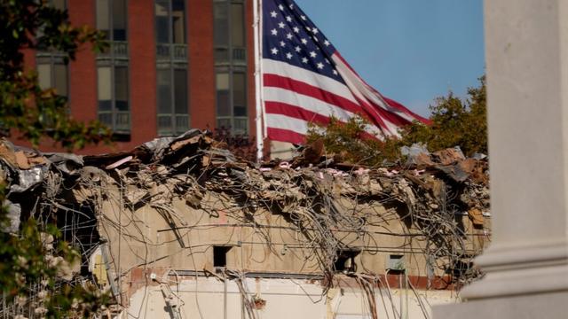
Satellite shows what’s really happening at the East Wing of the White House https://arstechni.ca/V9LX #earthobservation #remotesensing #DonaldTrump #planetlabs #WhiteHouse #Science #Space
Satellite shows what’s really happening at the East Wing of the White House

“Now it looks like the White House is physically being destroyed.”…

Ars Technica
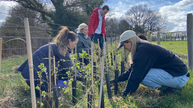
The East Sussex & Brighton Hove Local Nature Recovery Strategy consultation is open. Have your say.
Lots of proposed actions that will need monitoring. How will that be achieved?
#opendata #remotesensing and #participatoryGIS could play an important part.
https://yourvoice.westsussex.gov.uk/lnrs-east
East Sussex and Brighton & Hove LNRS - Help shape your Local Nature Recovery Strategy

A new strategy to help nature The first Local Nature Recovery Strategy (LNRS) for East Sussex and Brighton & Hove has now been drafted. Informed by the views and expertise of nearly 1,000 local people and organisations, the strategy serves as a vital blueprint to

Your Voice West Sussex
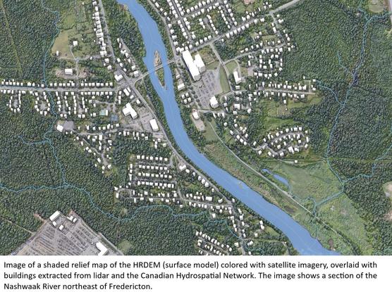
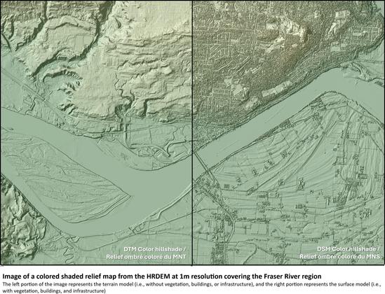
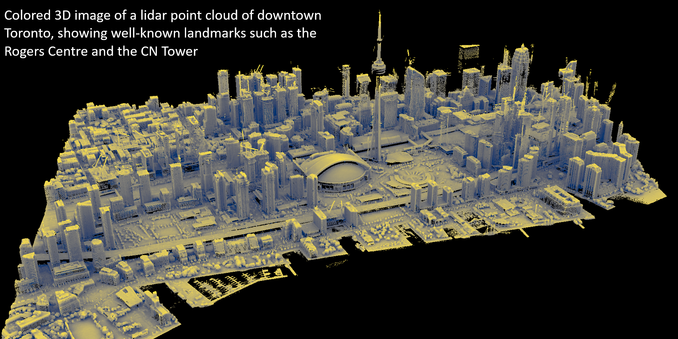
More [Canadian] High-Resolution Lidar [HRDEM] And Elevation Data Now Available
--
https://natural-resources.canada.ca/science-data/science-research/geomatics/more-high-resolution-lidar-elevation-data-now-available <-- shared technical press release
--
“... In this first article, highlights include:
• HRDEM & HRDEM Mosaic - over 709,000 km² of new LiDAR-derived elevation data added since May 2024, increasing coverage by 54%. This product now covers 244 of Canada’s 250 largest cities, and over 95% of the population.
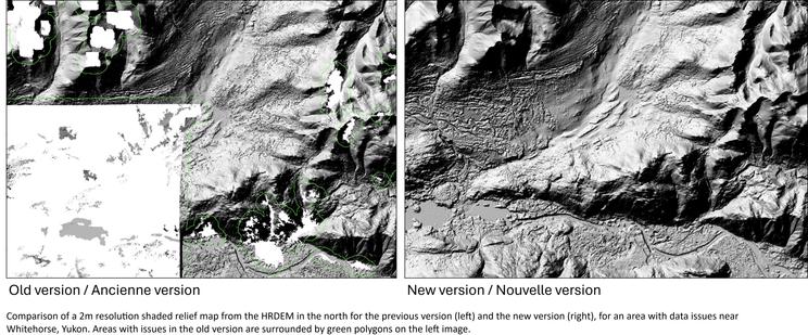
• Northern HRDEM data - fully updated using ArcticDEM v4.1, improving quality for the entire Canadian Arctic.
• Automatically Extracted Buildings - Added 61 new projects and over 2.58 million building footprints, bringing the total to over 13.6 million.
• LiDAR Point Clouds - Expanded by over 200,000 km2, now totalling close to 364,000 km²…”
#GIS #spatial #mapping #Canada #HRDEM #mosaic #LiDAR #elevation #NationalElevationDataStrategy #pointcloud #ArcticDEM #building #footprints #geographic #coverage #progress #opendata #Canadian #arctic #remotesensing #earthobservation #NaturalResourcesCanada
We found some interesting visuals illustrating how well #wildfire damage can be #mapped with #remotesensing when Dr Daniel Hölbling & I undertook a project on the potential of #Sentinel1 to delineate #peatland.
This animation shows in the lined area the effects of the 2018 Winter Hill wildfire in Lancashire & #peatlandrestoration works since.
Our research https://lnkd.in/eaPpipQu
For further peatland mapping research/other nature-based solutions please contact me.
All using the power of #qgis

You might have seen the pictures of the (de-)construction of the #Trump #WhiteHouse. These activities can even be seen from #space with #satellite #RemoteSensing. #Sentinel2 imagery clearly shows a lot of soil being moved around the East Wing. #uspol

Image credit: #Copernicus Programme

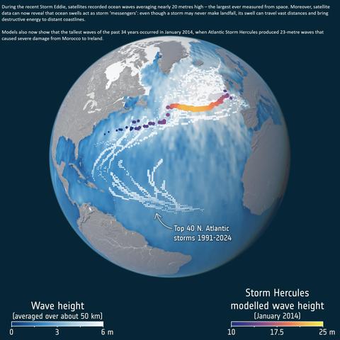
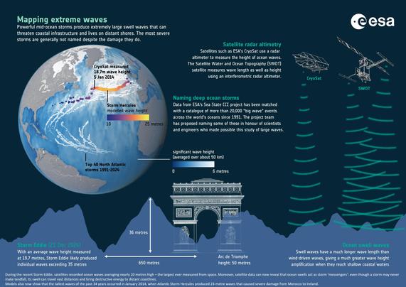
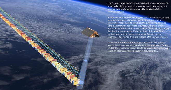
Satellites Reveal The Power Of Ocean Swell
--
https://www.esa.int/Applications/Observing_the_Earth/Space_for_our_climate/Satellites_reveal_the_power_of_ocean_swell <-- shared technical article
--
https://doi.org/10.1073/pnas.2513381122 <-- shared paper
--
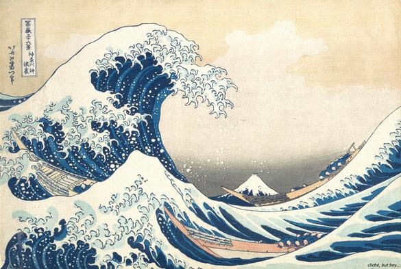
“During recent storms, satellites recorded ocean waves averaging nearly 20 metres high – the largest ever measured from space. Moreover, satellite data now reveal that ocean swells act as storm ‘messengers’ - even though a storm may never make landfall, its swell can travel vast distances and bring destructive energy to distant coastlines...
This record merges data from satellites such as #SARAL, #Jason3, #Copernicus #Sentinel 3A and 3B, Copernicus #Sentinel6 Michael Freilich, #CryoSat and #CFOSAT…”
#GIS #spatial #mapping #remotesensing #earthobservation #satellite #ocean #marine #oceanwaves #waves #swell #storm #extremeweather #risk #hazard #impacts #humanimpacts #coast #coastline #longswells #energy #erosion #weather #longwaves #ESA #ClimateChangeInitiative #CCI #SeaState #meteorology #coastalengineering #mitigation #ESA
@europeanspaceagency