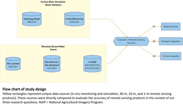
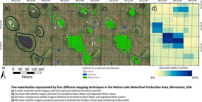
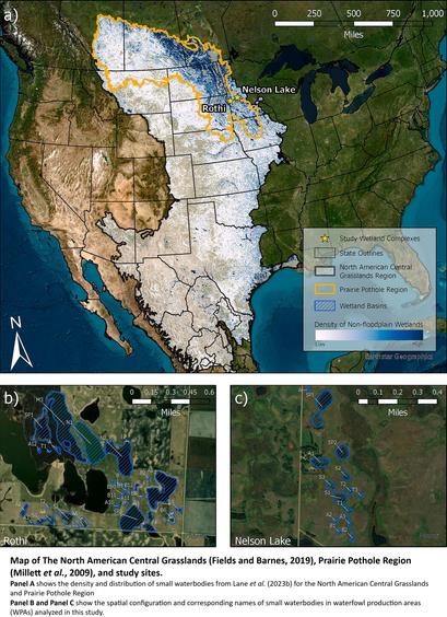
Small Waterbodies Of Large Conservation Concern - Towards An Integrated Approach To More Accurately Measuring Surface Water Dynamics
--
https://doi.org/10.1016/j.ecolind.2025.113525 <-- shared paper
--
“HIGHLIGHTS
• Hydrologic models were used to assess remotely sensed surface water estimates.
• The accuracy of satellite surface water estimates diminished for waterbodies < 2 ha.
• Vegetation reduces accuracy of surface water detection, especially during wet years..."
#GIS #spatial #mapping #waterbodies #Conservation #planning #surfacewater #Hydrologicmodeling #remotesensing #earthobservation #water #hydrology #hydrographic #model #modeling #spatialanalysis #spatiotemporal #waterbody #small #conservation #inventory #monitoring #accuracy #aquatic #vegetation #climate #NorthAmerica #kettle #landforms #landcover #glaciation #prairie #pothole
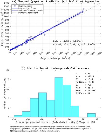
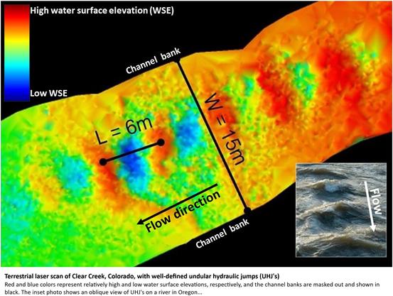
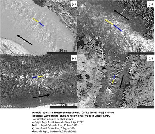
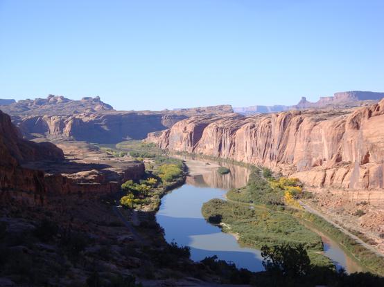
Inferring River Discharge From Google Earth Images - Critical Flow Theory Can Predict River Discharge Based On The Spacing Of Standing Waves Captured By Google Earth Images
--
https://eos.org/editor-highlights/inferring-river-discharge-from-google-earth-images <-- shared technical article
--
https://doi.org/10.1029/2025GL114851 <-- shared paper
--
“… KEY POINTS:
• Standing waves in rivers indicate unique hydraulic conditions that allow depth and velocity to be inferred from the spacing of the waves
• Critical flow theory can be used to calculate discharge based on measurements of wavelength and width made using readily available images
• Discharges estimated via the critical flow approach for 82 images agreed closely with discharges recorded at gaging stations (R² = 0.98)…”
#GIS #spatial #mapping #spatialanalysis #remotesensing #GoogleEarth #CriticalFlowTheory #riverdischarge #standingwaves #gages #gauges #earthobservation #flow #volume #hydraulicjumps #velocity #depth #water #hydrography #hydrology #wavelength #channelwidth #discharge #estimation

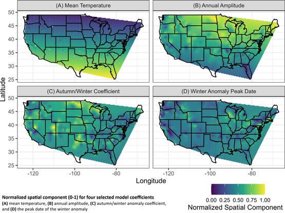
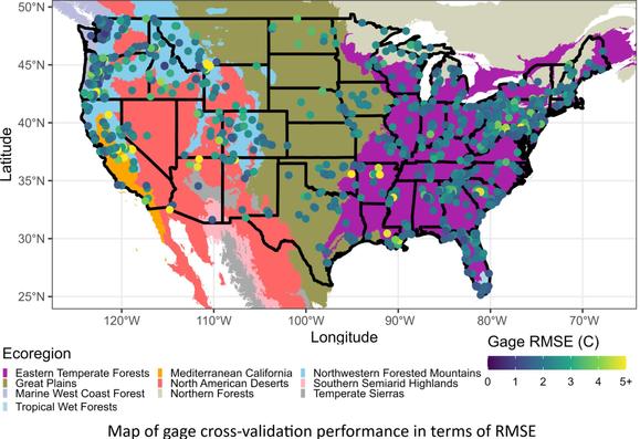
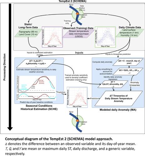
For the last few years, I've been working on making it possible to estimate high-resolution (daily, 1-km) river temperatures anywhere in the contiguous US. I'm delighted to announce that the paper introducing TempEst 2, the first high-resolution, ungaged river temperature model for the CONUS, has just been published in the Journal of Hydrology. TempEst 2 comes with a data retrieval script (Google Earth Engine) and a pretrained model, so you just provide the coordinates for your points of interest - on any stream, any size, urban or less-disturbed, etc - and get estimates with a typical RMSE of 2.0 C. I've found that it's practical to use for up to 10,000 sites or so for a given analysis (though you do need to split the data retrieval into blocks of <1500 sites). The paper also introduces a modeling framework for ungaged rivers called SCHEMA, which takes advantage of highly seasonal conditions to build well-performing models with few coefficients suitable for ungaged coefficient estimation.

Open-access paper (with Claudia R. Corona, Katie Schneider, Ashley Rust, and Terri S. Hogue): https://doi.org/10.1016/j.jhydrol.2025.133321

Model source code and usage information: https://github.com/mines-ciroh/tempest2

Open data: https://doi.org/10.4211/hs.a8b243957f7946e388d10ab206990675

TempEst 2 builds on our work with river temperature seasonality (https://doi.org/10.1111/1752-1688.13228).

#RiverTemperature #hydrology #modeling

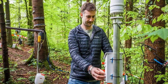
🌳 💦 Research by Marius Floriancic at ETH Zurich's "Waldlabor" confirms the "old water paradox": The majority of water in forest soils is surprisingly old! Five years of unique hydrology experiments reveal water's hidden journey. #Hydrology #ForestResearch

https://ethz.ch/en/news-and-events/eth-news/news/2025/05/old-water-new-insights.html

Old water, new insights

Five years ago, an experiment began at ETH Hönggerberg: researchers set up an outdoor laboratory in the forest near the campus. They used sensors positioned in trees, the soil and in a stream to study water dynamics and the “old water paradox”. ETH News accompanied the head of the experiment, Marius Floriancic.

ETH Zurich
Pretty cool study showing that #isotope #analyses in #primate #teeth can be used to reconstruct the #season of birth and changes in the #hydrology in the animal's environment.
www.sciencedirect.com/science/article/pii/S001670372500287X

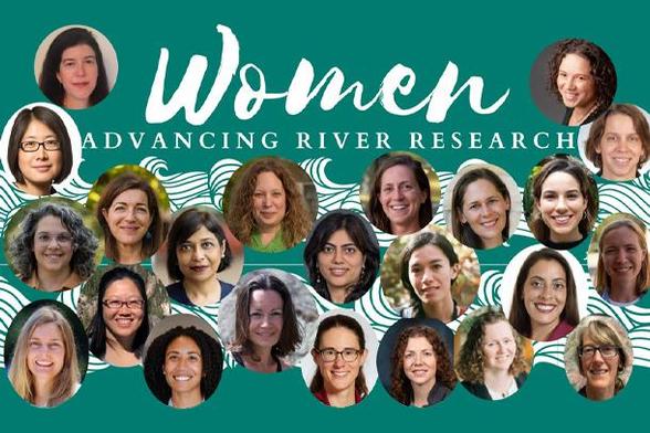
The next event in the Women Advancing River Research webinar series is happening in June.

Visit here for the date and time info, and to review videos from past sessions.

Coming up next: Key Drivers of Carbon Fluxes in Watersheds: Hydro-biogeochemistry, Weathering, and Extreme Events presented by Bryn Stewart, Caltech, U.S. Bhavna Arora, Lawrence Berkeley National Lab, U.S.

🗓️🔗: https://bit.ly/WARR_2024

#hydrology #science #research #ClimateChange

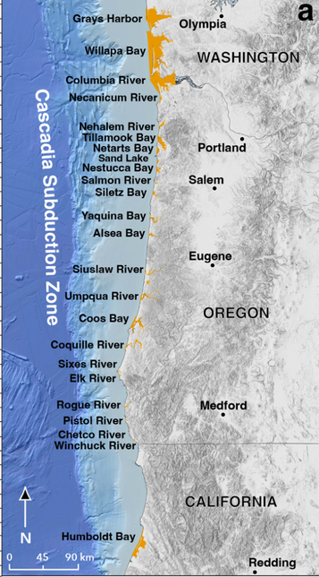
A tsunami that never ends? Study highlights a looming West Coast risk.

“The pressure keeps building below the Earth’s surface off the coast of the Pacific Northwest, and a multi-layered disaster could strike at any time.

“A huge earthquake is brewing along the Cascadia Subduction Zone that could destroy bridges, reshape the landscape and trigger a massive #tsunami. Scientists have known about the looming danger for years, but ongoing #research keeps painting a clearer picture of what could happen.

“Among the dangers: A huge tsunami that will wash over coastal areas and permanently flood them... The quake is a certainty, but could be hundreds of years off...”

We were ruminating about whether it would ever be possible for good governance to mandate the pullback of wealthy coastal property owners.

Insurers rely too much on the billionaires' premiums (and share investments) ever to deny coverage to them, since those companies will always get the less privileged to subsidize landowners' liabilities, and underwriters are certain to get public bailouts after their inexorable losses.

So of course the answer is to defund all research.

#climate #coastalManagement #hydrology #tides #Oregon #floods #insurance #disaster #seismology

https://www.aol.com/tsunami-never-ends-study-highlights-100237539.html
A tsunami that never ends? Study highlights a looming West Coast risk.

The tsunami wave from an anticipated earthquake off the West Coast reach 100 feet and permanently flood parts of the coast.

AOL