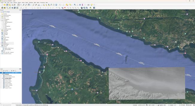
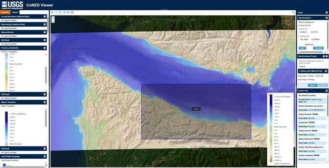
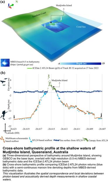
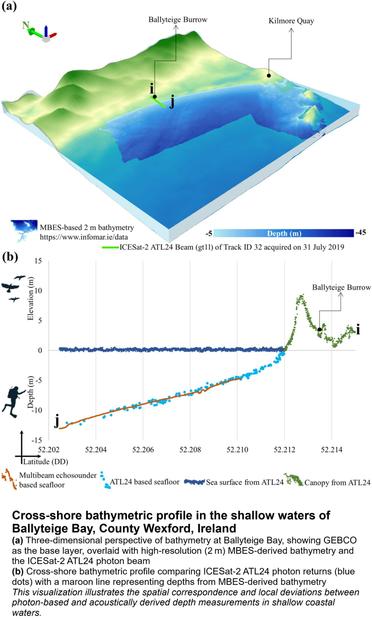
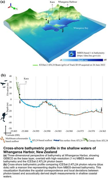
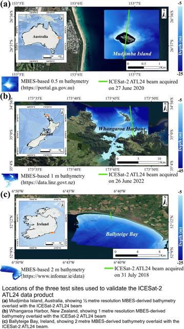
USGS CoNED (TopoBathy) WebMap Viewer & (Open) Data Downloader
--
https://topotools.cr.usgs.gov/topobathy_viewer/ <-- shared #USGS Viewer webmap & download selector
--
https://www.usgs.gov/coastal-changes-and-impacts/coned <-- shared USGS CoNED overview/entry page
--
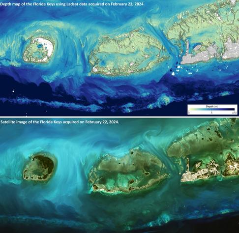
[I used to shore dive in the Straits Of Juan de Fucca, Washington State side, and Crescent Lake - so I chose that area as a CoNED example to explore; good memories, including of the 18 Wheeler Burger with pie & coffee in Joyce, WA on drizzly days]
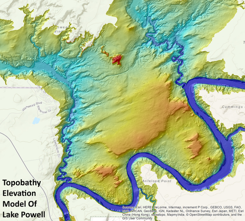
#GIS #spatial #mapping #remotesensing #model #modeling #CoastalNationalElevationDatabase #CoNED #elevation #topography #bathymetry #topobathy #opendata #openscience #fedscience #publicgood #usecase #naturalworld #coastal #coast #depth #hydrospatial #hydrography #download #shoreline #inundation #sedimenttransport #sealevelrise #SLR #stormsurge #models #modeling #extremeweather #tsunami #impact #risk #hazard #assessment #climatechange #geomorphology #geomorphometry #Restoration, #redevelopment #protection #cliff #flood #flooding #webmap
@USGS
--
https://topotools.cr.usgs.gov/topobathy_viewer/ <-- shared #USGS Viewer webmap & download selector
--
https://www.usgs.gov/coastal-changes-and-impacts/coned <-- shared USGS CoNED overview/entry page
--
[I used to shore dive in the Straits Of Juan de Fucca, Washington State side, and Crescent Lake - so I chose that area as a CoNED example to explore; good memories, including of the 18 Wheeler Burger with pie & coffee in Joyce, WA on drizzly days]
#GIS #spatial #mapping #remotesensing #model #modeling #CoastalNationalElevationDatabase #CoNED #elevation #topography #bathymetry #topobathy #opendata #openscience #fedscience #publicgood #usecase #naturalworld #coastal #coast #depth #hydrospatial #hydrography #download #shoreline #inundation #sedimenttransport #sealevelrise #SLR #stormsurge #models #modeling #extremeweather #tsunami #impact #risk #hazard #assessment #climatechange #geomorphology #geomorphometry #Restoration, #redevelopment #protection #cliff #flood #flooding #webmap
@USGS