#Update für basemap.de Web Raster und P10 Raster (Q2-2026). Mehr Infos: https://www.bkg.bund.de/SharedDocs/Produktinformationen/BKG/DE/P-2026/260413_basemap-de-Raster_P10.html #basemap

Riccardo Klinger demonstrates how to build an independent #basemap pipeline from #OpenStreetMap data using #GDAL/#OGR and integrate the resulting #vectorTiles into the #Esri ecosystem. Open-source and proprietary tools turn out to complement each other seamlessly.
trip #Graz to Graz via #Schwarzach-St. Veit and #Klagenfurt using EC, IC and RJ 🤗
Map made completely in QGIS, map data by #OpenStreetMap #OSM, #basemap.at and schedule data by #ÖBB
😊
@BKG leider sind die Dienste des #Geodatenzentrum seit Mittwoch Morgen nicht erreichbar ohne das eine verwertbare Information gibt.
🗺️ Die basemap.de Web Raster ist aktualisiert. Die Web-Dienste enthalten nun den Stand der Datenlieferungen der Länder von Juli 2025. Mehr Infos: https://www.bkg.bund.de/SharedDocs/Produktinformationen/BKG/DE/P-2025/251006_basemap-de-Raster.html


The “#BaseMap” from Switzerland’s NMGA #swisstopo is an award-winning interactive cartographic product that integrates data from multiple partners and was recognized with the 2025 #ICA #MapAward. An article by Swisstopo explains how the map was refined through user-feedback and iterative design enhancing mobile #usability and readability.
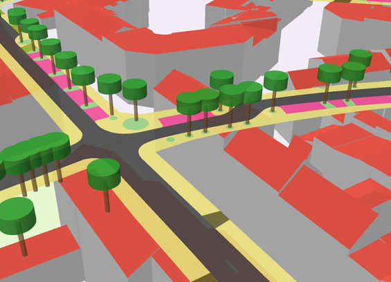
I am working on an online map with MapLibre. The basemap contains 3D buildings. However, these are transparent. You can see other layers through the buildings. Perhaps this can be seen in the screenshot.
The basemap is from basemap.de / @BKG.
Website, including code (German): https://basemap.de/produkte-und-dienste/3d/
Style JSON: https://sgx.geodatenzentrum.de/gdz_basemapde_vektor/styles/bm_web_col.json
Is there a way to remove the transparency?
basemap.world web vector map service for web and mobile devices, developed by the federal and state governments and provided by the Federal Office for Cartography and Geodesy (BKG) of Germany #basemap