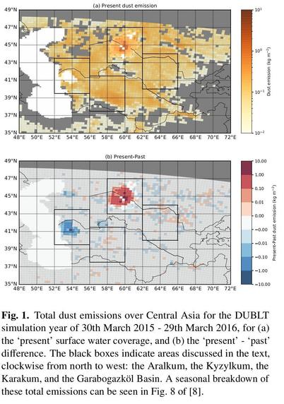
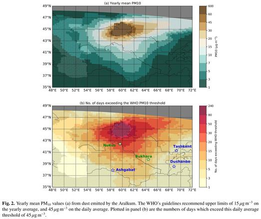
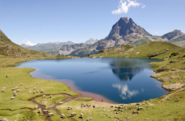
A regional modelling perspective on the impacts on Central Asia of dust emitted from the Aralkum, the desiccated lakebed of the Aral Sea | E3S Web of Conferences
E3S Web of Conferences, open access proceedings in environment, energy and earth sciences
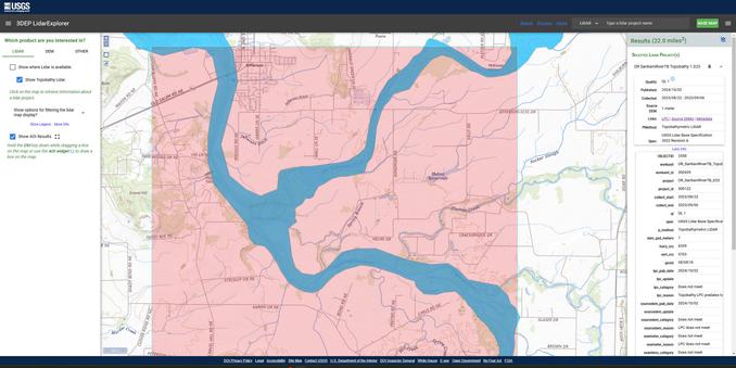
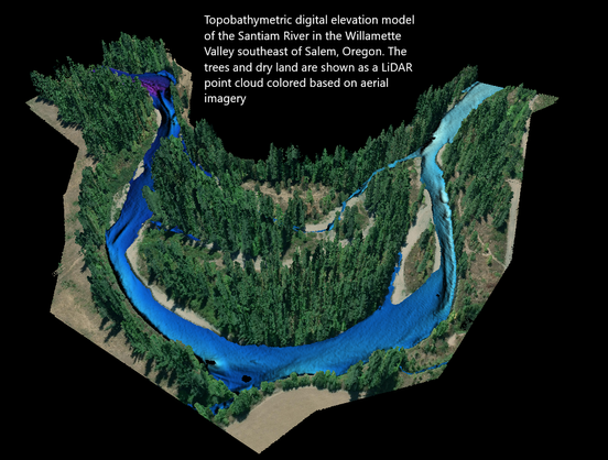
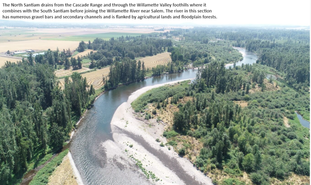
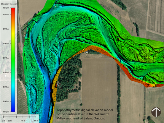
New USGS dataset uncovers the Santiam River’s underwater topography to aid in fish habitat and water flow management | U.S. Geological Survey
A new dataset for the Santiam River in Oregon, published by the U.S. Geological Survey, provides a highly detailed underwater 3D elevation map that will help support fish habitat restoration and flood modeling work.
The 3D National Topography Model Call for Action—Part 1. The 3D Hydrography Program
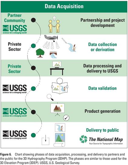
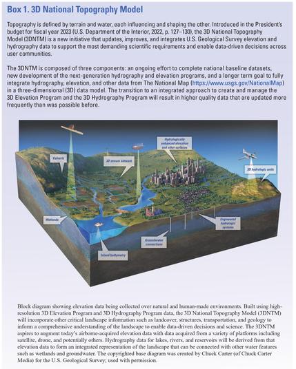
The U.S. Geological Survey is initiating the 3D Hydrography Program (3DHP), the first systematic remapping of the Nation’s surface waters since the original 1:24,000-scale topographic mapping program was active from 1947 to 1992. Building on decades of experience maintaining the National Hydrography Dataset (NHD), the Watershed Boundary Dataset (WBD), and the NHDPlus High Resolution (NHDPlus HR), the 3DHP will completely refresh the Nation’s hydrography data and improve discovery and sharing of water-related data. The design of the 3DHP is based on the results of a study that estimated that the fully implemented program would have the potential to provide more than $1 billion in benefits to Federal, State, Tribal, Territorial, and local governments and to private and nonprofit organizations every year, in addition to myriad societal benefits. The 3DHP would directly support better decision making regarding water resources by providing more accurate, complete, and integrated information than is currently available.The...

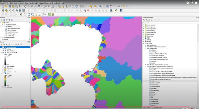
Use QGIS to Delineate Catchments of Streams Flowing into a Lake
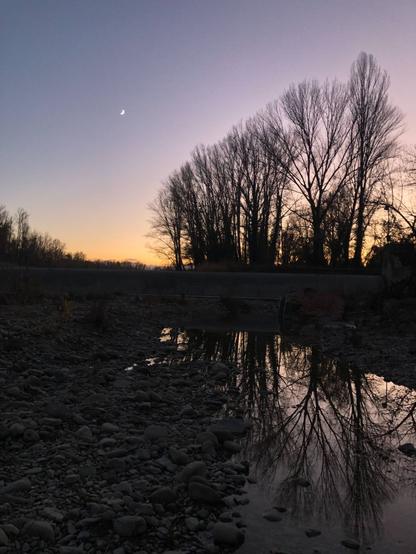
The last days of autumn. Crossing Sillaro stream near Bologna.
#twilight #crescentmoon #silhouettedtrees #reflection #waterbody #nature
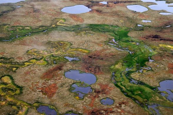
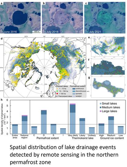
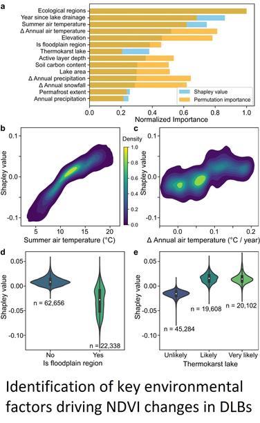
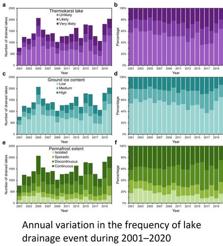
Tracking lake drainage events and drained lake basin vegetation dynamics across the Arctic - Nature Communications
The Arctic is dotted with lakes, including thermokarst lakes highly threatened by climate change. Here, the authors investigate 35 years of lake drainage events and related vegetation trends across the Arctic, finding differences between thermokarst and non-thermokarst lake drainage events.
