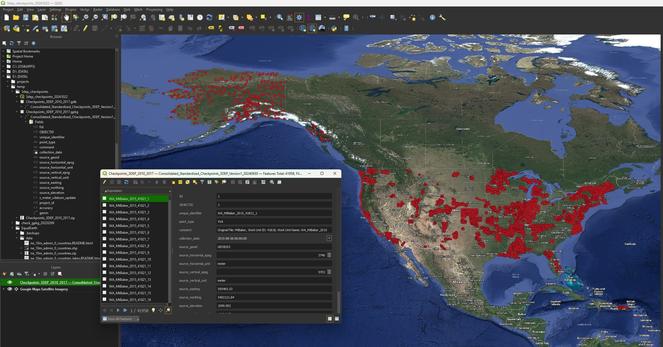
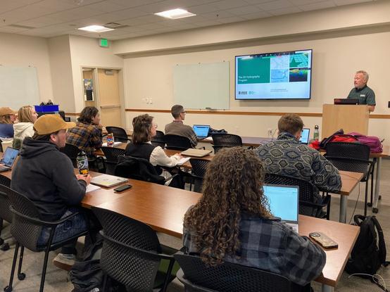
I Am Proud To Be Part Of The Integrated Team Generating and Publishing An Open Data 3DHP Hydrology Spatial Data Product For The Nation At The USGS
--
https://doi.org/10.5066/P148NT7B <-- shared product DOI
--
https://commons.datacite.org/doi.org?query=10.5066%2FP148NT7B <-- shared DateCite repository record
--
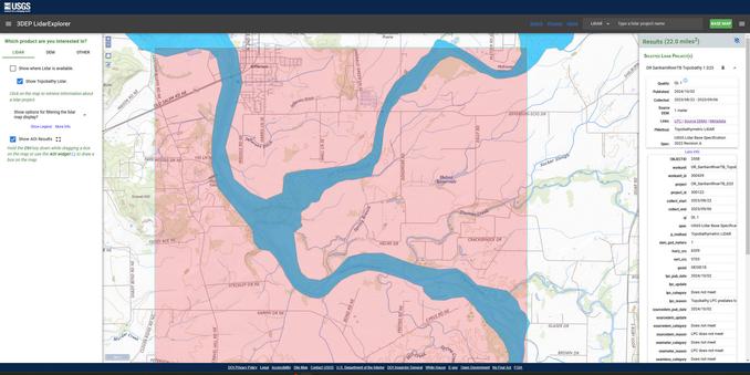
https://3dhp.nationalmap.gov/ <-- 3DHP data is also available via a USGS spatial data service (with select & export capability)
--
[‘my’ first product DOI generation & publication as well ~smile~]
#GIS #spatial #mapping #data #water #hydrology #LiDAR #EDH #elevationderivedhydrography #3DHP #opendata #publicdata #DOI #stagedproducts #3DTNM #3DEP #NHD #national #USA #nonproprietary #waterresources #spatialanalysis #model #modeling #3d #vector #schema #DOI#geopackage #filegeodatabase #metadata #XML
@USGS
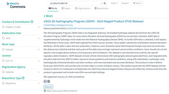
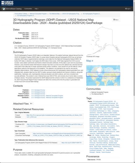
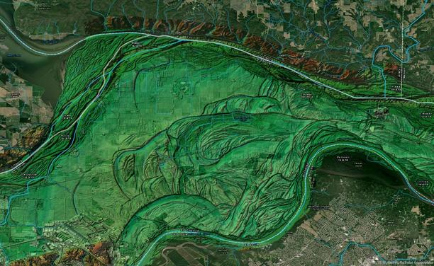
3D Hydrography Program (3DHP) 2024 Staged Product (FY25 Release) - ScienceBase-Catalog

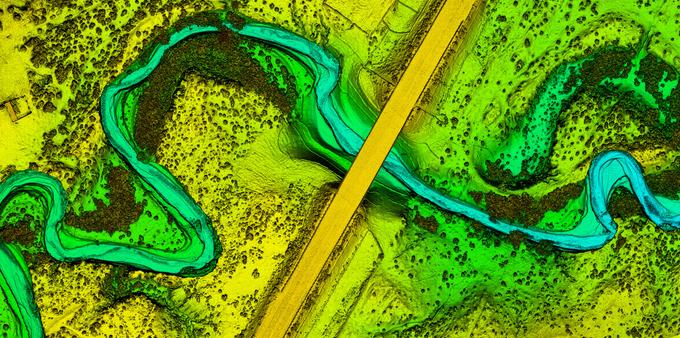
This product is new in federal fiscal year 2025 (FY25), and consists only of vector data in a series of feature classes. The product represents the 3DHP dataset and the schema in which it is contained as of September 30, 2024 Future Annual Staged Product releases will reflect the schema at the time the product is generated and include more EDH-sourced data holdings.

Collaboration Advances Elevation Mapping – USGS EROS And NGTOC Work Together To Map A 1 Metre Digital Elevation Model For A Watershed
--
https://www.usgs.gov/centers/eros/news/collaboration-advances-elevation-mapping <-- shared technical article
--
https://doi.org/10.5066/P1CEPE2M <-- USGS data release, Lower Androscoggin Watershed Hydrologic Unit 8 Seamless 1-m DEM Pilot, 2013 to 2020
--
#GIS #spatial #mapping #remotesensing #LiDAR #water #hydrology #3dep #3dhp #3dtnm #NGTOC #spatialanalysis #elevation #DEM #EROS #seamlessonemeter #Androscoggin #ME #maine #research #integration #watershed #opendata
@USGS | @USGS_EROS
Collaboration Advances Elevation Mapping | U.S. Geological Survey

We can know a place pretty well and still learn something from a map of it. A map showing terrain elevation including rivers and streams, for example, indicates where heavy rainfall will flow or new construction of structures, bridges and roads would be most suitable.

New USGS dataset uncovers the Santiam River’s underwater topography to aid in fish habitat and water flow management | U.S. Geological Survey

A new dataset for the Santiam River in Oregon, published by the U.S. Geological Survey, provides a highly detailed underwater 3D elevation map that will help support fish habitat restoration and flood modeling work. 

Getting Started On Diagramming This Project’s Workflow, ‘Old School’
--
Couple of 10s of pages of data inventory, roles and responsibilities, even the start of a RACI, pot of good black tea – now time to get started on diagramming this project’s workflow, components, interim data products, R&R, development and more #oldschoool, ready for full team involvement – ‘helpers’ notwithstanding!
#GIS #spatial #mapping #opendata #water #hydrology #3dep #edh #3dhp #datadelivery #3dhedit #3dtnm #rolesandresponsibilities #RACI #5W1H #workflow #planning #pm #projectmanagement #integration
Consolidated Standardized Survey-Grade Checkpoints 3DEP 2010 to 2017 [USGS]
--
https://www.sciencebase.gov/catalog/item/67075e6bd34e969edc59c3e7
--
“One of the key aspects of 3DEP data is that data is verified by a collection of certified survey-grade GNSS checkpoints spread throughout each project. These points have always been available but were difficult to find and not standardized. [The USGS] have collated and standardized almost 42,000 of these checkpoints and are making them available for other uses. These points here in this first phase span from 2010-2017, but [the USGS] are in the process of making these available for all [their] projects, and hope to enable them in different ways in the future...”
#GIS #spatial #mapping #USGS #USA #elevation #opendata #remotesensing #LiDAR #ifSAR #3dep #3dhp #water #hydrology #3d #opendata #3dtnm #checkpoint #checkpointdigital #GNS #GPS #NGD #DEM #survey #surveygrade #accuracy #precision #calibration #digital #NGTOC #NAD83
@USGS
Consolidated Standardized Survey-Grade Checkpoints 3DEP 2010 to 2017 - ScienceBase-Catalog

The 3D Elevation Program (3DEP) is managed by the U.S. Geological Survey (USGS) National Geospatial Program to respond to growing needs for high-quality topographic data and for a wide range of other three-dimensional (3D) representations of the Nation's natural and constructed features. 3DEP informs critical decisions that are made across our Nation every day that depend on elevation data, ranging from immediate safety of life, property, and environment to long term planning for infrastructure projects. Lidar, an airborne laser detection technology for mapping features on the ground, is being collected nationwide, while Interferometric Synthetic Aperture Radar (IfSAR) is being collected over Alaska. Assessing the accuracy of the lidar point cloud data collected for 3DEP is defined in the Lidar Base Specification (https://www.usgs.gov/ngp-standards-and-specifications/lidar-base-specification-online). The vertical accuracy of the lidar and IfSAR data and the derived Digital Elevation Models (DEMs) is the most scrutinized accuracy metric. 3DEP data are assessed and reported in accordance with the American Society of Photogrammetry and Remote Sensing (ASPRS) Positional Accuracy Standards for Digital Geospatial Data. Vegetated vertical accuracy (VVA) and non-vegetated vertical accuracy (NVA) are assessed for absolute vertical accuracy compared to survey-grade checkpoints collected with Global Navigation Satellite System (GNSS) receivers by professional land surveyors. These checkpoints are published with 3DEP projects (https://rockyweb.usgs.gov/vdelivery/Datasets/Staged/Elevation/metadata/) and represent tens of millions of dollars of high accuracy data that can be used to assess both 3DEP and other endeavors such as the Seamless 1-m DEM that the National Geospatial Directorate is producing to support the USGS 3D National Topography Model. However, these checkpoints were not standardized until Lidar Base Specification 2022 rev. A. All checkpoints prior to this revision were delivered by contractors in XML, PDFs, excel spreadsheets, CSVs, shapefiles, and geodatabase feature classes depending on the preference of the lidar contractors and 3DEP partners. In 2021, the National Geospatial Technical Operations Center (NGTOC) consolidated the checkpoints in the 3DEP and older lidar/IfSAR data holdings gathered between 2010-2017 to support research for and the eventual publication of a journal article called “The Accuracy and Consistency of 3D Elevation Program Data: A Systematic Analysis” (https://doi.org/10.3390/rs14040940). In 2024, NGTOC enriched and standardized the points used in that paper to match the current survey point delivery schema. This included re-projecting the data horizontally to North American Datum of 1983 (NAD83) (2011) geographic, deleting duplicate points, identifying the point type as NVA or VVA, identifying matching work unit and project ID numbers within the Work Unit Extent Spatial Metadata, verifying the correct geoid models, using National Oceanic and Atmospheric Administration’s (NOAA) National Geodetic Survey (NGS) VDatum tool to update the Z elevation values in the conterminous United States (CONUS) and Puerto Rico into meters and GEOID18 and everything in Hawaii and Alaska into meters and GEOID12B, determining the collection date and the publication date, and finding the URL to the source information where possible. This is the first version of the 3DEP checkpoints database which includes 41,958 survey-grade points from 205 lidar and IfSAR projects covering 710 published work units. NGTOC will update this database with additional checkpoints in 2025.

USGS Releases ‘The 3D National Topography Model [3DTNM] Call For Action - Part 1: The 3D Hydrography Program [3DHP]’
--
https://www.usgs.gov/news/technical-announcement/now-available-usgs-releases-3d-national-topography-model-call-action <-- technical announcement
--
https://pubs.usgs.gov/publication/cir1519 <-- USGS Circular 1519 publication link
--
https://www.usgs.gov/3DHP <-- shared USGS 3DHP home page
--
https://internetofwater.org/ <-- shared Internet of Water home page
--
[ nice to see this, although I am maybe biased ~wink~ ]
#GIS #spatial #mapping #water #hydrology #surfacewater #3D #opendata #3DHP #3DEP #EDH #3DTNM #elevationderivedhydrology #topography #hydrography #CallForAction #publicdata #HYFeatures #opensource #IOW #InternetOfWater #DEMs #digitalinfrastructure #waterresources #resourcemanagement #inventory #planning
@USGS
Now Available: USGS releases the 3D National Topography Model Call for Action - Part 1: The 3D Hydrography Program | U.S. Geological Survey

When fully implemented, the 3D Hydrography Program will provide benefits to the Nation estimated at more than $1 billion dollars annually.

The 3D National Topography Model Call for Action—Part 1. The 3D Hydrography Program

The U.S. Geological Survey is initiating the 3D Hydrography Program (3DHP), the first systematic remapping of the Nation’s surface waters since the original 1:24,000-scale topographic mapping program was active from 1947 to 1992. Building on decades of experience maintaining the National Hydrography Dataset (NHD), the Watershed Boundary Dataset (WBD), and the NHDPlus High Resolution (NHDPlus HR), the 3DHP will completely refresh the Nation’s hydrography data and improve discovery and sharing of water-related data. The design of the 3DHP is based on the results of a study that estimated that the fully implemented program would have the potential to provide more than $1 billion in benefits to Federal, State, Tribal, Territorial, and local governments and to private and nonprofit organizations every year, in addition to myriad societal benefits. The 3DHP would directly support better decision making regarding water resources by providing more accurate, complete, and integrated information than is currently available.The...

3D Nation Study Hub Site now available! – Office of Coast Survey

Talking To CSU Warner College Students on USGS Hydrography and 3D The National Map (TNM) Products Overall
--
https://www.usgs.gov/national-hydrography/3d-national-topography-model-call-action-part-1-3d-hydrography-program <-- link to 3DHP project
--
https://gis.colostate.edu/event/seminar-usgsdata-032023/ <-- CSU link
--
H/T Elizabeth Tulanowski
It was a pleasure to be invited to speak to her CSU Warner College NR493 class and the Geospatial Centroid at CSU
#GIS #spatial #mapping #NHD #3DHP #3DEP #elevation #LiDAR #3DTNM #hydrology #water #spatialanalysis #opendata #USA #project #students #university #USGS #CSU

.

The 3D National Topography Model Call for Action - Part 1: The 3D Hydrography Program | U.S. Geological Survey

The implementation of 3D National Hydrography Program marks the beginning of a new era of water data. The public and private sectors that depend on high-quality water data have expressed the need for better information to answer the most demanding water resource management questions. Community-wide coordinated investments contribute toward consistent set of national water data.