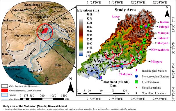
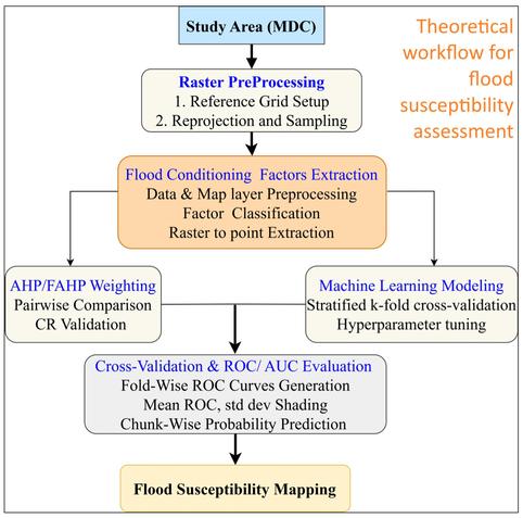
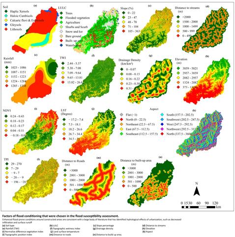
Integrated Data-Driven Multi-Criteria Analysis and Machine Learning Approaches for Assessment of Flood Susceptibility Mapping
--
https://doi.org/10.3390/w18070844 <-- shared paper
--
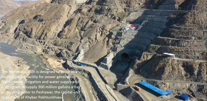
https://youtu.be/N7nyU1cMg5k?si=8WuXIaz4-JKPdCE0 <-- shared video, Mohmand Dam flooding
---
#FloodSusceptibility #FloodMapping #MachineLearning #GIS #RemoteSensing #Hydrology #Water #EnvironmentalResearch #AHP #FAHP #climatechange #extremeweather #GoogleEarthEngine #GIS #spatial #mapping #AI #model #modeling #MohmandDam #SwatRiver #Pakistan #machinelearning #AI #criteria #parameters #indices #rainfall #precipitation #LULC #soiltexture #planning #policy #water #hydrology #hydrography #riskmanagement #risk #hazard #flood #flooding #mitigation #watershed #watermanagement #resilence
--
https://doi.org/10.3390/w18070844 <-- shared paper
--
https://youtu.be/N7nyU1cMg5k?si=8WuXIaz4-JKPdCE0 <-- shared video, Mohmand Dam flooding
---
#FloodSusceptibility #FloodMapping #MachineLearning #GIS #RemoteSensing #Hydrology #Water #EnvironmentalResearch #AHP #FAHP #climatechange #extremeweather #GoogleEarthEngine #GIS #spatial #mapping #AI #model #modeling #MohmandDam #SwatRiver #Pakistan #machinelearning #AI #criteria #parameters #indices #rainfall #precipitation #LULC #soiltexture #planning #policy #water #hydrology #hydrography #riskmanagement #risk #hazard #flood #flooding #mitigation #watershed #watermanagement #resilence