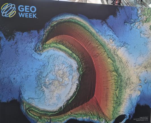
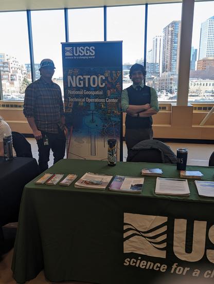
Good To Be (Back) At #GeoWeek
--
https://www.geo-week.com/
--
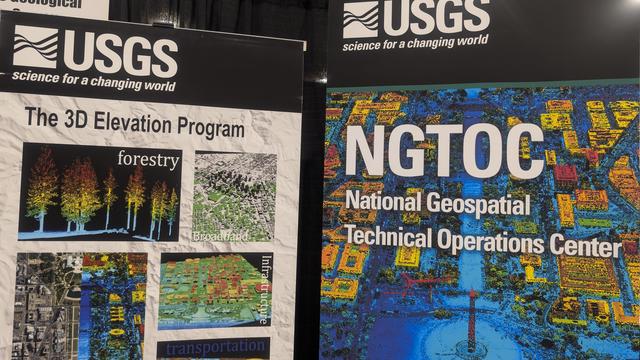
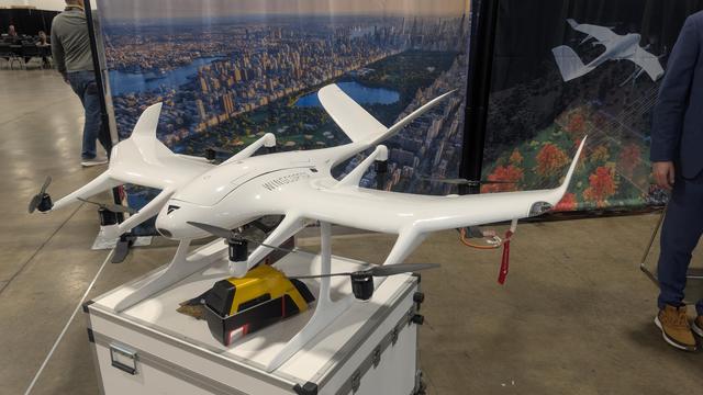
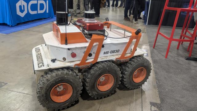
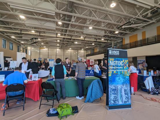
Volunteering at the #USGS booth, meeting & re-meeting fellow spatial professionals, seeing all the sweet hardware, and more...
(moving next year, so taking advantage of it being local to me...)
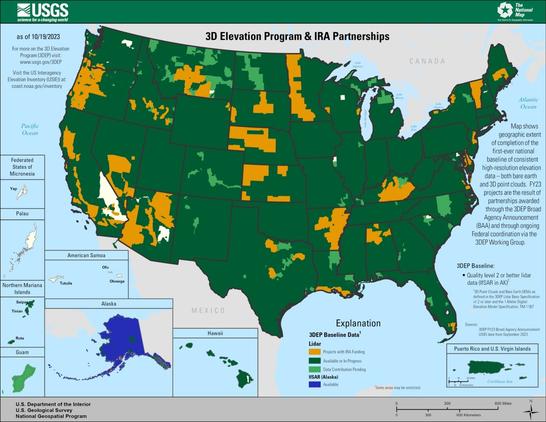
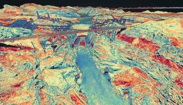
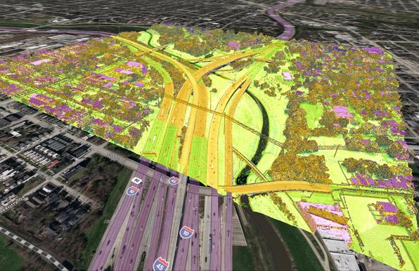
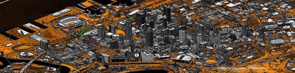
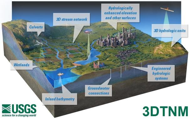
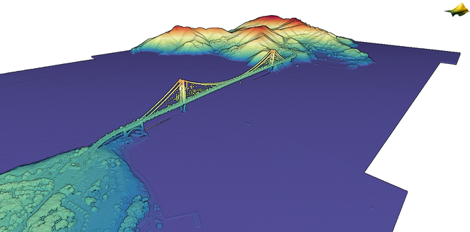
#GIS #spatial #mapping #conference #Denver #professional #hardware #professional #NGTOC #3DHP #3DEP #opendata #fedscience #fedservice
@GeoWeeK
USGS topoBuilder Milestone of 1 Million Maps Delivered
--
https://www.usgs.gov/programs/national-geospatial-program/topobuilder <-- USGS topoBuilder Open Source / Open Data creation page, make your own custom USGS ‘topo map’!
--
“Each year, [the #USGS has] seen steady growth in map requests, underscoring the public’s trust and appreciation for these innovative products.
This [USGS topoBuilder Milestone of 1 Million Maps Delivered] is a testament to the dedication and expertise of colleagues across the National Geospatial Program and the National Geospatial Technical Operations Center. The success of topoBuilder is built on the collective efforts behind The National Map...
[The USGS] has modernized and advanced #topographic mapping…”
#GIS #spatial #mapping #NGP #NGTOC #usecase #fedscience #fedservive #topomap #ondemand #custom #USGS #topobuilder #opendata #publicservice #publicgood #milestone #TNM #NationalMap #free #recreation #usecase #agriculture #hiking
@USGS
Streams & River Names Across The USA From USGS NHDPlus
--
https://www.linkedin.com/posts/john-hammond-9b4a932b_ever-wonder-how-streams-and-rivers-differ-activity-7395939476793090048-QvLc <-- shared technical post
--
H/T John Hammond | Research Hydrologist @ USGS
“Ever wonder how streams and rivers differ in naming across the country and what the most common names are?...
----
NAME COUNT
--
Mill Creek 6,213
Spring Creek 5,862
Dry Creek 5,750
Bear Creek 4,945
Beaver Creek 4,740
Rock Creek 4,514
Indian Creek 4,231
Cedar Creek 3,849
Willow Creek 3,777
Cottonwood Ck 3,694
Big Creek 3,424
Clear Creek 3,223
Sand Creek 2,863
Deer Creek 2,781
Turkey Creek 2,752
Wolf Creek 2,701
Mud Creek 2,518
Crooked Creek 2,176
Brush Creek 2,019
Buffalo Creek 2,009
Elk Creek 1,950
Salt Creek 1,932
Horse Creek 1,899
Silver Creek 1,887…”
#water #hydrology #name #USA #NHDPlus #variety #names #rivers #streams #NGTOC #3DHP #national #country #CONUS #nomenclature
#USGS
Latest #USGS Map-Product Release - 250K Topo OnDemand Topo Products Now Available Through The Topobuilder Application
--
https://www.usgs.gov/programs/national-geospatial-program/news/regional-view-reliable-data-introducing-usgs-250k-topo <-- USGS product announcement page and topoBuilder custom map construction application access
--
“The U.S. Geological Survey (USGS) has launched the 250K Topo, a new digital map product designed to support regional planning, land and resource management, and emergency response coordination…”
--
#GIS #spatial #mapping #USGS #OnDemandTopo #NGP #topoBuilder #OnDemand #250KTopo #Geospatial #TopographicMaps #GIS #MappingInnovation #OpenData #Maps #NGTOC #NGP #custom #opendata #latest #spatialdata #topomap #fedservice #fedscience #publicgood
@USGS
Collaboration Advances Elevation Mapping – USGS EROS And NGTOC Work Together To Map A 1 Metre Digital Elevation Model For A Watershed
--
https://www.usgs.gov/centers/eros/news/collaboration-advances-elevation-mapping <-- shared technical article
--
https://doi.org/10.5066/P1CEPE2M <-- USGS data release, Lower Androscoggin Watershed Hydrologic Unit 8 Seamless 1-m DEM Pilot, 2013 to 2020
--
#GIS #spatial #mapping #remotesensing #LiDAR #water #hydrology #3dep #3dhp #3dtnm #NGTOC #spatialanalysis #elevation #DEM #EROS #seamlessonemeter #Androscoggin #ME #maine #research #integration #watershed #opendata
@USGS | @USGS_EROS
Collaboration Advances Elevation Mapping | U.S. Geological Survey

We can know a place pretty well and still learn something from a map of it. A map showing terrain elevation including rivers and streams, for example, indicates where heavy rainfall will flow or new construction of structures, bridges and roads would be most suitable.

Consolidated Standardized Survey-Grade Checkpoints 3DEP 2010 to 2017 [USGS]
--
https://www.sciencebase.gov/catalog/item/67075e6bd34e969edc59c3e7
--
“One of the key aspects of 3DEP data is that data is verified by a collection of certified survey-grade GNSS checkpoints spread throughout each project. These points have always been available but were difficult to find and not standardized. [The USGS] have collated and standardized almost 42,000 of these checkpoints and are making them available for other uses. These points here in this first phase span from 2010-2017, but [the USGS] are in the process of making these available for all [their] projects, and hope to enable them in different ways in the future...”
#GIS #spatial #mapping #USGS #USA #elevation #opendata #remotesensing #LiDAR #ifSAR #3dep #3dhp #water #hydrology #3d #opendata #3dtnm #checkpoint #checkpointdigital #GNS #GPS #NGD #DEM #survey #surveygrade #accuracy #precision #calibration #digital #NGTOC #NAD83
@USGS
Consolidated Standardized Survey-Grade Checkpoints 3DEP 2010 to 2017 - ScienceBase-Catalog

The 3D Elevation Program (3DEP) is managed by the U.S. Geological Survey (USGS) National Geospatial Program to respond to growing needs for high-quality topographic data and for a wide range of other three-dimensional (3D) representations of the Nation's natural and constructed features. 3DEP informs critical decisions that are made across our Nation every day that depend on elevation data, ranging from immediate safety of life, property, and environment to long term planning for infrastructure projects. Lidar, an airborne laser detection technology for mapping features on the ground, is being collected nationwide, while Interferometric Synthetic Aperture Radar (IfSAR) is being collected over Alaska. Assessing the accuracy of the lidar point cloud data collected for 3DEP is defined in the Lidar Base Specification (https://www.usgs.gov/ngp-standards-and-specifications/lidar-base-specification-online). The vertical accuracy of the lidar and IfSAR data and the derived Digital Elevation Models (DEMs) is the most scrutinized accuracy metric. 3DEP data are assessed and reported in accordance with the American Society of Photogrammetry and Remote Sensing (ASPRS) Positional Accuracy Standards for Digital Geospatial Data. Vegetated vertical accuracy (VVA) and non-vegetated vertical accuracy (NVA) are assessed for absolute vertical accuracy compared to survey-grade checkpoints collected with Global Navigation Satellite System (GNSS) receivers by professional land surveyors. These checkpoints are published with 3DEP projects (https://rockyweb.usgs.gov/vdelivery/Datasets/Staged/Elevation/metadata/) and represent tens of millions of dollars of high accuracy data that can be used to assess both 3DEP and other endeavors such as the Seamless 1-m DEM that the National Geospatial Directorate is producing to support the USGS 3D National Topography Model. However, these checkpoints were not standardized until Lidar Base Specification 2022 rev. A. All checkpoints prior to this revision were delivered by contractors in XML, PDFs, excel spreadsheets, CSVs, shapefiles, and geodatabase feature classes depending on the preference of the lidar contractors and 3DEP partners. In 2021, the National Geospatial Technical Operations Center (NGTOC) consolidated the checkpoints in the 3DEP and older lidar/IfSAR data holdings gathered between 2010-2017 to support research for and the eventual publication of a journal article called “The Accuracy and Consistency of 3D Elevation Program Data: A Systematic Analysis” (https://doi.org/10.3390/rs14040940). In 2024, NGTOC enriched and standardized the points used in that paper to match the current survey point delivery schema. This included re-projecting the data horizontally to North American Datum of 1983 (NAD83) (2011) geographic, deleting duplicate points, identifying the point type as NVA or VVA, identifying matching work unit and project ID numbers within the Work Unit Extent Spatial Metadata, verifying the correct geoid models, using National Oceanic and Atmospheric Administration’s (NOAA) National Geodetic Survey (NGS) VDatum tool to update the Z elevation values in the conterminous United States (CONUS) and Puerto Rico into meters and GEOID18 and everything in Hawaii and Alaska into meters and GEOID12B, determining the collection date and the publication date, and finding the URL to the source information where possible. This is the first version of the 3DEP checkpoints database which includes 41,958 survey-grade points from 205 lidar and IfSAR projects covering 710 published work units. NGTOC will update this database with additional checkpoints in 2025.

New study seeks to shed light on earthquake hazards in the Gallatin Range | U.S. Geological Survey

Earthquakes that rupture the ground surface leave behind the telltale signature of fault scarps, which provide clues about seismic activity in the geologic past. A new study focused on scarps along the East Gallatin-Reese Creek fault system will provide more information on seismic hazards in northwest Yellowstone National Park.

CU Denver Career Fair Participation - With The USGS
--
https://architectureandplanning.ucdenver.edu/career-connections/employers <-- link to CU Denver employer connection job
--
Always a pleasure to be part of a career fair…
#GIS #spatial #mapping #careerfair #cudenver #usgs #careerdevelopment #NGTOC #NGP #jobfair #jobfair2024 #careerempowerment #Colorado #denver #federaljobs #federalservice
@USGS @CUDenver
Employer Connections

CAP provides support to employers in recruiting our undergraduate students, graduate students, and alumni for all types of roles.

Inflation Reduction Act accelerates USGS effort to collect high-resolution data of landscapes across 25 states | U.S. Geological Survey

Over $6 million in funding will support the USGS goal of nationwide high-resolution 3D data coverage.

Mapping the Land - Connected World

With the passage of the Bipartisan Infrastructure Law, one of the largest and most significant investments in rebuilding our roads and bridges since President Eisenhower’s Interstate Highway System, attention has been paid to updating the maps that will show where construction and long-term investments are most needed. To provide this data, the U.S. Geological Survey LiDAR used for USGS mapping

Connected World - IoT and Digital Transformation