Thawing Out

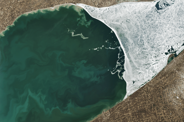
Lake Erie, the shallowest of the Great Lakes, can almost completely freeze over in winter. In this satellite image of the lake in March 2025, about a third of the lake remains ice-covered, while sediment — resuspended by wind and currents — and phytoplankton swirl in the ice-free zone. In recent decades, scientists discovered that diatoms, one of the phytoplankton groups found in the lake, can live within and just below Erie’s ice, thanks to a symbiotic relationship with an ice-loving bacteria. This symbiosis allows the diatoms to attach to the underside of the ice and gather the light needed for photosynthesis. Even in the depths of winter, an ice-covered lake can teem with life. (Image credit: M. Garrison; via NASA Earth Observatory)

#biology #fluidDynamics #physics #phytoplankton #satelliteImage #science #sedimentation
A Sandy Spine

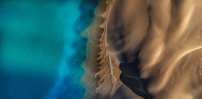
Where sea and sand meet, Gaia’s spine rises. Photographer Satheesh Nair captured this striking image in western Australia, where wind and wave action have dragged a dune into vertebrae-like cusps. Notice how the size and shape of the curves differs between the under- and above-water sections. Those differences reflect the differing forces that shape them — just water for one set, water and air for the other. (Image credit: S. Nair/IAPOTY; via Colossal)

#beachCusps #fluidDynamics #fluidsAsArt #oceanWaves #physics #science #sedimentTransport #sedimentation

South Island Sediments

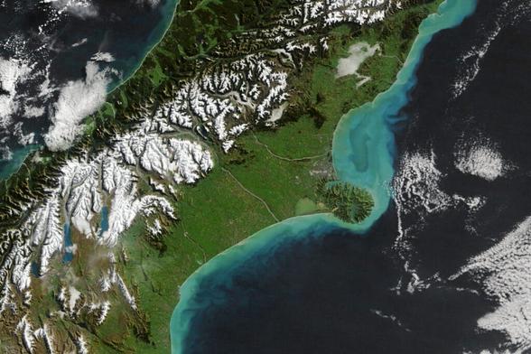
In April and May late autumn storms ripped through Aotearoa New Zealand. This image shows the central portion of South Island, where coastal waters are unusually bright thanks to suspended sediment. We typically think of storm run-off as water, but these flows can carry lots of sediment as well. Here, the large amount of sediment is likely a combination of increased run-off from rivers and coastal sediment stirred up by faster river flows. (Image credit: W. Liang; via NASA Earth Observatory)

#flowVisualization #fluidDynamics #physics #satelliteImage #science #sedimentTransport #sedimentation

@vniBW

Ja, die #Sedimentation (ein schöner Begriff aus der #Wissenssoziologie, finde ich!) findet v.a. über #Begriffsarbeit statt. Im Buch #Verschwörungsmythen (besserer Begriff 1) findet sich auch eine ausführliche Diskussion von egozentrischem #Relativismus, gruppenbezogenem #Dualismus und schließlich dialogischem #Monismus. Bessere Begriffe brauchen oft länger, um sich gegen alte Konzepte durchzusetzen. Aber das ist die Aufgabe, die ich mir stellte. #Wissenschaft https://shop.verlagsgruppe-patmos.de/verschwoerungsmythen-011573.html

Verschwörungsmythen

Dams Fill Reservoirs With Sediment

Dams are critical pieces of infrastructure, but, as Grady shows in this Practical Engineering video, they are destined to be temporary. The reason is that they naturally fill with sediment over time. Rivers carry a combination of water and sediment; the latter is critical to healthy shorelines and stable ecology. But while sediment gets carried along by a fast-flowing river, slower flow rates allow sediment to fall out of suspension, as demonstrated in Grady’s tabletop flume. As his river transitions to a deeper, slower-flowing reservoir, sand falls out of the flow, building up colorful strata. The sand and water even create dynamic feedback loops, as seen with the dunes that form in his timelapse and march toward the dam.

Any long-term plan for a dam has to deal with this inevitable build-up of sediment, and, unfortunately, it’s not a simple or cheap problem to address, as discussed in the video. (Video and image credit: Practical Engineering)

#civilEngineering #dams #engineering #fluidDynamics #physics #science #sedimentTransport #sedimentation

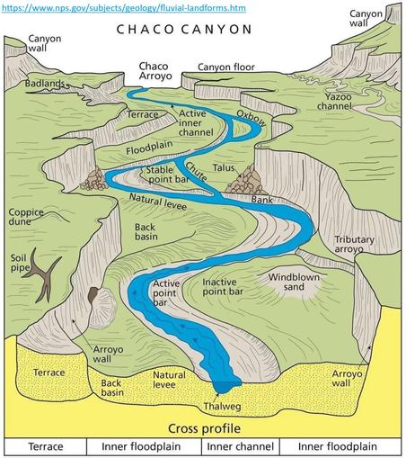
Fluvial System Block Diagrams
--
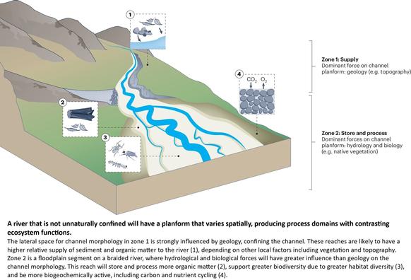
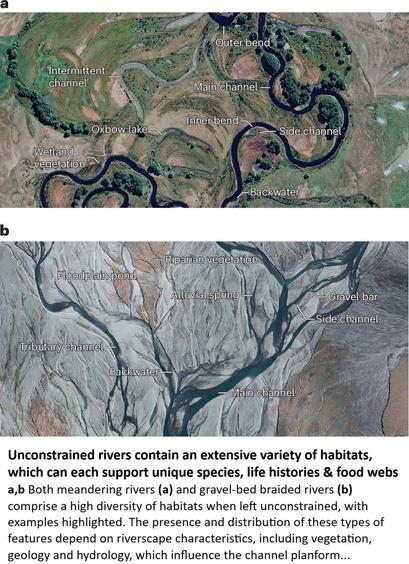
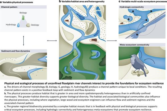
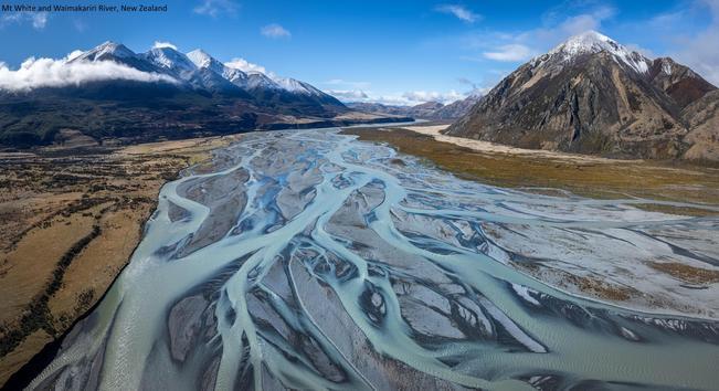
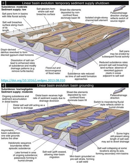
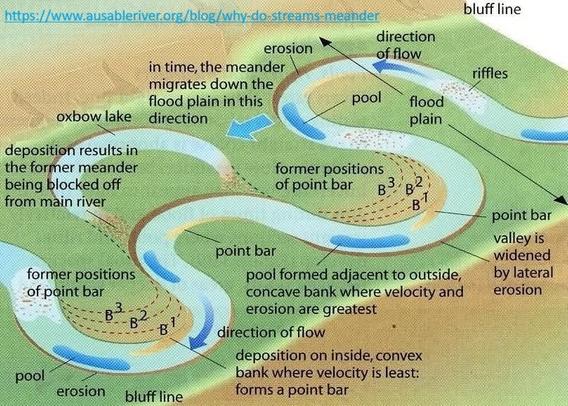
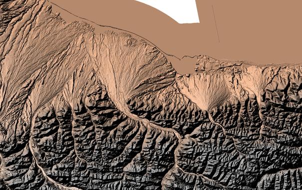
I was looking to understand a fluvial system the other day, up in the high Arctic, as I looked at 3DEP remote sensed elevation data… I have always been fascinated by the how geology, water, weather shapes a landscape, including erosion (aka geomorphology if you will) – and realized how very much value fluvial block diagrams have as we try to conceptualise what has, is and will happen(ed.)
#spatial #spatiotemporal #morphology #meander #levee #understanding #oxbow #pointbar #river #water #hydrology #landform #geomorphology #geomorphometry #geology #fluvial #riverine #weather #climate #erosion #sediment #sedimentation #Arctic #3dep #opendata #DEM #BeringSea #northslope #opendata #fedservice