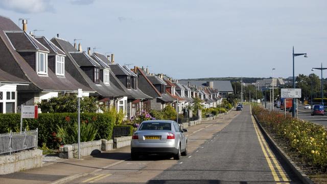
There was man with a ball thing on a pole outside our house today.
I got chatting and he was from Ordnance Survey, taking measurements of the estate so that it could be added to their maps.
I really like maps so I found this very interesting.
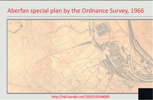
#Mapping A World Of Change
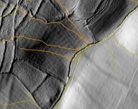
Inviting the Welsh poet Grug Muse to compose & recite a triptych inspired by #OrdnanceSurvey's incredible maps of Aberfan following the tragedy there produced one of the most emotion-evoking presentations ever at a conference.
The maps can be seen at the The National Library of Wales in Aberystwyth or their website :
British Street Addresses, When Licenses Collide

British Street Addresses, When Licenses Collide https://hackaday.com/2026/05/14/british-street-addresses-when-licenses-collide/
#CurrentEvents #Opengovernmentlicence #Opensourcedata #Ordnancesurvey #Uk
#CurrentEvents #Opengovernmentlicence #Opensourcedata #Ordnancesurvey #Uk
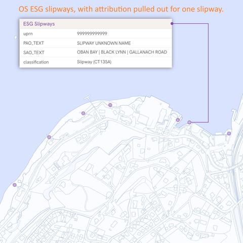
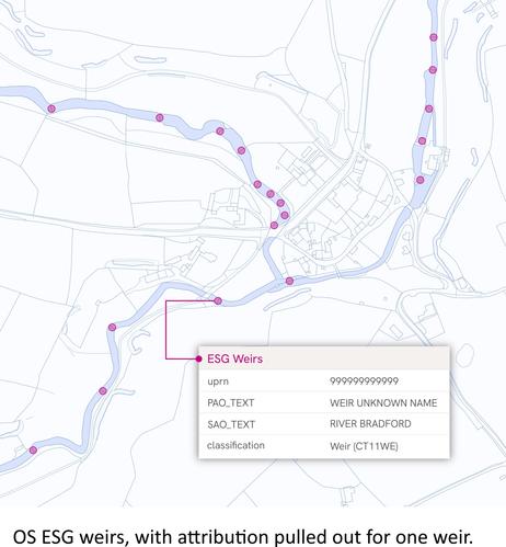
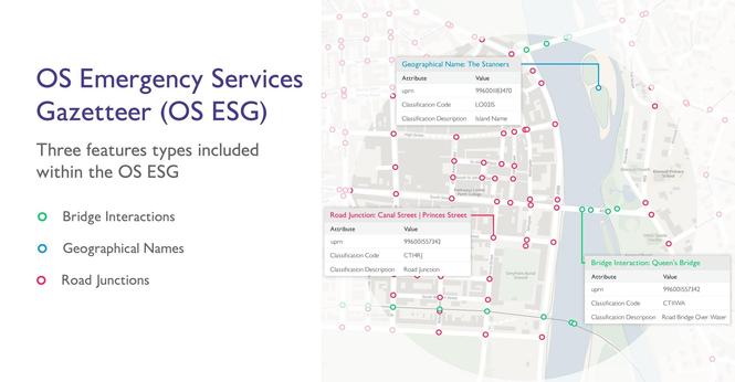
OS Emergency Services Gazetteer - Not Every Emergency Happens At A Place With An Official Address. 🚑 [UK]
--
https://www.linkedin.com/posts/not-every-emergency-happens-at-a-place-with-ugcPost-7458093278580654080-p6r0 <-- shared technical post
--
https://www.ordnancesurvey.co.uk/products/os-emergency-services-gazetteer <-- OS Emergency Services Gazetteer hub
-
#GIS #spatial #mapping #OSDataHub #emergencyservices #emergencyresponse #routing #addressing #UK #England #Wales #Scotland #OS #EmergencyServicesGazetteer #dataset #responders #risk #hazard ##EmergencyServices #PublicHealth #PublicSafety #FirstResponders #LocationData #AddressingChallenges #DispatchOperations #SituationalAwareness #SmartCities #CommunitySafety
#OrdnanceSurvey
--
https://www.linkedin.com/posts/not-every-emergency-happens-at-a-place-with-ugcPost-7458093278580654080-p6r0 <-- shared technical post
--
https://www.ordnancesurvey.co.uk/products/os-emergency-services-gazetteer <-- OS Emergency Services Gazetteer hub
-
#GIS #spatial #mapping #OSDataHub #emergencyservices #emergencyresponse #routing #addressing #UK #England #Wales #Scotland #OS #EmergencyServicesGazetteer #dataset #responders #risk #hazard ##EmergencyServices #PublicHealth #PublicSafety #FirstResponders #LocationData #AddressingChallenges #DispatchOperations #SituationalAwareness #SmartCities #CommunitySafety
#OrdnanceSurvey
Anyone know what impact #KesslerSyndrome would have on #GNSS ?
I assume it renders these services at least partly (or even wholly) unusable, even if the satellites themselves are unaffected
We use GNSS a fair bit at work, both for staffs own navigation devices (when they are visiting clients) and the visit logging system (which confirms they are in correct location), I expect I have to prepare for disruption to this as part of #BusinessContinuity
At least it seems folk from #Zimbabwe (where many of our staff are from) get good #education on how to use #maps in high #school and their national mapping is very similar to #OrdnanceSurvey
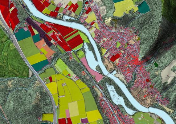
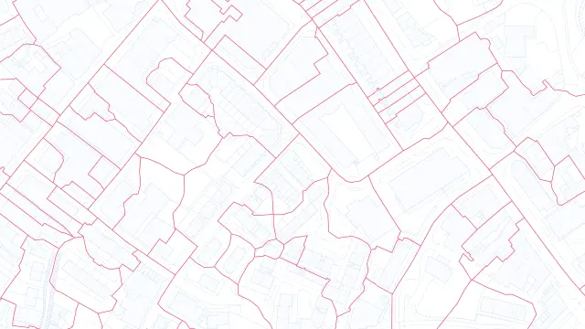
Latest Data Release From Ordnance Survey Delivers Britain’s Most Detailed Digital Map Ever [UK]
--
https://www.ordnancesurvey.co.uk/news/latest-data-release-delivers-britains-most-detailed-digital-map <-- shared technical article
--
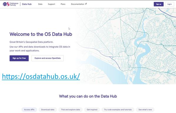
https://osdatahub.os.uk/ <-- shared OS spatial data hub
--
https://www.ordnancesurvey.co.uk/blog/os-basemap-pro-announcement <-- shared details of new OS BaseMap Pro
--
#GIS #spatial #mapping #UK #Britain #GreatBritain #OrdnanceSurvey #map #Kent #cartography #history #modern #OSNationalGeographicDatabase #OSNGD #database #opendata #digitalmapping #metadata #attribution #consistency #accessability #usecase #OSBaseMapPro #transportation #routing #infrastructure #healthcare #emergencyservices #spatialanalysis #publicservice #publicgood #publicsafety #publichealth #planning #sustainability #climateadaptation #resilience #spatialdata #cartography
#OrdnanceSurvey
--
https://www.ordnancesurvey.co.uk/news/latest-data-release-delivers-britains-most-detailed-digital-map <-- shared technical article
--
https://osdatahub.os.uk/ <-- shared OS spatial data hub
--
https://www.ordnancesurvey.co.uk/blog/os-basemap-pro-announcement <-- shared details of new OS BaseMap Pro
--
#GIS #spatial #mapping #UK #Britain #GreatBritain #OrdnanceSurvey #map #Kent #cartography #history #modern #OSNationalGeographicDatabase #OSNGD #database #opendata #digitalmapping #metadata #attribution #consistency #accessability #usecase #OSBaseMapPro #transportation #routing #infrastructure #healthcare #emergencyservices #spatialanalysis #publicservice #publicgood #publicsafety #publichealth #planning #sustainability #climateadaptation #resilience #spatialdata #cartography
#OrdnanceSurvey

🇺🇦 #NowPlaying on #BBC6Music's #FreakZonePlaylist
Ordnance Survey:
🎵 Isolated Showers
#6music #OrdnanceSurvey
▶️ 🪄 Automagic 🔊 show 📻 playlist on Spotify
▶️ Song/Cover on #Bandcamp:
Isolated Showers, by Ordnance ...
Isolated Showers, by Ordnance ...

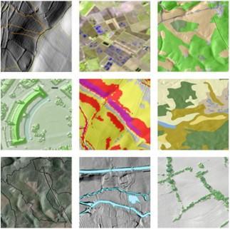
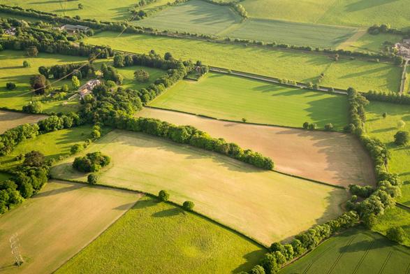
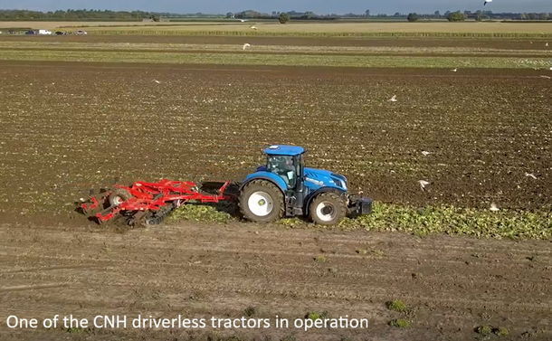
How Ordnance Survey Supports Agriculture And Land Management Through Innovation And Trusted, Authoritative Data [UK]
--
https://www.ordnancesurvey.co.uk/insights/supporting-agriculture-and-land-management <-- shared technical article
--
https://youtu.be/BQReQyr3Xv0?si=6ov42Fe94epDBfBh <-- shared video, ‘CNH supports farmers with driverless tractors using OS technology’
--
https://www.ordnancesurvey.co.uk/products/os-ngd <-- shared link to the OS National Geographic Database open spatial data portal
--
#OrdnanceSurvey #OS #agency #OSNet #GPS #navigation #routing #safety #security #location #locating #GIS #spatial #mapping #precisionagriculture #farmers #farming #UK #Britain #England #Scotland #Wales #NorthernIreland #agriculture #production #food #foodsecurity #geospatial #farming #locationdata #tractor #SeeABetterPlace #mechanisation #automation #driverless #landuse #landuseframework #defra #spatialdata #opendata #OSNationalGeographicDatabase #API #downloads #Geovation #LandApp #OkoAg #SoilBenchmark #sustainable #environment
@OrdnanceSurvey @Defra @CNH
--
https://www.ordnancesurvey.co.uk/insights/supporting-agriculture-and-land-management <-- shared technical article
--
https://youtu.be/BQReQyr3Xv0?si=6ov42Fe94epDBfBh <-- shared video, ‘CNH supports farmers with driverless tractors using OS technology’
--
https://www.ordnancesurvey.co.uk/products/os-ngd <-- shared link to the OS National Geographic Database open spatial data portal
--
#OrdnanceSurvey #OS #agency #OSNet #GPS #navigation #routing #safety #security #location #locating #GIS #spatial #mapping #precisionagriculture #farmers #farming #UK #Britain #England #Scotland #Wales #NorthernIreland #agriculture #production #food #foodsecurity #geospatial #farming #locationdata #tractor #SeeABetterPlace #mechanisation #automation #driverless #landuse #landuseframework #defra #spatialdata #opendata #OSNationalGeographicDatabase #API #downloads #Geovation #LandApp #OkoAg #SoilBenchmark #sustainable #environment
@OrdnanceSurvey @Defra @CNH

Overland Flow Pathways [England]
--
https://environment.data.gov.uk/dataset/36e7f4d3-61b2-4e64-aaa2-2b85bceb61a9 <-- shared technical resource / overview
--
#GIS #spatial #mapping #environment #Elevation #Hydrography #hydrology #remotesensing #survey #hydrologicflow #flow #catchment #DigitalElevationModel #LiDAR #remotesensing #earthobservation #opendata #UK #England #Britain #overlandflow #water #hydrology #risk #hazard #pollution #soil #erosion #flood #flooding #risk #hazard #naturalhazard #network #polyline #DTM #landscape #slope #D8 #watershed #ponding #flowdirection #environment #hydroenforced #digitalterrainmodel
#OrdnanceSurvey | #UKEnvironmentAgency
--
https://environment.data.gov.uk/dataset/36e7f4d3-61b2-4e64-aaa2-2b85bceb61a9 <-- shared technical resource / overview
--
#GIS #spatial #mapping #environment #Elevation #Hydrography #hydrology #remotesensing #survey #hydrologicflow #flow #catchment #DigitalElevationModel #LiDAR #remotesensing #earthobservation #opendata #UK #England #Britain #overlandflow #water #hydrology #risk #hazard #pollution #soil #erosion #flood #flooding #risk #hazard #naturalhazard #network #polyline #DTM #landscape #slope #D8 #watershed #ponding #flowdirection #environment #hydroenforced #digitalterrainmodel
#OrdnanceSurvey | #UKEnvironmentAgency