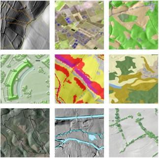
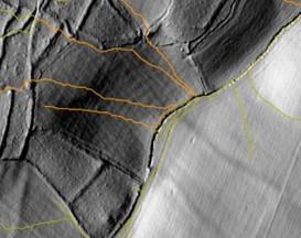
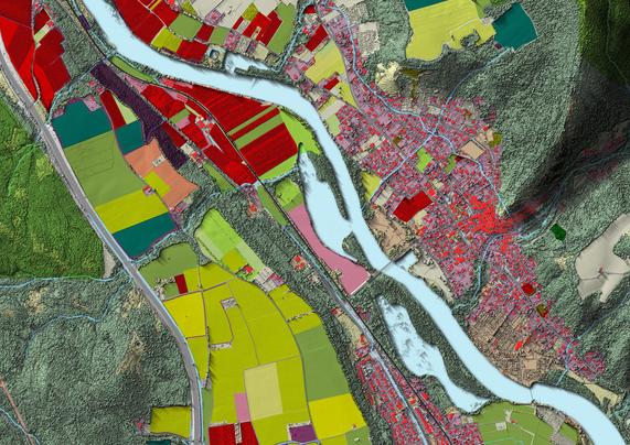
Overland Flow Pathways [England]
--
https://environment.data.gov.uk/dataset/36e7f4d3-61b2-4e64-aaa2-2b85bceb61a9 <-- shared technical resource / overview
--
#GIS #spatial #mapping #environment #Elevation #Hydrography #hydrology #remotesensing #survey #hydrologicflow #flow #catchment #DigitalElevationModel #LiDAR #remotesensing #earthobservation #opendata #UK #England #Britain #overlandflow #water #hydrology #risk #hazard #pollution #soil #erosion #flood #flooding #risk #hazard #naturalhazard #network #polyline #DTM #landscape #slope #D8 #watershed #ponding #flowdirection #environment #hydroenforced #digitalterrainmodel
#OrdnanceSurvey | #UKEnvironmentAgency
--
https://environment.data.gov.uk/dataset/36e7f4d3-61b2-4e64-aaa2-2b85bceb61a9 <-- shared technical resource / overview
--
#GIS #spatial #mapping #environment #Elevation #Hydrography #hydrology #remotesensing #survey #hydrologicflow #flow #catchment #DigitalElevationModel #LiDAR #remotesensing #earthobservation #opendata #UK #England #Britain #overlandflow #water #hydrology #risk #hazard #pollution #soil #erosion #flood #flooding #risk #hazard #naturalhazard #network #polyline #DTM #landscape #slope #D8 #watershed #ponding #flowdirection #environment #hydroenforced #digitalterrainmodel
#OrdnanceSurvey | #UKEnvironmentAgency