Spinning Earth with clouds, atmosphere, and night lights 🌎🛰️

#Clouds #Earth #ICESat2 #ISS #Nightlights #Orbit #OrbitCoverage #Satellite

⏩ 2 new pictures and 2 new videos from NASA (SVS) https://commons.wikimedia.org/wiki/Special:ListFiles?limit=8&user=OptimusPrimeBot&ilshowall=1&offset=20250722125721

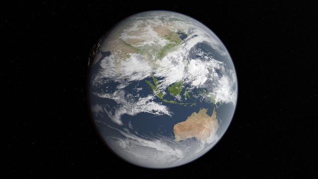
"ETOPO 2022 is an updated topographic–bathymetric dataset at 15 arcsec global resolution that incorporates bare-Earth datasets with forests and buildings removed. ETOPO 2022 integrates more than a dozen source datasets for land topography, sea bathymetry, lake bathymetry, and ice-sheet bed elevation data, all of which have been carefully evaluated for quality, accuracy, and seamless integration."

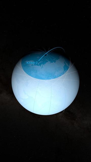
Quality controlled with nearly a trillion #ICESat2 #LIDAR shots.

Did some successful microwave keyhole shots back in the day, using #SRTM data. This would have been even better.

#DigitalElevationModel
#DEM

https://essd.copernicus.org/articles/17/1835/2025/

The Earth Topography 2022 (ETOPO 2022) global DEM dataset

Abstract. Here we present Earth TOPOgraphy (ETOPO) 2022, the latest iteration of NOAA's global seamless topographic–bathymetric dataset. ETOPO1, NOAA's prior release at 1 arcmin resolution, has been a widely used benchmark global digital elevation model (DEM) since its initial release in 2009 (Amante and Eakins, 2009). Tsunami forecasting, modeling, and warning systems critically rely upon accurate topographic and bathymetric data to predict and reproduce water movement across global ocean surfaces, wave heights at the coastline, and subsequent land inundation. ETOPO 2022 is an updated topographic–bathymetric dataset at 15 arcsec global resolution that incorporates bare-Earth datasets with forests and buildings removed. ETOPO 2022 integrates more than a dozen source datasets for land topography, sea bathymetry, lake bathymetry, and ice-sheet bed elevation data, all of which have been carefully evaluated for quality, accuracy, and seamless integration. We evaluate the relative and absolute vertical accuracies of all land-elevation input datasets, as well as the final ETOPO 2022 tiles, using a geographically optimized, independent database of bare-Earth elevation photons from NASA's ICESat-2 satellite mission over the calendar year 2021. Measured against more than 960 billion lidar measurements from ICESat-2 that span nearly the entire globe, ETOPO 2022 measures a global RMSE of 7.17 m. ETOPO 2022 is publicly available in both ice surface and bedrock versions that portray either the top layer of the ice sheets covering Greenland and Antarctica or the bedrock below, and both versions are also available in GeoTIFF and NetCDF formats in 15×15° tiles, as well as global tiles at 30 and 60 arcsec resolutions. ETOPO 2022 provides a new publicly available seamless, globally validated elevation dataset to meet the present and future needs of the scientific global hazard and mapping communities. Datasets for the ETOPO 2022 15 Arc-Second Global Relief Model are available at https://doi.org/10.25921/fd45-gt74 (NOAA National Centers for Environmental Information, 2022).

ESA And NASA Deliver First Joint Picture Of Greenland Ice Sheet Melting
--
https://www.esa.int/Applications/Observing_the_Earth/FutureEO/CryoSat/ESA_and_NASA_deliver_first_joint_picture_of_Greenland_Ice_Sheet_melting <-- shared technical article
--
https://doi.org/10.1029/2024GL110822 <-- shared paper
--
[Visualising the latest results from ESA's CryoSat radar altimeter, consistent with measurements from NASA's ICESat-2 laser altimeter]
--
#GIS #spatial #mapping #remotesensing #earthobservation #cryosphere #Greenland #icesheet #melting #CryoSat #satellite #ICESat2 #spatiotemporal #spatialanalysis #Jakobshavn #glacier #ice #snow #radar #laser #iceloss #climatechange #altimeter #elevation #topography #height
@ESA @nasa
ESA and NASA deliver first joint picture of Greenland Ice Sheet melting

Global warming is driving the rapid melting of the Greenland Ice Sheet, contributing to global sea level rise and disrupting weather patterns worldwide. Because of this, precise measurements of its changing shape are of critical importance for adapting to climate change.Now, scientists have delivered the first measurements of the Greenland Ice Sheet’s changing shape using data from ESA's CryoSat and NASA's ICESat-2 ice missions.

#ESA and #NASA satellites deliver first joint picture of #Greenland Ice Sheet melting

#GlobalWarming is causing the Ice Sheet to melt and flow more rapidly, raising sea levels and disturbing weather patterns across our planet. Precise measurements of its changing shape are of critical importance.
Scientists have now delivered the first measurements of Greenland Ice Sheet thickness change using #CryoSat2 and #ICESat2

https://phys.org/news/2024-12-esa-nasa-satellites-joint-picture.html

#ClimateScience
#Cryosphere
#RemoteSensing

ESA and NASA satellites deliver first joint picture of Greenland Ice Sheet melting

Academics from Northumbria University are part of an international research team which has used data from satellites to track changes in the thickness of the Greenland Ice Sheet.

Phys.org
I'm happy to announce a new version of our global coastal DTM: DeltaDTM v1.1. 🎉 Now up to 30 m (was 10 m) above the EGM2008 geoid, with improved accuracy across the board. Specifically we now use CopernicusDEM 2023_3 (was 2022_2) as the input and add another year of @NASA #ICESat2 data. The method stayed the same and is described in https://doi.org/10.1038/s41597-024-03091-9. Get it at https://doi.org/10.4121/21997565, or as an GEE asset `users/maartenpronk/deltadtm/v1-1`. #elevation #terrain
Water for a Desert Lake in Algeria

Scientists are studying the rare filling of Sebkha el Melah for clues about past—and possibly future—greening of the Sahara Desert.