Multi-Hazard Improves App Retention - Comparison Of Alerting & Attrition For The Multi-Hazards SD Emergency & The Single-Hazard #QuakeAlert
--
https://doi.org/10.1016/j.ijdrr.2025.105832 <-- shared paper
--
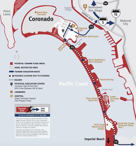
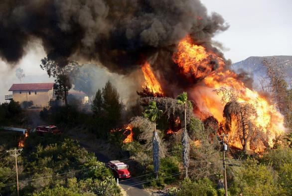
“• Fire is responsible for over 50 % of alerts for County of San Diego, California, USA.
• App installation rates closely mirror the timing of hazard events.
• Multi-hazard apps retain users at a 15 % higher rate compared to single-hazard apps.
• Higher retention improves likelihood people will receive an alert for low-frequency high-impact events like earthquakes..."
#GIS #spatial #mapping #naturalhazards #Alert #warning #smartphone #userretention #wildfire #SanDiego #California #USA #risk #hazard #mitigation #humanimpacts #socialmedia #push #mobileapps #alerting #earlywarning #warningsystem #multihazard #fire #spatiotemporal #spatialanalysis #earthquake #tsunami #flooding #weather #earlywarning #hazardmanagement #usecase #statistics #events #effect #effectiveness #community #public #infrastructure #loss #damage #cost
--
https://doi.org/10.1016/j.ijdrr.2025.105832 <-- shared paper
--
“• Fire is responsible for over 50 % of alerts for County of San Diego, California, USA.
• App installation rates closely mirror the timing of hazard events.
• Multi-hazard apps retain users at a 15 % higher rate compared to single-hazard apps.
• Higher retention improves likelihood people will receive an alert for low-frequency high-impact events like earthquakes..."
#GIS #spatial #mapping #naturalhazards #Alert #warning #smartphone #userretention #wildfire #SanDiego #California #USA #risk #hazard #mitigation #humanimpacts #socialmedia #push #mobileapps #alerting #earlywarning #warningsystem #multihazard #fire #spatiotemporal #spatialanalysis #earthquake #tsunami #flooding #weather #earlywarning #hazardmanagement #usecase #statistics #events #effect #effectiveness #community #public #infrastructure #loss #damage #cost