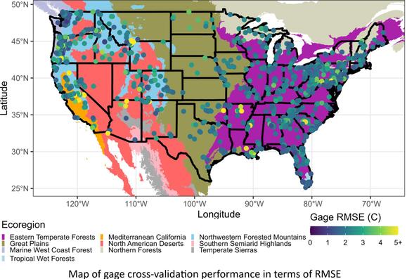
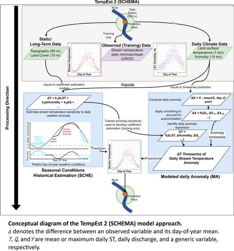
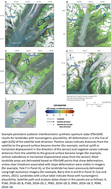
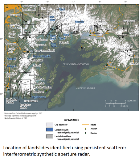
The spcosa package provides an R framework for spatial coverage sampling.

Explore examples at https://git.wur.nl/Walvo001/spcosa

#Rstats #RSpatial #GIS #SpatialStatistics

It is a real privilege to learn about #SpatialStatistics in R from Prof. @edzer !

Participants over the next 5 days will learn spatial stats, sampling, geostatistics, regression, ML, and big-data methods.

https://www.physalia-courses.org/courses-workshops/spatial-statistics/

#Rstats

BURGER - A Bottom-Up Regionalization Approach for Global Sub-Daily Intensity-Duration-Frequency Data
--
https://doi.org/10.1029/2024WR039773 <-- shared paper
--
https://zenodo.org/records/15473689 <-- shared dataset
--
"KEY POINTS
• BURGER is the first global IDF data set derived from observations of sub-daily rainfall
• Sub-daily rainfall intensities are computed with the Simplified Metastatistical Extreme Value (SMEV) approach for a range of return periods
• BURGER intensities compare well with expected intensities, indicated by an interquartile range of the percentage bias between −5% and 5%..”
#GIS #spatial #data #mapping #global #exteremeweather #precipitation #rainfall #gauge #intensity #model #modeling #spatialanalysis #spatiotemporal #BURGER #geostatistics #spatialstatistics # statistics #GSDR #IDF #remotesensing #earthobservation #machinelearning #AI #weather #climate #prediction #usecase #flood #risk #hazard #SMEV #accuracy #metrology

🚨 Population Data and #Vaccine Mapping in Focus at Key Global Conferences

👉 WorldPop researchers presented their work at two major international gatherings this month – placing the spotlight on the power of data to drive progress across health and development in West and Central #Africa.

#HISWACA2025 #VaxPop #SpatialStatistics #UNFPA_WCARO

https://www.worldpop.org/blog/population-data-and-vaccine-mapping-in-focus-at-key-global-conferences/

Is your current biological image analysis producing inaccurate results? Apply for #EMBOBioImage and fix that! 🔬✨ Learn theoretical advancements and the practical skills to apply them.

📩 Apply by 4 June
🗓️ 14 – 19 September
📍 EMBL Heidelberg and Virtual
➡️ https://s.embl.org/bia25-01-ma

#EMBLEvents #bioimageanalysis #spatialstatistics #artificialintelligence #computervision #microscopydata

Advanced methods in bioimage analysis

Assessing landslide risks in Prince William Sound  | U.S. Geological Survey

Anchorage, AK- A recent effort by the U.S. Geological Survey (USGS) has identified 43 different landslides in the Prince Williams Sound that showed movement between 2016 and 2022.