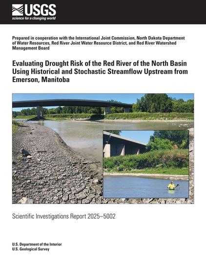
Evaluating Drought Risk Of The Red River Of The North Basin Using Historical And Stochastic Streamflow Upstream From Emerson, Manitoba
--
https://pubs.usgs.gov/publication/sir20255002 <-- shared link to USGS publication
--
https://waterdata.usgs.gov/nwis <-- USGS National Water Information System (NWIS) database - USGS water open data for the Nation
--
#GIS #spatial #mapping #deterministic #waterbalance #stochasticweather #model #modeling #RedRiver #USA #Canada #spatialanalysis #spatiotemporal #waterresources #streamgage #NorthDakota #Manitoba #streamflow #flood #flooding #watersupply #agriculture #farming #ecology #drought #extremeweather #meteorology #basin #subbasin #risk #hazard #gauge #flow
@USGS
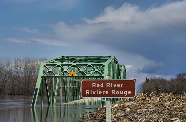
Evaluating drought risk of the Red River of the North Basin using historical and stochastic streamflow upstream from Emerson, Manitoba

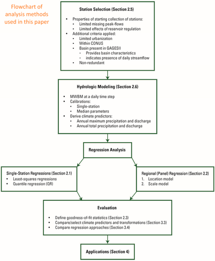
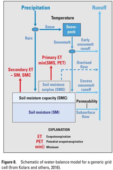
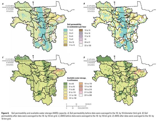
Drought and its effect on streamflow are important to understand because of the potential to adversely affect water supply, agricultural production, and ecological conditions. The Red River of the North Basin in north-central United States and central Canada is susceptible to dry conditions. During an extended drought, streamflow conditions in the Red River of the North may become inadequate to support existing water supply needs in the basin for agriculture, industry, human use, and aquatic life. To understand potential future low-streamflow conditions in the Red River of the North Basin, the U.S. Geological Survey, in cooperation with the International Joint Commission, North Dakota Department of Water Resources, Red River Joint Water Resource District, and Red River Watershed Management Board, developed a water-balance model of the Red River of the North Basin upstream from Emerson, Manitoba, Canada, and coupled the model with stochastic weather inputs to simulate possible future low-streamflow conditions.Historical...

Why isn't Colorado's snowpack ending up in the Colorado River? Research suggests it might be the lack of spring rainfall

The Colorado River and its tributaries provide water for hydropower, irrigation and drinking water in seven U.S. states and Mexico. Much of this water comes from the snowpack that builds up over the winter and then melts each spring. Every year in early April, water managers use the snowpack to predict how much water will be available for the upcoming year.

Phys.org
Drinks With Electrolytes: Do They Really Work? - Keepithealthy

Looking to replenish your energy after a strenuous workout or bout of sickness? Here we break down the advantages of electrolyte drinks and when you need them.

Keepithealthy
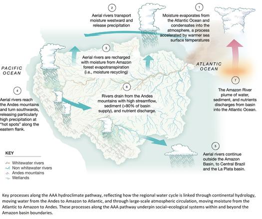
There's a Hidden Water Cycle in The Amazon We Barely Know Anything About

Earth's largest remaining tract of tropical rainforest is kept alive by a complex water cycle that we're only just beginning to understand.

ScienceAlert
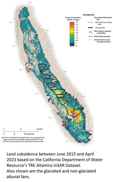
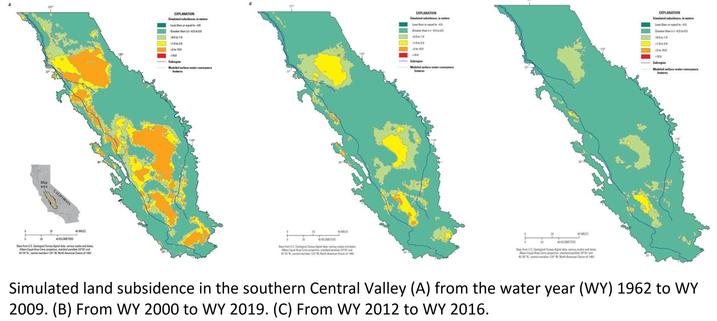
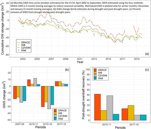
Groundwater Sustainability and Land Subsidence in California’s Central Valley

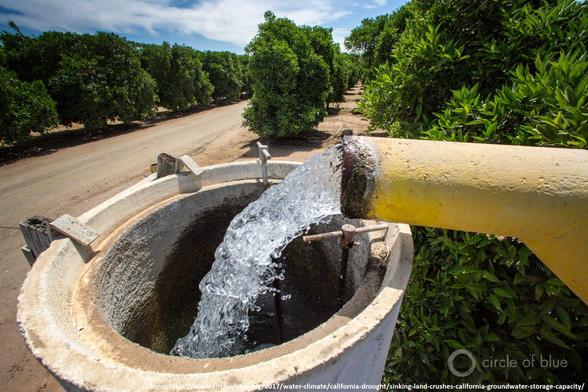
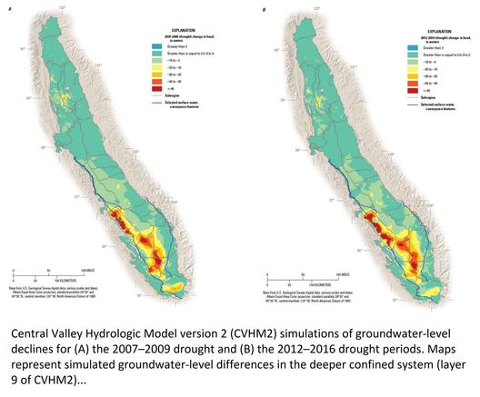
The Central Valley of California is one of the most prolific agricultural regions in the world. Agriculture is reliant on the conjunctive use of surface-water and groundwater. The lack of available surface-water and land-use changes have led to pumping-induced groundwater-level and storage declines, land subsidence, changes to streamflow and the environment, and the degradation of water quality. As a result, in part, the Sustainable Groundwater Management Act (SGMA) was developed. An examination of the components of SGMA and contextualizing regional model applications within the SGMA framework was undertaken to better understand and quantify many of the components of SGMA. Specifically, the U.S. Geological Survey (USGS) updated the Central Valley Hydrologic Model (CVHM) to assess hydrologic system responses to climatic variation, surface-water availability, land-use changes, and groundwater pumping. MODFLOW-OWHM has been enhanced to simulate the timing of land subsidence and attribute its inelastic and elastic portions. In addition to extending CVHM through 2019, the new version, CVHM2, includes several enhancements as follows: managed aquifer recharge (MAR), pumping with multi-aquifer wells, inflows from ungauged watersheds, and more detailed water-balance subregions, streamflow network, diversions, tile drains, land use, aquifer properties, and groundwater level and land subsidence observations. Combined with historical approximations, CVHM2 estimates approximately 158 km3 of storage loss in the Central Valley from pre-development to 2019. About 15% of the total storage loss is permanent loss of storage from subsidence that has caused damage to infrastructure. Climate extremes will likely complicate the efforts of water managers to store more water in the ground. CVHM2 can provide data in the form of aggregated input datasets, simulate climatic variations and changes, land-use changes or water management scenarios, and resulting changes in groundwater levels, storage, and land subsidence to assist decision-makers in the conjunctive management of water supplies.
MDPI
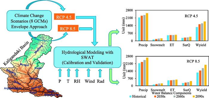
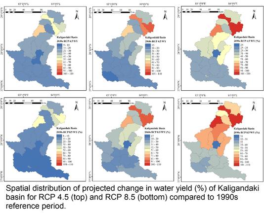
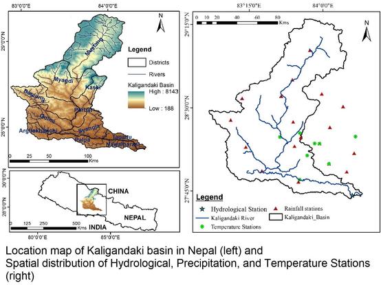
Climate Change Impact Assessment On The Hydrological Regime Of The Kaligandaki Basin, Nepal
--
https://doi.org/10.1016/j.scitotenv.2017.12.332 <-- shared paper
--
“HIGHLIGHTS
• The rise in temperature and increase in precipitation is projected in future in Kaligandaki River basin.
• The water availability in the basin is not likely to decrease during this century.
• The change in water balance in the upper sub-basins of Kaligandaki River is higher.
• The output from this research could be beneficial for water resources management..."
#GIS #spatial #mapping #Nepal #Kaligandaki #riverbasin #basin #river #hydrology #model #modeling #numericmodeling #climatechange #temperature #precipitation #ET ##waterresources #water #watersecurity #waterbalance #impactassessment #humanimpacts #freshwater #HinduKush #himalayas #SWAT #prediction #projection #cimip5 #gcm #waterbalance #snowmelt #evapotranspiration #spatialanalysis #spatiotemporal