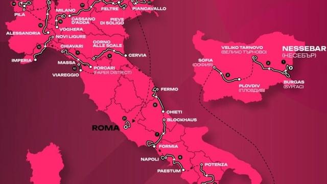
Today: Tappa 2 oggi, Giro d'Italia 2026: Burgas-Veliko Tarnovo, percorso e altimetria
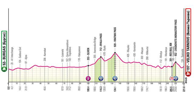
Oggi, sabato 9 maggio, si corre la seconda tappa del Giro d'Italia 2026, la Burgas-Veliko Tarnovo di 220 km. Dopo la prima tappa indossa la maglia rosa il francese Paul Magnier (Soudal Quick-Step) ha vinto sull'arrivo di Burgas dopo una maxi-caduta nell'ultimo chilometro.Altimetria e favoriti...
Stage 2 today, Giro d'Italia 2026: Burgas-Veliko Tarnovo, route and elevation profile
Today, Saturday, May 9th, the second stage of the Giro d’Italia 2026, Burgas-Veliko Tarnovo of 220 km, is being held. After the first stage, the French Paul Magnier (Soudal Quick-Step) wearing the pink jersey won at the finish in Burgas after a major crash in the last kilometer. Altimetry and favorites...
#GirodItalia #second #220km #first #French #PaulMagnier #SoudalQuick-Step #Burgas #Altimetry
https://www.today.it/sport/altro/tappa-2-oggi-giro-italia-9-maggio-2026-altimetria-diretta.html