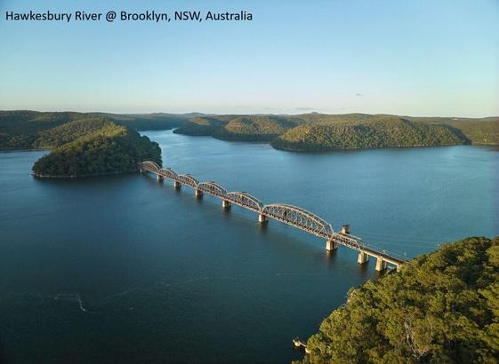
Observing The Tidal Pulse Of Rivers From Wide-Swath Satellite Altimetry
--
https://doi.org/10.1038/s41586-026-10287-z <-- shared paper
--
https://dahiti.dgfi.tum.de/en/products/river-tides/map/ <-- shared interactive map, ‘River Tides from SWOT’
--
#SWOT #RemoteSensing #Hydrology #EarthObservation #ClimateScience #CoastalSystems #Rivers #OpenScience #opendata #tide #tidal #dynamics #exchange #estuary #estuarine #webmap #wetlands #ecosystems #habitat #elevation #marine #freshwater #water #hydrography #hydrology #river #GIS #spatial #mapping #satellite #altimetry #coast #coastal #GIS #spatial #mapping #spatialanalysis #spatiotemporal #SurfaceWaterandOceanTopography #global #coverage #monitoring #model #modeling #riverine #fluvial #carbonbudgets #nitrogencycle #sedimentation #sealevelrise #SLR #megadroughts #extraction #pumping #regulations #groundwater #intrusion #risk #hazard #naturalhazards #stormsurge #waterresources #tidalrange #rivermouth
--
https://doi.org/10.1038/s41586-026-10287-z <-- shared paper
--
https://dahiti.dgfi.tum.de/en/products/river-tides/map/ <-- shared interactive map, ‘River Tides from SWOT’
--
#SWOT #RemoteSensing #Hydrology #EarthObservation #ClimateScience #CoastalSystems #Rivers #OpenScience #opendata #tide #tidal #dynamics #exchange #estuary #estuarine #webmap #wetlands #ecosystems #habitat #elevation #marine #freshwater #water #hydrography #hydrology #river #GIS #spatial #mapping #satellite #altimetry #coast #coastal #GIS #spatial #mapping #spatialanalysis #spatiotemporal #SurfaceWaterandOceanTopography #global #coverage #monitoring #model #modeling #riverine #fluvial #carbonbudgets #nitrogencycle #sedimentation #sealevelrise #SLR #megadroughts #extraction #pumping #regulations #groundwater #intrusion #risk #hazard #naturalhazards #stormsurge #waterresources #tidalrange #rivermouth