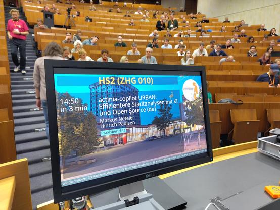
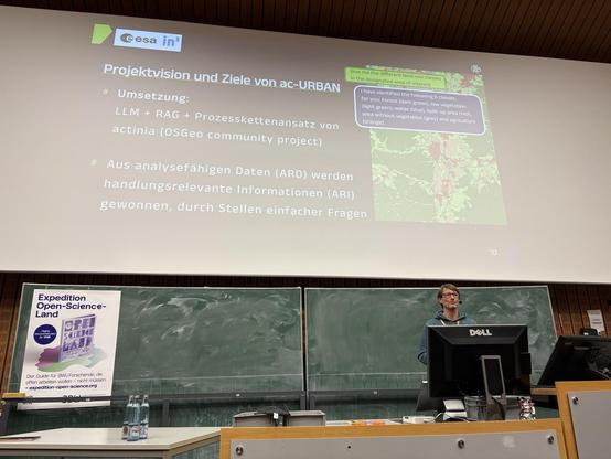
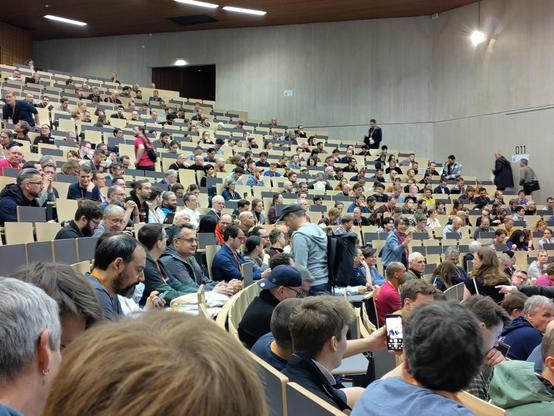
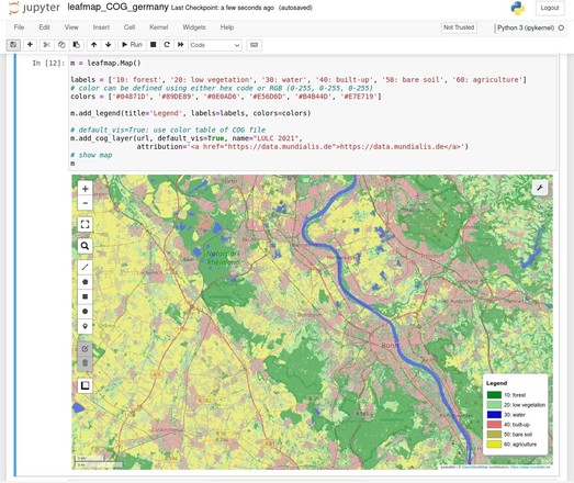
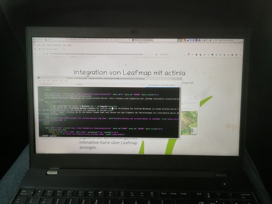
actinia wachsen Blätter: Geoprozessierung und Visualisierung mit Leafmap in Jupyter

media.ccc.de

@mundialis @terrestris

Letzte Vorbereitungen für die spannende @FOSSGISeV 2024 Konferenz ab Morgen in Hamburg!

Ich freue mich auf spannende Vorträge, Workshops und Gespräche, bis morgen!

#fossgis2024 #hamburg #osgeo #actinia #leafmap #grassgis

Scientists create artificial protein capable of degrading microplastics in bottles

Every year, around 400 million tons of plastics are produced worldwide, a number that increases by around 4% annually. The emissions resulting from their manufacture are one of the elements contributing to climate change, and their ubiquitous presence in ecosystems leads to serious ecological problems.

Phys.org
Springer Makes Open Source Chapter Of Upcoming Handbook Of Geographic Information Freely Accessible In April
-
https://link.springer.com/chapter/10.1007/978-3-030-53125-6_30 <-- shared & free journal issue
-
[a good overview of open source GIS software stacks - with an OUTSTANDING and comprehensive reference list/links at the end!]
“... As a service to the readers, the reference section of this chapter includes scientific video recordings which provide additional content regarding software capabilities, historical notes and background information: #Actinia, #GeoBlackLight, #GeoPaparazzi, #GeoPython, #GeoServer, #GeoTools, #GMT, #GRASSGIS, #gvSIG, #JTS, #Leaflet, #MapServer, #NASAWorldWind, #OSGeoLive. #PostGIS, #PROJ, #QGIS, #rasdaman. In addition, scientific videos about the #OSGeo Foundation and the annual #SolKatzAwards or #GeospatialFreeandOpenSourceSoftware are included…”
#GIS #spatial #mapping #free #opensource #software #FOSS #opensourcesoftware #algorithms #geospatialtechnology #postgresql #postgres #softwarestacks
Open Source – GIS

This chapter provides an overview over the current spectrum of free and open source licensed geospatial software tools and communities. The number of available open source geospatial tools continues to grow and diversify, while new fields of application emerge. This...

SpringerLink
Now running at #FOSSGIS2023: Our workshop on surface classification of orthophotos with #actinia and https://fosstodon.org/@grassgis. The Jupyter notebooks are available here: https://github.com/mundialis/fossgis2023/tree/main/notebooks #python
GRASS GIS (@[email protected])

87 Posts, 194 Following, 555 Followers · GRASS GIS news, tutorials, and other GIS resources.

Fosstodon
Day 2 at #fossgis2023 starts with "News from #actinia", presented by Carmen Tawalika from mundialis
#foss #grassgis #osgeo

The source code of #actinia, our #cloud based #geodata processing engine has moved!

In order to structure the actinia #GitHub repositories more clearly, the source code of actinia has moved to its own organisation https://github.com/actinia-org.

In addition to actinia-core, the plugins, an actinia-introduction/, the actinia-python-client, a list of processing-examples, and much more are now located here.
Interested in actinia? Just start or contact us.

And: actinia is an #OSGeo community project!

actinia

The cloud based geoprocessing platform actinia is able to ingest and analyse large volumes of geodata already present in the cloud. - actinia

GitHub