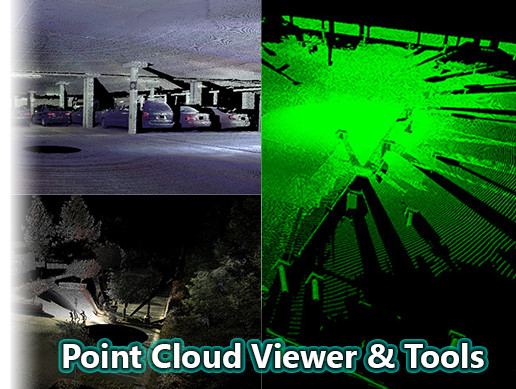
[Deprecated] Point Cloud Viewer and Tools #Ply #Lidar #Xyzrgb #Asc #Pts #Viewer #Point #Las #Xyz #Laserscanning #Pointcloud #Pointcloud #AssetStore
https://u3dn.com/packages/deprecated-point-cloud-viewer-and-tools-16019
[Deprecated] Point Cloud Viewer and Tools #Ply #Lidar #Xyzrgb #Asc #Pts #Viewer #Point #Las #Xyz #Laserscanning #Pointcloud #Pointcloud #AssetStore
https://u3dn.com/packages/deprecated-point-cloud-viewer-and-tools-16019
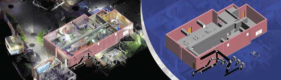
Digital Survey Transformation Using Point Cloud to BIM
Traditional surveying approaches can result in incomplete measurements and repeated visits. Laser scanning captures millions of spatial data points. When integrated into Point Cloud to BIM, surveyors can create structured 3D models, improve communication, and enhance planning accuracy for construction projects.
Know more: https://www.hitechdigital.com/blog/point-cloud-to-bim-for-construction-surveyors
#PointCloudToBIM #ScanToBIM #BIM #ConstructionSurveying #LaserScanning #3DScanning
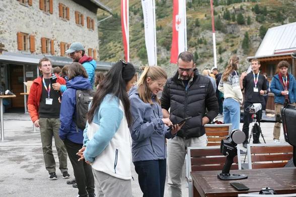
Open call for participation at the Sensing Mountains 2026 edition of the international and interdisciplinary Innsbruck Summer School of Alpine Research. We are looking forward to meet you in Obergurgl (Austria).
https://www.uibk.ac.at/en/weiterbildung/sensing-mountains/
https://www.uibk.ac.at/en/geography/sensing-mountains/2026/
#sensingmountains #remotesensing #closerangesensing #laserscanning #photogrammetry #thermography #changedetction #timeseries #mountainresearch #geography #geomorphology #forestry #naturalhazards #earthobservation @uniinnsbruck

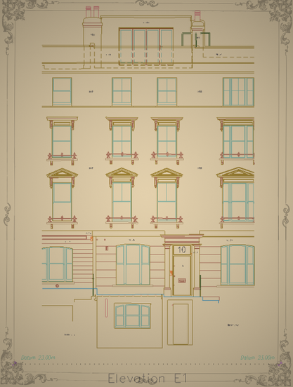
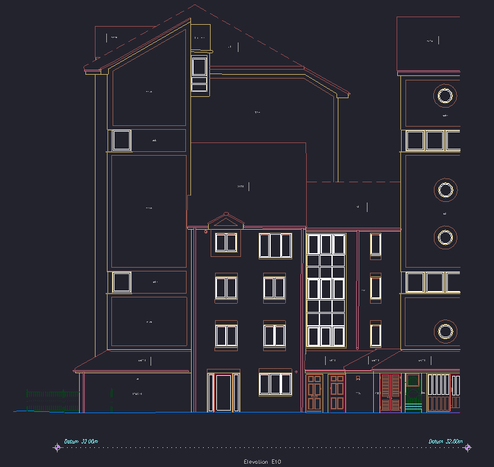
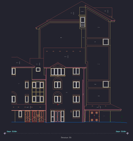
Excited to share a glimpse into my latest architectural elevation drawings✨️
My aim is always to blend precision with elegance, and I feel these pieces truly embody that spirit.
#Architecture #2Ddrawing #Elevations #Portfolio #NewProjects #laserscanning #cad #BIM #outsourcingfirm
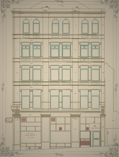
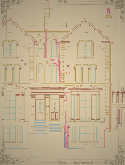
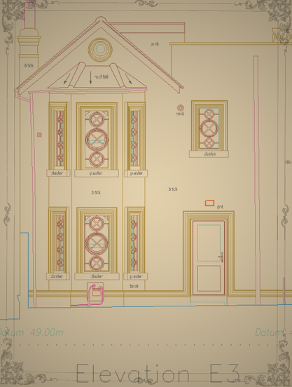
What a year it's been!🎉 Feeling immense gratitude and pride as I look back at some of my latest architectural elevation drawings. Each line, every detail, crafted with passion and precision.
Ready to jump into new challenges and projects! #Architecture #Elevations #Portfolio #2Ddrawing #CADdrafting #geodesy #pointcloud #laserscanning #survey

Is there a way to guide normal calculation of points in 3d space e.g. via placing points that are guaranteed to be "outside" of the mesh? Cloud Compare works with spanning trees, but I do not get correct results in complex models.
Discover precision with top 3D laser scanning services in London! 🏙️📏
🔗 Discover more—link in bio!
https://kershmedia.co.uk/3d-scanning-surveyors-london/
#laserscanning #surveyors #londonrealestate #constructiontech #3dsurvey
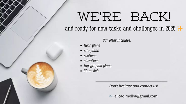
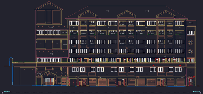
We're back and ready to work! Check out the offer ✨️❄️
#floorplan #2Ddrawing #CADdrafting #geodesy #pointcloud #laserscanning #survey #dwg #landsurveyor #measuredbuildingsurvey #outsourcing #elevation #section #architecture #inventarisation