#Digitalcamerashacks #Howto #3dscanning #Mirror #OpenScan #Photogrammetry #Pointcloud
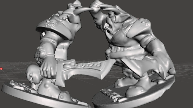
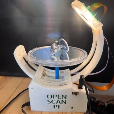
Using a Mirror to 3D Scan Both Sides of an Object at Once
[Deprecated] Point Cloud Viewer and Tools #Ply #Lidar #Xyzrgb #Asc #Pts #Viewer #Point #Las #Xyz #Laserscanning #Pointcloud #Pointcloud #AssetStore
https://u3dn.com/packages/deprecated-point-cloud-viewer-and-tools-16019
VSCode とブラウザで使える軽量点群ビューアを作ってみた
https://qiita.com/hrpad/items/588474a1b70d413104f8?utm_campaign=popular_items&utm_medium=feed&utm_source=popular_items
Vandaag staan @terglobo en ik op de HAS #GeoExperience in 's-Hertogenbosch met een #QGIS‑stand. We geven ook een workshop over #pointcloud processing & #3D #visualisatie in QGIS.
Niet erbij? De workshop is gratis online te volgen op @gisocw: https://courses.gisopencourseware.org/course/view.php?id=82
Er staan nóg meer NL‑cursussen op GIS OpenCourseWare. Zie: https://courses.gisopencourseware.org/course/index.php?categoryid=8
Day 3/100: 25M points in one file. Where to start?
FOSS4G 2019: Connor Manning & Adam Steer demo'd PDAL/Entwine. Hooked instantly.
Sequence matters: classify, filter, mesh, interpolate.
Filter too early → lose detail. Too late → noise corrupts.
570M points. 19h processing. Open-source JSON pipelines. All documented. Visualization: seconds. Processing: 19 hours.
https://blog.maptheclouds.com/learning/lidar-pdal-experiments-yosemite-valley
During my studies, I connected with the company that captured a point cloud of the iconic Agfa-Gevaert factory nearby. It’s fascinating to see these two technologies converge in a single file.
more info: https://jeroenbocken.com/works/3d_laser_scan_pointcloud_agfa-gevaert.html