lol Ben is getting serious

#girt #humdinger

Postfire debris-flow hazards | U.S. Geological Survey

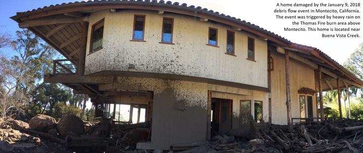
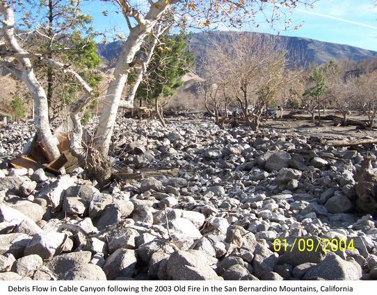
Estimates of the probability and volume of debris flows that may be produced by a storm in a recently burned area, using a model with characteristics related to basin shape, burn severity, soil properties, and rainfall.Wildfire can significantly alter the hydrologic response of a watershed to the extent that even modest rainstorms can produce dangerous flash floods and debris flows. The USGS conducts post-fire debris-flow hazard assessments for select fires in the Western U.S. We use geospatial data related to basin morphometry, burn severity, soil properties, and rainfall characteristics to estimate the probability and volume of debris flows that may occur in response to a design storm.

The USGS Provides Maps & Imagery For Hurricane Response
--
https://www.usgs.gov/news/featured-story/usgs-provides-maps-and-imagery-hurricane-response <-- link to technical article
--
https://apps.nationalmap.gov/event-support-map-hub/ <-- Geospatial Information Response Team (GIRT) hazard USGS The National Map (TNM) page
--
H/T #XanFredricks
“🌊For this hurricane season, the [U.S. Geological Survey (USGS) Geospatial Information Response Team] GIRT has a newly designed, publicly available Event Support Map HUB site that offers access to applications, resources and information for hurricanes and other natural disasters…”
#GIS #spatial #mapping #USGS #NGP #GIRT #EROS #NGTOC #HDDS #3DEP #TheNationalMap #science #maps #imagery #hurricanes #tropicalstorms #hazards #emergencyresponse #disasterresponse #firstresponders #supportmaps #realtimedata #information #response #gischat #appliedscience
@usgs #USGS
The USGS provides maps and imagery for hurricane response | U.S. Geological Survey

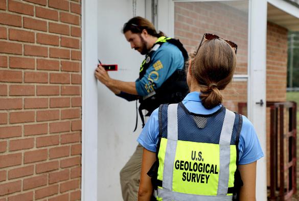
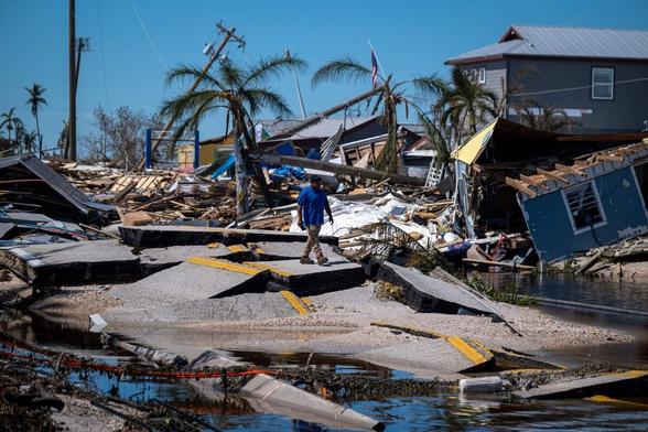
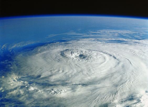
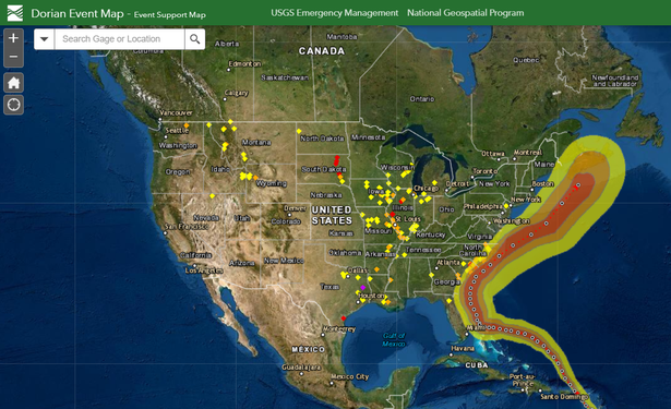
The 2023 Atlantic Hurricane Season runs from June 1 through November 30. Throughout the season, the U.S. Geological Survey will be providing science that can help guide efforts to protect lives and property if a storm threatens the U.S.