Přednáška: hannah baer – I need you [in the club]

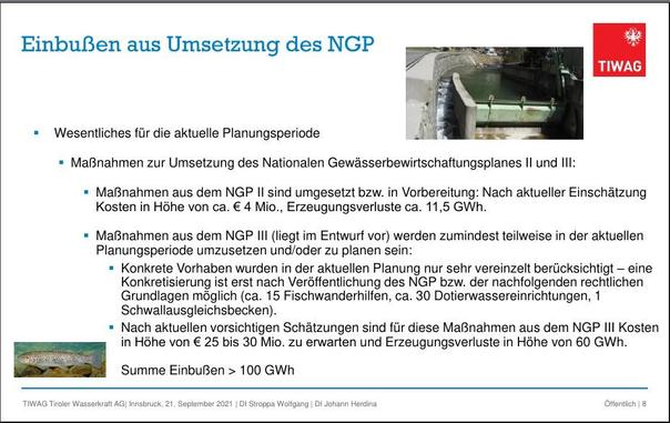
Die TIWAG hebt das sogar explizit als Kapitel hervor:
"Einbußen aus Umsetzung des NGP"
Kosten und Erzeugungsverluste. Kein Wort zu einer Notwendigkeit die Natur intakt zu halten (auch auf den anderen Seiten der gezeigten Präsentation ["Ausbau der Wasserkraft in Tirol"] nicht).
Ist eben ein kapitalgetriebenes Unternehmen. 🤷♂️
Und das Land Tirol als Nutznießer von "Sonderdividenden" schaut weg. Erst Gerichte müssen das zu 100% in Landesbesitz stehende Unternehmen zu den gesetzlich vorgeschriebenen Ausgleichsmaßnahmen zwingen - wie eben 2022 die Ausgleichsmaßnahmen zum Speicherneubau Kühtai (Längental 2).
"Inn: Vom Gericht verordnete Renaturierung"
https://tirol.orf.at/stories/3141905/
#JournalismusAmLimit #Wasserkraft #TIWAG #Tirol #Kühtai #Längental #Umweltschutz #Naturschutz #Gewässerökologie #NGP #Fischwanderhilfe #Geld #Gier #TaxTheRich #EatTheRich
Přednáška: hannah baer – I need you [in the club]


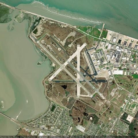
Naval Air Station Corpus Christi Truax Field - Corpus Christi, United States
https://en.wikipedia.org/wiki/Naval_Air_Station_Corpus_Christi
https://www.openstreetmap.org/#map=13/27.692600/-97.291100
#KNGP #NGP #CorpusChristi #UnitedStates #airport #aviation #avgeeks #GIS

Détruire l’école en douceur : mode d’emploi (OCDE, 1996)
En 1996, dans un rapport passé relativement inaperçu de ce côté-ci de l’Atlantique, l’OCDE présentait sa vision de l’éducation pour le XXIe siècle...
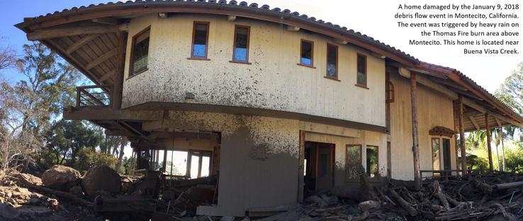

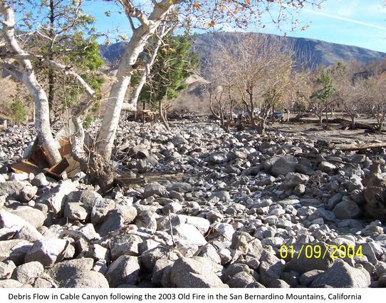

Estimates of the probability and volume of debris flows that may be produced by a storm in a recently burned area, using a model with characteristics related to basin shape, burn severity, soil properties, and rainfall.Wildfire can significantly alter the hydrologic response of a watershed to the extent that even modest rainstorms can produce dangerous flash floods and debris flows. The USGS conducts post-fire debris-flow hazard assessments for select fires in the Western U.S. We use geospatial data related to basin morphometry, burn severity, soil properties, and rainfall characteristics to estimate the probability and volume of debris flows that may occur in response to a design storm.