LA NOTIZIA: Caldo soffocante e bombe d’acqua: il Ponte del 2 Giugno sarà all’insegna dell’instabilità meteorologica

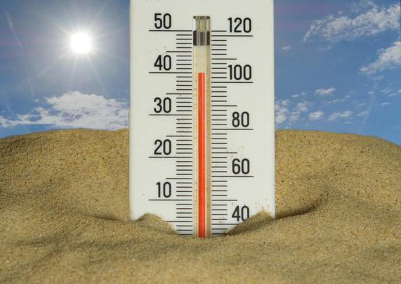
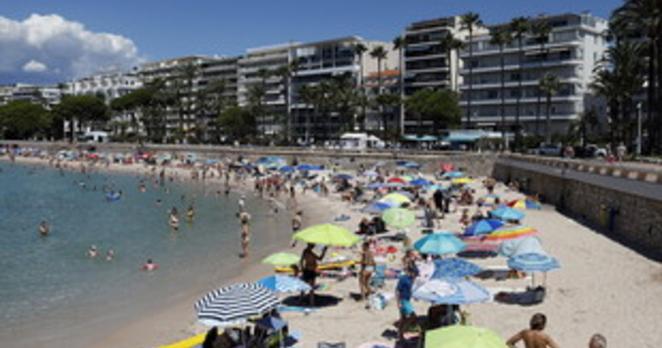
Sembra proprio che l’afa soffocante, intervallata da brevi ma intensi rovesci, accompagnerà l’Italia almeno fino al Ponte del 2 Giugno, in occasione della Festa della Repubblica.
Come riferisce Lorenzo Tedici, meteorologo responsabile media de iLMeteo.it, in questi giorni si sta assistendo a una lieve e temporanea diminuzione delle temperature a causa dell’instabilità che sta interessando soprattutto il Centro-Nord.
Già nelle prossime ore il maltempo scatenerà temporali improvvisi e di forte intensità sulla Pianura Padana, in particolare sull’Emilia e sui settori del Nord-Ovest, ma anche su Liguria e Toscana.
Con il passare delle ore, l’instabilità si sposterà progressivamente lungo la Penisola, concentrandosi inizialmente sulla fascia appenninica e successivamente sulle coste tirreniche. Attesi rovesci intensi sulla bassa Toscana, sull’Umbria, sul Lazio, sulla Calabria e sulla Sicilia.
Caldo soffocante e bombe d’acqua: il Ponte del 2 Giugno sarà all’insegna dell’instabilità meteorologica
Nelle restanti regioni, invece, continuerà a prevalere il sole, con temperature ancora superiori alla media stagionale.
A partire da domenica, seppur gradualmente, il maltempo inizierà ad abbandonare l’Italia. Le colonnine di mercurio nella Pianura Padana torneranno infatti a superare i 33 gradi, con picchi compresi tra i 34 e i 35 gradi. A rendere ancora più pesante la situazione contribuirà l’elevato tasso di umidità, che farà aumentare sensibilmente la percezione dell’afa.
Lunedì il bel tempo prevarrà su gran parte del Paese, ma martedì, in occasione della Festa della Repubblica, è atteso un nuovo e rapido peggioramento delle condizioni meteorologiche, con temporali diffusi su tutto il Nord e su gran parte del Centro Italia.
L'articolo Caldo soffocante e bombe d’acqua: il Ponte del 2 Giugno sarà all’insegna dell’instabilità meteorologica sembra essere il primo su LA NOTIZIA.

Hot, stifling heat and water bombs: the June 2nd Bridge will be marked by meteorological instability.

It seems that stifling heat, interspersed with brief but intense showers, will accompany Italy at least until the Ponte del 2 Giugno (June 2nd Bridge) in connection with the Festa della Repubblica (Republic Day).

As reported by Lorenzo Tedici, meteorologist responsible for media at iLMeteo.it, in these days we are witnessing a slight and temporary decrease in temperatures due to the instability affecting particularly the Center-North.

Already in the next hours, bad weather will trigger sudden and strong thunderstorms over the Padano Plain, particularly in Emilia and the Northwest sectors, but also in Liguria and Tuscany.

As the hours pass, the instability will progressively move along the peninsula, initially focusing on the Apennine range and subsequently on the Tyrrhenian coasts. Heavy showers are expected in southern Tuscany, Umbria, Lazio, Calabria, and Sicily.

Scorching heat and flash floods: the Ponte del 2 Giugno (June 2nd Bridge) will be marked by meteorological instability.

In the remaining regions, sunshine will continue to prevail, with temperatures still above the seasonal average.

Starting from Sunday, albeit gradually, the bad weather will begin to leave Italy. Mercury columns in the Padano Plain will return to exceed 33 degrees Celsius, with peaks between 34 and 35 degrees. The high humidity rate will further exacerbate the situation, significantly increasing the perception of stifling heat.

Monday will bring fair weather to most of the country, but Tuesday, on the occasion of the Festa della Repubblica (Republic Day), a new and rapid deterioration of weather conditions is expected, with widespread thunderstorms across Northern Italy and much of Central Italy.

#Italy #thePontedel2 #Giugno #LorenzoTedici #thePadanoPlain #Emilia #Northwest #Liguria #Tuscany #Apennine #Tyrrhenian #Umbria #Lazio #Calabria #Sicily #Mercury #33degreesCelsius #35degrees #NorthernItaly #CentralItaly

https://www.lanotiziagiornale.it/caldo-bombe-dacqua-ponte-2-giugno/

Caldo soffocante e piogge: il meteo del 2 Giugno sarà instabile | LA NOTIZIA

Caldo soffocante e bombe d’acqua: il Ponte del 2 Giugno sarà all'insegna dell'instabilità meteorologica su tutta l'Italia

LA NOTIZIA

Agenzia Nova: Veneto: Cunegato (Avs), legge su inclusione lavorativa persone con disabilita' rischia di essere occasione mancata

27 mag 11:31 - (Agenzia Nova) - La legge veneta in materia di inclusione lavorativa delle persone con disabilita' va nella direzione giusta,... (Rev)

An unusual heatwave over Italy: according to weather forecasts, in the center and north, mercury levels will reach record highs up to 36 degrees Celsius.

According to the calendar, we are in the final phase of spring, but observing the temperatures, the feeling is that we are already in the full summer. According to the latest weather forecasts, in the next few hours, the recent heatwave will peak, bringing maximum temperatures to 36 degrees Celsius in some northern cities.

This is a thermal anomaly that, according to meteorologist Lorenzo Tedici, responsible for media at iLMeteo.it, will see northern regions record values 8-9 degrees higher than the average for the period.

Based on the most up-to-date weather models, the hottest cities will be Pavia, Piacenza, Cremona, and Modena. But the heat will affect much of the Padano Plain, where temperatures will reach 35 degrees Celsius in cities such as Turin, Bologna, Alessandria, Asti, Vercelli, Milan, Lodi, Parma, Reggio Emilia, Mantua, Verona, Rovigo, Ferrara, and Forlì.

African heat will also prevail in the Center, where maximum temperatures will stabilize between 34 and 35 degrees Celsius. It will be slightly better in the South, with lower values than the rest of the country.

Anomalous heatwave over Italy: according to weather forecasts, in the center and north, the mercury columns will reach record values up to 36 degrees.

Temperatures will return to levels more in line with late spring only at the end of the month, when across much of Italy the maximums will fall between 32 and 34 degrees. A drop that, however, does not seem destined to bring real relief to Italians, due to the increase in humidity in the lower layers of the atmosphere, which will significantly increase the perceived temperature.

Further worsening the situation will be the atmospheric instability generated by these thermal fluctuations: the energy accumulated by the soil during the hottest hours will favor the development of intense, localized afternoon thunderstorms.

Tomorrow, thunderstorms will affect several areas of the North, while in the Center, bad weather will mainly hit the Apennine areas. In the South, probable afternoon showers will remain likely along the Apennines and, locally, along the Campania coastlines, while elsewhere the weather will remain more stable.

Friday will see the sun return to shine in the North, but the thunderstorm phenomena could be sudden and particularly intense. Instability is also forecast for the Center and South.

#Italy #36degreesCelsius #LorenzoTedici #Pavia #Piacenza #Cremona #Modena #thePadanoPlain #35degreesCelsius #Turin #Bologna #Vercelli #Milan #Parma #ReggioEmilia #Mantua #Verona #Rovigo #Ferrara #Forlì #African #Center #South #36degrees #34degrees #Italians #North #Apennine #Campania

https://www.lanotiziagiornale.it/caldo-anomalo-italia-previsioni-meteo/

Meteo: ondata di caldo anomalo sull'Italia | LA NOTIZIA

Ondata di caldo anomalo sull'Italia: secondo le previsioni meteo al centro e al nord le colonnine di mercurio toccheranno i 36 gradi

LA NOTIZIA

Il Tempo: Meteo, nel week esplode l'estate. Sole su tutta l'Italia, temperature fino a 30°

È all'insegna del caldo il tempo previsto sull'Italia domenica 24 maggio, e per i successivi quattro giorni, secondo il servizio meteorologico dell'Aeronautica militare. Sereno su tutte le regioni del Nord durante la mattinata; dalle prime ore pomeridiane sono attesi addensamenti nuvolosi a ridosso dell'arco alpino. Al Centro e sulla Sardegna sole per tutta la giornata così come nel Mezzogiorno e in Sicilia. Qualche rovescio soltanto nelle zone interne della Basilicata e lungo l'appennino meridionale. Le temperature minime saranno in aumento su gran parte del Paese, stazionarie sulla Sardegna e sulla Puglia. Massime in generale aumento sull'intera Penisola, potranno sfiorare i 30 gradi. L'estate tanto attesa esploderà nel fine settimana. I venti saranno deboli e questo aumenterà la percezione del caldo. I mari poco mossi. Ancora bel tempo e caldo lunedì e martedì.

Weather, this weekend, the summer explodes. Sun across all of Italy, temperatures up to 30°C.

The weather forecast for Italy on Sunday, May 24th, and for the following four days, according to the military aeronautical weather service, is dominated by heat. Sunny across all Northern regions during the morning; cloudiness is expected along the Alpine arc from early afternoon. Sunny throughout the day in Central Italy, Sardinia, and the South (Mezzogiorno) and Sicily. Only scattered showers are expected in the inland areas of Basilicata and along the southern Apennine. Minimum temperatures will rise across most of the country, remaining stable in Sardinia and Puglia. Maximum temperatures will generally increase across the entire peninsula, potentially reaching 30 degrees Celsius. The long-awaited summer will explode this weekend. Winds will be light and will increase the perception of heat. Calm seas. Still good weather and heat on Monday and Tuesday.

#Italy #Northern #Alpine #CentralItaly #Sardinia #Mezzogiorno #Sicily #Basilicata #Apennine #Puglia #30degreesCelsius

https://www.iltempo.it/attualita/2026/05/22/news/meteo-nel-week-esplode-l-estate-sole-su-tutta-l-italia-e-temperature-fino-a-30-gradi-47835018/

Meteo, nel week esplode l'estate. Sole su tutta l'Italia, temperature fino a 30°

È all'insegna del caldo il tempo previsto sull'Italia domenica 24 maggio, e per i successivi quattro giorni, secondo il servizio meteor...

RaiNews: Giro d’Italia: l’ultimo chilometro di Vingegaard che vince la Formia-Blockhaus di 244 km

Il danese scatta a cinque chilometri dall’arrivo del tappone appenninico, insieme a Pellizzari, poi allunga lasciando indietro il 22enne marchigiano

Giro d’Italia: Vingegaard’s last kilometer wins the 244 km Formia-Blockhaus stage

The Dane attacks five kilometers from the finish of the Apennine stretch, alongside Pellizzari, then pulls ahead, leaving the 22-year-old from the Marche behind.

#Girod’Italia #Vingegaard #lastkilometer #244km #Formia-Blockhaus #fivekilometers #Apennine #Pellizzari #Marche

https://www.rainews.it/video/2026/05/ciclismo-giro-d-italia-settima-tappa-formia-blockhaus-244-chilometr-tappa-ultimo-km-vingegaard-video-bae37979-d8c3-4e35-855e-31a00c67a766.html

Giro d’Italia: l’ultimo chilometro di Vingegaard che vince la Formia-Blockhaus di 244 km

Il danese scatta a cinque chilometri dall’arrivo del tappone appenninico, insieme a Pellizzari, poi allunga lasciando indietro il 22enne marchigiano

RaiNews

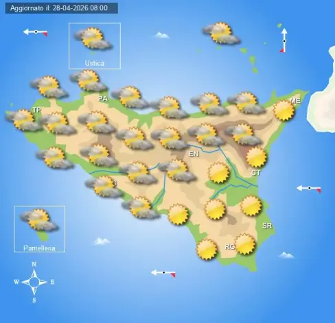
Sicilianews24.it: Meteo Sicilia di mercoledì 29 aprile

Tempo asciutto nel corso della giornata su tutta la regione con cieli sereni o poco nuvolosi sia al mattino che al pomeriggio. In serata e nottata si rinnovano condizioni di tempo stabile ma con nuvolosità irregolare in transito.
NAZIONALE
AL NORD
Al mattino molte nubi su tutte le regioni con piogge sparse specie su Alpi e Prealpi. Al pomeriggio instabilità in aumento sui rilievi alpini e appenninici con acquazzoni e temporali, locali sconfinamenti anche sulle pianure. In serata e in nottata si rinnovano condizioni di tempo instabile con ancora piogge soprattutto sulla Pianura Padana.
AL CENTRO
Tempo stabile al mattino su tutte le regioni con cieli sereni o poco nuvolosi. Al pomeriggio possibile qualche piovasco in Appennino, asciutto altrove con velature in transito. Tra la serata e la notte nuvolosità in aumento con anche possibili piogge tra Marche e Abruzzo.
AL SUD E SULLE ISOLE
Giornata all’insegna del bel tempo sulle regioni del Sud con cieli soleggiati sia al mattino che al pomeriggio, maggiore nuvolosità in transito sulle Isole Maggiori con locali piogge sulla Sardegna. Tra la serata e la notte nuvolosità in aumento anche sulle regioni peninsulari ma con tempo asciutto o al più dei piovaschi isolati tra Campania e Molise.
Temperature minime in generale diminuzione salvo un lieve rialzo sulle Isole Maggiori, massime in aumento ma con lieve calo lungo i settori adriatici.
Www.centrometeoitaliano.it
L'articolo Meteo Sicilia di mercoledì 29 aprile sembra essere il primo su Sicilianews24.it.

Weather in Sicily on Wednesday, April 29th

Dry weather throughout the day across the entire region with clear or slightly cloudy skies in the morning and afternoon. In the evening and night, stable weather conditions return but with irregular cloudiness moving through.

NATIONAL
NORTH
In the morning, many clouds over all regions with scattered showers, especially in the Alps and Prealps. In the afternoon, instability increases in the alpine and Apennine areas with showers and thunderstorms, with local spillover onto the plains. In the evening and night, unstable weather conditions return with continued showers, especially over the Padano Plain.
CENTRAL
Stable weather in the morning over all regions with clear or slightly cloudy skies. In the afternoon, occasional drizzle is possible in the Apennines, dry elsewhere with passing cloud cover. Between evening and night, cloudiness increases with possible showers between Marche and Abruzzo.
SOUTH AND ISLANDS
A day of beautiful weather across the southern regions with sunny skies in the morning and afternoon, greater cloudiness moving through the Larger Islands with local showers in Sardinia. Between evening and night, cloudiness increases also over the mainland regions but with dry weather or at most isolated showers between Campania and Molise.
Temperatures generally decreasing except for a slight rise in the Larger Islands, maximums increasing but with a slight drop along the Adriatic sectors.
Www.centrometeoitaliano.it
The article "Meteo Sicilia" of Wednesday, April 29th appears to be the first on Sicilianews24.it.

#Sicily #Prealps #Apennine #thePadanoPlain #Marche #Abruzzo #Sardinia #Campania #Molise #Adriatic #MeteoSicilia #first

https://www.sicilianews24.it/meteo-sicilia-di-mercoledi-29-aprile-827136.html

Meteo Sicilia di mercoledì 29 aprile

Tempo asciutto nel corso della giornata su tutta la regione con cieli sereni o poco nuvolosi sia al mattino che al pomeriggio. In serata e nottata si

Sicilianews24.it

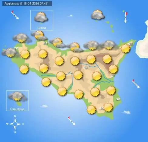
Sicilianews24.it: Meteo Sicilia di sabato 18 e domenica 19 aprile

Sabato. Giornata all’insegna del tempo stabile su tutta la regione con nubi sparse e schiarite sia al mattino che al pomeriggio, salvo isolati acquazzoni sui rilievi interni. Nessuna variazione in serata e nottata con tempo stabile e ampi spazi di sereno ovunque.
Domenica. Tempo asciutto su tutta la regione con cieli per lo più sereni al mattino e poco nuvolosi nel pomeriggio. In serata e nottata si rinnovano condizioni di tempo asciutto ma con qualche addensamento in più in transito.
NAZIONALE
AL NORD
Tempo stabile al mattino su tutte le regioni con sole prevalente e qualche addensamento alto in transito. Al pomeriggio instabilità in aumento sui rilievi con locali piovaschi, sereno o poco nuvoloso altrove. In serata e nottata tempo nuovamente stabile ma con nuvolosità in progressivo aumento.
AL CENTRO
Al mattino tempo stabile su tutte le regioni con cieli sereni o poco nuvolosi, locali addensamenti bassi sulle coste tirreniche. Nel pomeriggio si rinnovano condizioni di tempo asciutto con sole prevalente ovunque. In serata e nottata ancora tempo stabile con assenza prevalente di nuvolosità.
AL SUD E SULLE ISOLE
Al mattino tempo stabile su tutte le regioni con sole prevalente, salvo addensamenti bassi lungo le regioni Tirreniche. Al pomeriggio nuvolosità in sviluppo nelle zone interne appenniniche ma senza fenomeni di rilievo associati. In serata e nella notte si rinnovano condizioni di tempo asciutto ovunque con ampie schiarite su tutte le regioni.
Temperature minime stabili o in rialzo da nord a sud; massime in lieve calo al sud, stabili o in lieve rialzo al centro-nord e sulla Isole Maggiori.
Www.centrometeoitaliano.it
L'articolo Meteo Sicilia di sabato 18 e domenica 19 aprile sembra essere il primo su Sicilianews24.it.

Weather in Sicily on Saturday, April 18th and Sunday, April 19th

Saturday. A day marked by stable weather across the entire region with scattered clouds and clear skies both in the morning and afternoon, with isolated showers in the inland hills. No changes in the evening and night with stable weather and vast areas of clear skies everywhere.

Sunday. Dry weather across the entire region with mostly clear skies in the morning and slightly cloudy skies in the afternoon. In the evening and night, dry weather conditions persist but with some increased cloudiness passing through.

NATIONAL
NORTH
Stable weather in the morning across all regions with mostly sunny conditions and some high cloudiness passing through. In the afternoon, instability increases in the hills with local showers, clear skies or slightly cloudy conditions elsewhere. In the evening and night, weather stabilizes again but with progressively increasing cloudiness.

CENTRAL
In the morning, stable weather across all regions with clear or slightly cloudy skies, with local low cloudiness along the Tyrrhenian coasts. In the afternoon, dry weather conditions persist with mostly sunny skies everywhere. In the evening and night, stable weather continues with a predominance of clear skies.

SOUTH AND ISLANDS
In the morning, stable weather across all regions with mostly sunny conditions, except for low cloudiness along the Tyrrhenian regions. In the afternoon, cloudiness develops in the inland Apennine areas but without significant weather associated with it. In the evening and at night, dry weather conditions persist everywhere with vast clear skies across all regions.

Minimum temperatures stable or rising from north to south; maximum temperatures slightly decreasing in the south, stable or slightly rising in the center-north and on the larger islands.

Www.centrometeoitaliano.it
The article "Meteo Sicilia" for Saturday, April 18 and Sunday, April 19 appears to be the first on Sicilianews24.it.

#Sicily #Tyrrhenian #Apennine #MeteoSicilia #first

https://www.sicilianews24.it/meteo-sicilia-di-sabato-18-e-domenica-19-aprile-826064.html

Meteo Sicilia di sabato 18 e domenica 19 aprile

Sabato. Giornata all’insegna del tempo stabile su tutta la regione con nubi sparse e schiarite sia al mattino che al pomeriggio, salvo isolati acquazzoni

Sicilianews24.it

LA NOTIZIA: Meteo, la primavera ingrana la marcia e fino a venerdì farà segnare temperature sopra la media

Dopo essersi fatta desiderare a lungo, la primavera sembra aver ingranato la marcia. Come risulta dalle ultime previsioni meteo, almeno fino a venerdì l’anticiclone africano continuerà a dominare sull’Italia, portando temperature sopra la media e in linea sui valori tipici di fine maggio.
Nel weekend atteso un lieve peggioramento del meteo, con le temperature che si allineeranno alla media del periodo, passando dagli attuali 25-26°C a 20°C.
Meteo, la primavera ingrana la marcia
Secondo Lorenzo Tedici, meteorologo de iLMeteo.it, “il tempo si manterrà stabile e soleggiato quasi ovunque salvo qualche disturbo sull’Alto Adriatico portato da moderate correnti di Bora, un po’ di nubi basse marittime su Liguria e Basso Tirreno e qualche modesto addensamento pomeridiano lungo i rilievi appenninici”.
Secondo lui un possibile peggioramento “è atteso da domenica sera a partire dal Nordovest”.
Le previsioni in dettaglio
Domani, giovedì 9 aprile, al Nord ci sarà bel tempo diffuso, con qualche nube concentrata al Nordest. Nuovole che interesseranno soprattutto il Centro e in particolare i settori adriatici, mentre al Sud si registreranno nuvole occasionali.
Venerdì, al Nord e al Centro il cielo si farà più nuvoloso.
Nel weekend atteso un lieve calo termico su tutta l’Italia.
L'articolo Meteo, la primavera ingrana la marcia e fino a venerdì farà segnare temperature sopra la media sembra essere il primo su LA NOTIZIA.

Weather, spring is really getting going and temperatures will be above average until Friday.

After having lingered for a long time, spring seems to have shifted into high gear. As shown by the latest weather forecasts, at least until Friday, the African anticyclone will continue to dominate Italy, bringing temperatures above average and in line with typical late May values.

Over the weekend, a slight deterioration in the weather is expected, with temperatures aligning with the seasonal average, dropping from the current 25-26°C to 20°C.

Weather, spring shifts into high gear

According to Lorenzo Tedici, a meteorologist for iLMeteo.it, “the weather will remain stable and sunny almost everywhere, with only some disturbances in the Upper Adriatic brought by moderate Bora winds, some low maritime clouds over Liguria and the Lower Tyrrhenian Sea, and some modest afternoon cloud cover along the Apennine hills.”

According to him, a possible deterioration “is expected from Sunday evening, starting in the Northwest.”

Detailed forecasts

Tomorrow, Thursday, April 9th, the North will have widespread good weather, with some clouds concentrated in the Northeast. New clouds will affect mainly the Center and particularly the Adriatic sectors, while occasional clouds will be observed in the South.

Friday, the sky will become more cloudy in the North and Center.

A slight drop in temperature is expected over the weekend throughout Italy.

The article Weather, spring shifts into high gear and until Friday temperatures will exceed the average seems to be the first on LA NOTIZIA.

#African #Italy #25-26° #LorenzoTedici #theUpperAdriatic #Liguria #Apennine #Northwest #North #Northeast #Adriatic #South #theNorthandCenter #first #LANOTIZIA

https://www.lanotiziagiornale.it/meteo-primavera-temperature-sopra-media/

Meteo, la primavera ingrana la marcia | LA NOTIZIA

Meteo, la primavera ingrana la marcia e fino a venerdì farà segnare temperature sopra la media, vicine a quelle di fine maggio

LA NOTIZIA

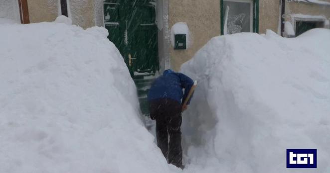
RaiNews: Maltempo intenso sferza Abruzzo e Molise

Nevicate abbondanti interessano le aree interne e appenniniche. Nel Basso Molise è scattato il piano di emergenza per la diga del Liscione

Severe weather is lashing Abruzzo and Molise.

Heavy snowfall is affecting inland and Apennine areas. An emergency plan has been activated for the Liscione dam in Lower Molise.

#Abruzzo #Molise #Apennine #Liscione #LowerMolise

https://www.rainews.it/video/2026/04/maltempo-intenso-sferza-abruzzo-e-molise-5cb2dec7-6ced-4ee9-b850-40ec4cc91192.html

Maltempo intenso sferza Abruzzo e Molise

Nevicate abbondanti interessano le aree interne e appenniniche. Nel Basso Molise è scattato il piano di emergenza per la diga del Liscione

RaiNews

LA NOTIZIA: Meteo, arriva il colpo di coda dell’inverno: attese abbondanti nevigate e forte vento sull’Appennino

L’anticipo di primavera che per settimane ha portato clima mite e giornate soleggiate, sta lasciando il passo all’ultimo colpo di coda dell’inverno. Stando alle ultime previsioni meteo, in queste ore sta tornando il freddo pungente e con esso anche forti raffiche di vento e anche abbondanti nevicate. A farne le spese è soprattutto l’Appennino centrale, dove è atteso un vero “bis” invernale, con fiocchi di neve che dovrebbero cadere fino a quota 600-700 metri.
Il colpo di coda dell’inverno colpisce soprattutto l’Appennino centrale
Sui rilievi dell’Appennino la neve cade fitta, mentre lungo l’Adriatico si assiste all’aumento della nuvolosità che porta pioggia diffusa. Al Sud a farla da padrone il maltempo, un territorio già duramente provato dagli allagamenti e dalle mareggiate degli ultimi giorni.
Ma il vero protagonista di questi giorni sarà il vento, con l’arrivo della Bora, del Grecale, e della Tramontana, che spazzeranno l’Italia in lungo e largo. Raffiche di vento che renderanno agitati i mari esposti e riporteranno condizioni pienamente invernali. Ma non è tutto. Questo vento, a tratti molto intenso, attiverà il temibile effetto Wind-Chill, ossia quel fenomeno per cui la temperatura percepita dal nostro corpo risulta nettamente inferiore a quella reale misurata dal termometro.
La primavera può attendere
Giovedì, quando si celebrerà la Festa del Papà, il tempo resterà incerto. Si segnala, infatti, ancora freddo a tratti – soprattutto al Sud – mentre nel resto del Paese si assisterà a un miglioramento delle temperature. Ma malgrado l’arrivo dell’Equinozio di primavera, previsto per il 19 marzo, la realtà è che la primavera si farà attendere ancora per un po’.
Il miglioramento meteorologico, infatti, sarà di breve durata e già nel primo weekend primaverile il meteo tornerà incerto e agitato, con quello che gli esperti ritengono essere il vero ultimo colpo di coda dell’inverno. Le previsioni per sabato 21 e domenica 22 restano tentennanti: al momento sono probabili nuove nevicate sulle Alpi nella giornata di sabato e un nuovo disturbo piovoso in transito tra Sicilia e Sardegna per domenica. Incertezza che si proietta anche sull’avvio della prossima settimana, la quale sembra destinata a restare sotto media dal punto di vista termico.
L'articolo Meteo, arriva il colpo di coda dell’inverno: attese abbondanti nevigate e forte vento sull’Appennino sembra essere il primo su LA NOTIZIA.

Weather, the final blow of winter is arriving: abundant snowfall and strong winds expected in the Apennines.

The spring advance that for weeks had brought mild weather and sunny days is giving way to winter’s final surge. According to the latest weather forecasts, the cold is returning with biting frost, along with strong wind gusts and abundant snowfall. The central Apennines are particularly affected, where a real “winter reprise” is expected, with snow falling down to 600-700 meters.

Winter’s surge is primarily hitting the central Apennines. On the Apennine hills, the snow falls thickly, while along the Adriatic coast, cloud cover is increasing, bringing widespread rain. In the South, the bad weather is dominant, a territory already severely impacted by flooding and storm surges in recent days.

But the true protagonist of these days will be the wind, with the arrival of the Bora, Grecale, and Tramontana, which will sweep across Italy. Wind gusts that will make exposed seas turbulent and return fully winter conditions. But that’s not all. This wind, often very intense, will activate the formidable Wind-Chill effect, that phenomenon whereby the perceived temperature by our body is markedly lower than the real temperature measured by the thermometer.

Spring can wait.

Thursday, when Father’s Day is celebrated, the weather will remain uncertain. Cold, particularly in the South, is still reported, while in the rest of the country, temperatures will improve. But despite the arrival of the spring equinox, scheduled for March 19th, the reality is that spring will be delayed for a while.

The meteorological improvement will be of short duration and already in the first spring weekend, the weather will return uncertain and turbulent, with what experts consider to be the true final surge of winter. Forecasts for Saturday, March 21st and Sunday, March 22nd remain hesitant: at the moment, new snowfall is likely in the Alps on Saturday and a new disruptive rain system will transit between Sicily and Sardinia for Sunday. This uncertainty also projects onto the start of the next week, which seems destined to remain below average from a thermal point of view.

#600-700meters #Apennine #Adriatic #South #Grecale #Tramontana #Italy #Wind-Chill #Sicily #Sardinia

https://www.lanotiziagiornale.it/colpo-coda-inverno-neve-appennino/

Sicilianews24.it: Meteo del 17 marzo 2026: previsioni regione per regione in Italia

Il 17 marzo 2026 si inserisce in un contesto primaverile ancora instabile, con correnti umide in transito da ovest e possibilità di piogge sparse soprattutto al Centro-Sud e sulle zone alpine e appenniniche. Il *Servizio Meteorologico dell’Aeronautica Militare (MeteoAM)* indica che la giornata sarà caratterizzata da alternanza di nuvolosità e schiarite, con ventilazione variabile lungo le coste e sui rilievi. Le *previsioni regionali* e i valori termici qui riportati rappresentano una ricostruzione editoriale coerente con il quadro generale nazionale.

Valle d’Aosta
Il *17 marzo* in Valle d’Aosta si presenta con cieli prevalentemente nuvolosi, ma con qualche schiarita durante le ore centrali. Sui rilievi alpini persistono deboli nevicate oltre i 1400 metri, con possibili riduzioni di visibilità sui passi. Le temperature rimangono fresche, soprattutto di notte, con gelate diffuse nei fondovalle. I venti saranno deboli nei fondovalle, moderati sui crinali.
Minime e massime: Aosta -3°C / 6°C.

Piemonte
In Piemonte il cielo sarà spesso coperto con possibilità di piogge leggere sulle pianure e rovesci intermittenti sulle zone collinari e pedemontane. Sulle Alpi piemontesi non mancheranno deboli nevicate alle quote più elevate. Temperature in leggero aumento rispetto ai giorni precedenti, minime intorno allo zero e massime fino a 12°C in pianura. Venti moderati in montagna, deboli in pianura.
Minime e massime: Torino 0°C / 12°C, Novara 1°C / 11°C, Cuneo 0°C / 11°C, Alessandria 1°C / 12°C.

L'articolo Meteo del 17 marzo 2026: previsioni regione per regione in Italia sembra essere il primo su Sicilianews24.it.

Weather forecast for March 17, 2026: regional forecasts in Italy

On March 17, 2026, the weather will occur within a still unstable springtime context, with humid currents in transit from the west and the possibility of scattered showers, especially in the Central-South and on the Alpine and Apennine areas. The *Military Aeronautical Weather Service (MeteoAM)* indicates that the day will be characterized by alternating cloudiness and clearings, with variable winds along the coasts and in the mountainous areas. The *regional forecasts* and thermal values listed here represent a coherent editorial reconstruction consistent with the national overall picture.

Valle d’Aosta (Aosta Valley)
On March 17th in the Aosta Valley, the sky will be predominantly cloudy, but with some clearings during the central hours. On the alpine peaks, light snow will persist above 1400 meters, with possible reduced visibility on the passes. Temperatures will remain cool, especially at night, with widespread frosts in the valleys. Winds will be weak in the valleys, moderate on the crests.
Minimum and maximum: Aosta -3°C / 6°C.

Piemonte (Piedmont)
In Piedmont, the sky will be mostly cloudy with a chance of light rain in the plains and intermittent showers in the hilly and foothill areas. On the Piedmontese Alps, light snow will not be lacking at higher elevations. Temperatures will rise slightly compared to the previous days, minimums around zero and maximums up to 12°C in the plains. Winds will be moderate in the mountains, weak in the plains.
Minimum and maximum: Turin 0°C / 12°C, Novara 1°C / 11°C, Cuneo 0°C / 11°C, Alessandria 1°C / 12°C.

The article Weather forecast of March 17, 2026: regional forecasts in Italy appears to be the first on Sicilianews24.it.

#Italy #theCentral-South #Alpine #Apennine #AostaValley #theAostaValley #above1400meters #Aosta #Piedmont #Piedmontese #Turin #Novara #Cuneo #Italy #first

https://www.sicilianews24.it/meteo-del-17-marzo-2026-previsioni-regione-per-regione-in-italia-823084.html

Meteo del 17 marzo 2026: previsioni regione per regione in Italia

Il 17 marzo 2026 si inserisce in un contesto primaverile ancora instabile, con correnti umide in transito da ovest e possibilità di piogge sparse

Sicilianews24.it