Sicilianews24.it: Meteo Sicilia di venerdì 5 giugno
Giornata all’insegna del tempo stabile su tutta la regione con nuvolosità irregolare al mattino e ampie spazi di sereno nel pomeriggio. In serata e nottata si rinnovano condizioni di tempo asciutto con cieli sereni o poco nuvolosi.
NAZIONALE
AL NORD
Al mattino nuvolosità in transito con piogge e temporali al Nord-Est, prime schiarite al Nord-Ovest. Al pomeriggio tempo in miglioramento con nuvolosità e schiarite, salvo residui fenomeni su Triveneto e Romagna. In serata e in nottata molti addensamenti al settentrione con locali piogge specie su Alpi e Prealpi.
AL CENTRO
Al mattino nuvolosità irregolare in transito con locali piogge specie su Umbria, Marche e Abruzzo. Al pomeriggio temporali in sviluppo nelle zone interne con sconfinamenti sul versante adriatico. In serata e in nottata tempo in generale miglioramento con anche ampie schiarite e qualche velatura in transito.
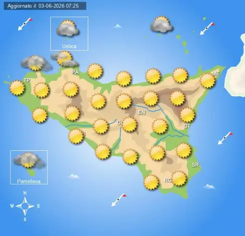
AL SUD E SULLE ISOLE
Tempo stabile al mattino su tutte le regioni con sole prevalente e qualche nube sulla Sardegna. Al pomeriggio qualche acquazzone in sviluppo nelle zone interne di Campania e Molise, per lo più soleggiato altrove. In serata e in nottata si rinnovano condizioni di tempo stabile con cieli sereni o poco nuvolosi su tutti i settori.
Temperature minime stabili o in generale lieve diminuzione, massime in calo al Centro-Nord ed in rialzo al Sud.
Www.centrometeoitaliano.it
L'articolo Meteo Sicilia di venerdì 5 giugno sembra essere il primo su Sicilianews24.it.
Weather in Sicily on Friday, June 5th
A day marked by stable weather across the entire region with irregular cloudiness in the morning and wide areas of clear skies in the afternoon. In the evening and nighttime, dry weather conditions persist with clear or slightly cloudy skies.
NATIONAL
NORTH
In the morning, cloudiness in transit with rain and thunderstorms in the Northeast, with clearing skies in the Northwest. In the afternoon, improving weather with cloudiness and clear skies, except for residual phenomena in the Veneto and Romagna regions. In the evening and nighttime, many cloud developments in the north with local rain, especially in the Alps and Prealps.
CENTRAL
In the morning, irregular cloudiness in transit with local rain, particularly in Umbria, Marche, and Abruzzo. In the afternoon, thunderstorms developing in inland areas with spillover onto the Adriatic coast. In the evening and nighttime, generally improving weather with also wide clear skies and some scattered cloudiness in transit.
SOUTH AND ISLANDS
Stable weather in the morning across all regions with mostly sunny conditions and some clouds over Sardinia. In the afternoon, some showers developing in the inland areas of Campania and Molise, mostly sunny elsewhere. In the evening and nighttime, stable weather conditions persist with clear or slightly cloudy skies across all sectors.
Minimum temperatures stable or in general a slight decrease, maximum temperatures falling in the Central-North and rising in the South.
Www.centrometeoitaliano.it
The article "Meteo Sicilia" from Friday, June 5th appears to be the first on Sicilianews24.it.
#Sicily #Northeast #Northwest #Veneto #Romagna #Prealps #Umbria #Marche #Abruzzo #Adriatic #Sardinia #Campania #South #MeteoSicilia #first
https://www.sicilianews24.it/meteo-sicilia-di-venerdi-5-giugno-831260.html