Water Data Keep Us Strong | USGS WaterAlert Water Safety at Your Fingertips [USGS Water]
--
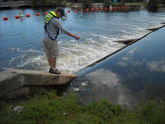
https://www.usgs.gov/media/images/water-data-keep-us-strong and https://www.usgs.gov/media/images/usgs-wateralert-water-safety-your-fingertips <-- shared pair of USGS water-related infographics
--
https://accounts.waterdata.usgs.gov/wateralert/ <-- shared link to subscribe to USGS Water Alert
--
#water #hydrology #fedservice #fedscience #watersecurity #infographics #infographic #opendata #data #GIS #spatial #mapping #US #USA #alert #risk #hazard #monitoring #notification #waterdata #usecase #farms #agriculture #businesses #industry #residential #cost #economics #vitalresource #damage #assesr #resource #energy #HEP #watersupply #waterresources #management #planning #education #awareness #national #nation #WaterAlert #alerts #flows #streamflow #river #streamgauge #notification
@USGS
--
https://www.usgs.gov/media/images/water-data-keep-us-strong and https://www.usgs.gov/media/images/usgs-wateralert-water-safety-your-fingertips <-- shared pair of USGS water-related infographics
--
https://accounts.waterdata.usgs.gov/wateralert/ <-- shared link to subscribe to USGS Water Alert
--
#water #hydrology #fedservice #fedscience #watersecurity #infographics #infographic #opendata #data #GIS #spatial #mapping #US #USA #alert #risk #hazard #monitoring #notification #waterdata #usecase #farms #agriculture #businesses #industry #residential #cost #economics #vitalresource #damage #assesr #resource #energy #HEP #watersupply #waterresources #management #planning #education #awareness #national #nation #WaterAlert #alerts #flows #streamflow #river #streamgauge #notification
@USGS

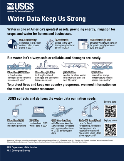


Water Data Keep Us Strong
Water is one of America's greatest assets, providing energy, irrigation for crops, and water for homes and businesses. But water isn't always safe or reliable, and damages are costly. To protect lives and keep our country prosperous, we need information on the state of our water resources. USGS collects and delivers the water data our nation needs. Water data keep us strong.A PDF version of this infographic is available here.