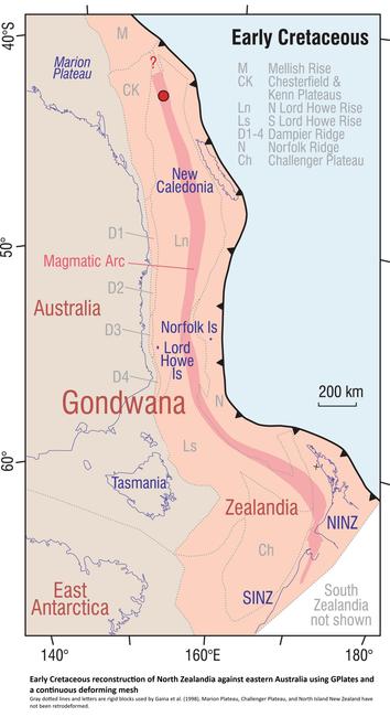
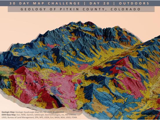
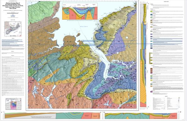
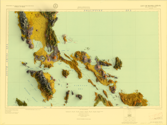
New USGS Map Offers An Interactive Look At The Rocks Beneath Our Feet
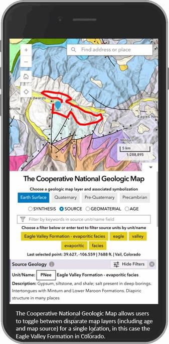
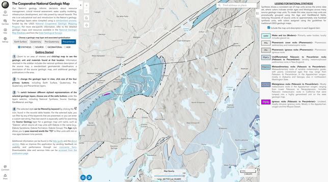
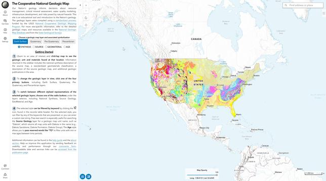
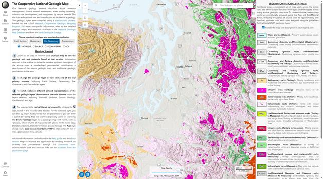
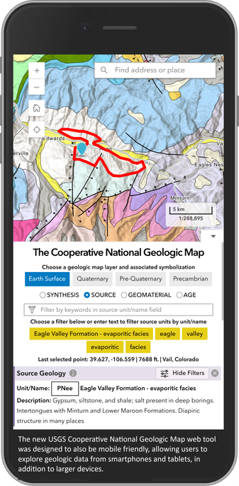
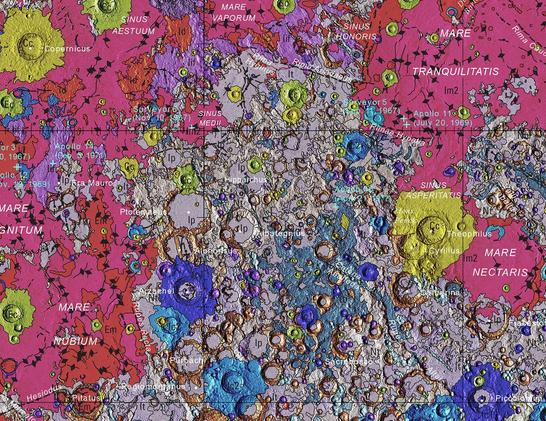
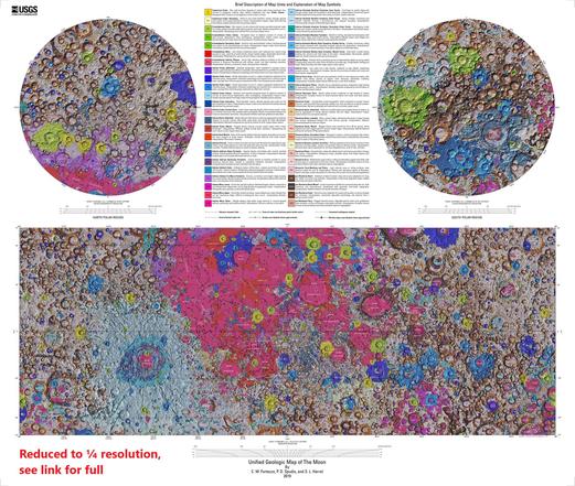
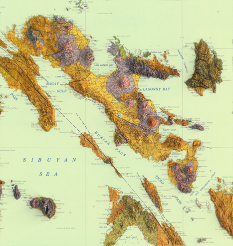
The Cooperative National Geologic Map is an interactive tool that builds on both cutting-edge technology and decades of mapping by geoscientists.
--
https://eos.org/articles/new-usgs-map-offers-an-interactive-look-at-the-rocks-beneath-our-feet <-- shared EOS-source technical article
--
https://ngmdb.usgs.gov/nationalgeology/#lat=37.0000&lng=-97.5000&zoom=5&theme=esurf&symbology=synthesis <-- shared @USGS resource
--
[recognising that I posted something similar earlier ~smile~]
#GIS #spatial #mapping #data #fedopendata #fedscience #geologicmap #geology #webmap #geologicdata #energy #minerals #mining #waterresources #hydrology #risk #hazard #landuse #infrastructure #planning #realestate #insurance #rock #sediment #mapunits #compilation #criticalminerals #economicgeology #nation #mobile #fieldwork #interactivewebtool #publicgood #online #state #federal #map #usecase #energy #resources #CooperativeNationalGeologicMap #USGS #mainland #CONUS
@USGS