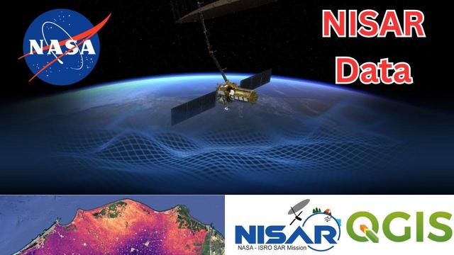
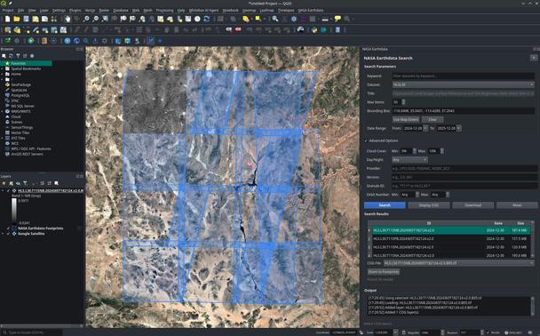
How to Download and Visualize NASA-ISRO NISAR Data in QGIS | Step-by-Step Tutorial [shared]
--
https://youtu.be/oRTplHPf_T0 <-- shared video tutorial
--
https://github.com/opengeos/qgis-nasa-earthdata-plugin <-- shared NASA Earthdata Plugin for QGIS
--
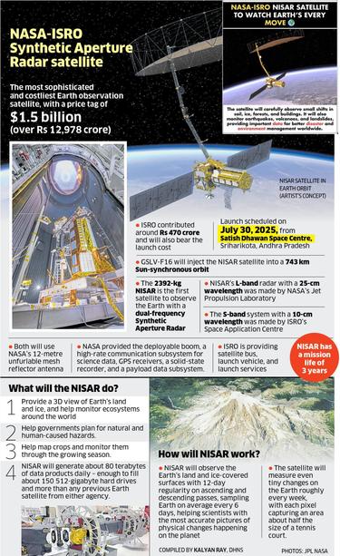
https://science.nasa.gov/mission/nisar/ <-- shared #NASA NISAR mission home page
--
H/T Qiusheng Wu
#remotesensing #earthobservation #tutorial #training #onlinelearning #download #visualisation #NISAR #opendata #satellite #NASA #Earthdata #QGIS #plugin #SAR #icemovement #ecosystems #vegetation #biomass #naturalhazard #risk #hazard #NetCDF #spatialvisualisation
@QGIS | @nasa
--
https://youtu.be/oRTplHPf_T0 <-- shared video tutorial
--
https://github.com/opengeos/qgis-nasa-earthdata-plugin <-- shared NASA Earthdata Plugin for QGIS
--
https://science.nasa.gov/mission/nisar/ <-- shared #NASA NISAR mission home page
--
H/T Qiusheng Wu
#remotesensing #earthobservation #tutorial #training #onlinelearning #download #visualisation #NISAR #opendata #satellite #NASA #Earthdata #QGIS #plugin #SAR #icemovement #ecosystems #vegetation #biomass #naturalhazard #risk #hazard #NetCDF #spatialvisualisation
@QGIS | @nasa