Next week on the Euro-Mediterranean Entanglements in #Medieval History Seminar : Karen Pinto (Univ. Colorado), Masking Conflict with Harmony. The Mediterranean in the Islamic #Cartographic Imagination.

July 1 | 5-6 pm CET | online

https://t1p.de/entanglements_2025-05

@dhiroma.bsky.social

#medievalmediterranean #medievalmaps #medievalhistory #entanglement #IslamicHistory

Oldest Maps of USA: A Historical Journey Through Cartographic Time - Oldest.org

Discover the oldest maps of USA, from 19th-century state lines to 15th-century world charts. See how early cartographers envisioned America through the ages.

Oldest.org

Revisiting this diagram I posted on Twitter in 2016. A handy guide to two Greek #cartographic terms that I made up based on our use of choropleth. I'm writing a paper and found this as I tried to remember what term I'd come up with for a line-choropleth. Hopefully I can sneak "grammapleth" in to my paper.

If I recall correctly, I specifically used Euclid's terms for line and point when coming up with this.

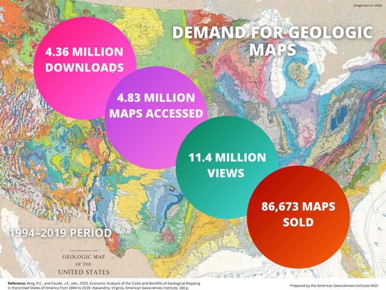
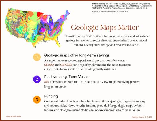
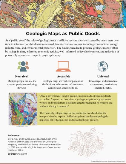
Why Geological Maps Are the Best Investment You’ve Never Heard Of

Investments in geological mapping paid off big time for Americans.

ZME Science
Mystery Tapes etc. – xMAP
#ASMR #World #cartographic #unknowable
CC BY-NC-SA (#CreativeCommons Attribution Non Commercial Share Alike) #ccmusic
https://x-tapes.bandcamp.com/album/xmap
xMAP, by Mystery Tapes etc.

4 track album

Mystery Tapes etc.
Cartography of generative AI

Bridgman's map of the suburbs of New York City (New York City, New York)

From Digital Collections of New York Public Library
http://digitalcollections.nypl.org/items/8be59e80-bc28-0131-5554-58d385a7bbd0
#NewYork #NewYorkCity #NYC #NYPL #US #USA #history #image #historical #maps #cartographic

Bridgman's map of the suburbs of New York City

One of hundreds of thousands of free digital items from The New York Public Library.

NYPL Digital Collections
Fascinating new #OpenAccess article on #Tactile #Cartographic #Signs from Albina Mościcka, Emilia Śmiechowska-Petrovskij, Jakub Wabiński, Andrzej Araszkiewicz & Damian Kiliszek in #CaGIS, #GISchat, https://doi.org/10.1080/15230406.2024.2379456

About the weekend and my newest exercises in QGIS and #OSM: a #cartographic #transitmap of the #trolleybus network in #Szeged, #Hungary. #Trams and #railways are shown too but the focus lies on trolleybuses 😊 map data by #OpenStreetMap, designed by me completely in #QGIS. Did it for fun 😊 enjoy!

Constructive feedback is welcome.

See also http://www.transitdiagrams.at/ or https://www.linkedin.com/posts/chrisneuherz_qgis-osm-trolleybuslove-activity-7223606043635793922-gKwn?utm_source=combined_share_message&utm_medium=member_desktop

Everyone Is A Critic, Even Cats (Especially Cats?)
--
https://www.quaillanepress.com/products/colorado-map-the-front-range-from-fort-collins-to-colorado-springs?variant=32457347661956
--
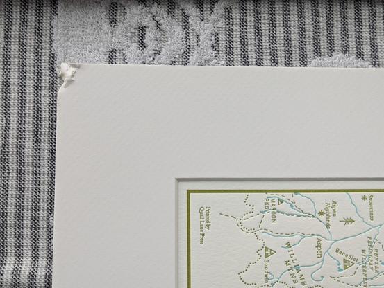
Framing up some pictures, the matte was out of the frame for 2¼ minutes, cat managed to chew on a corner as I filled my tea cup ...
He must be a cartographic critic...
(fortunately it was small enough so that is tucked under the corner of the frame)
#SundayMorning #Sundayfeeling #SundayFunday #GIS #spatial #mapping #cartography #cartographic #cat #feline #wallart #frame #framing #gischat
Colorado Map, The Front Range from Fort Collins to Colorado Springs