Worth noting for
#GoogleMaps users... It has been clear to me for some time that
#Google is using machine learning algorithms (sometimes called "AI") to adjust boundaries of geographic features. I assume they run an
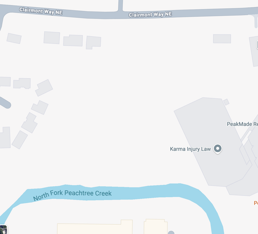
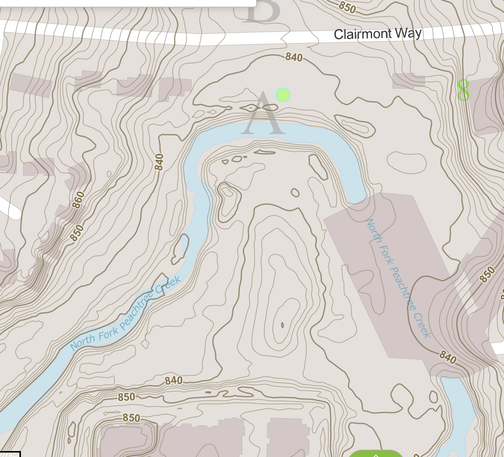
#ML model over satellite photos to do this. Here's a example of it failing, badly. The first picture attached is a Google Map of an urban creek in my town, with a street just north of it. Note how Google shows the creek not going anywhere near the street. The second picture is a topographic map of the same area. Notice how the creek ACTUALLY goes much farther north than Google depicts. For creeks and bodies of water I've noticed this most often happens where there is an adjacent
#FloodPlain that the creek spills into on occasion. Clearly Google's algorithm is noticing water during flood conditions, or breaks in the tree line, and "learning" that the creek has moved. (In their defense, it is quite unusual that this urban creek passes directly under an office building parking deck, which probably also played a part. But why use ML to do this stuff when
#topographic data exists?)
#AIFails #AIFailures