Here's what to know as the scope of damage from #Hawaii's #floods becomes clearer

By AUDREY McAVOY and GENE JOHNSON
March 23, 2026 at 3:18 pm PDT

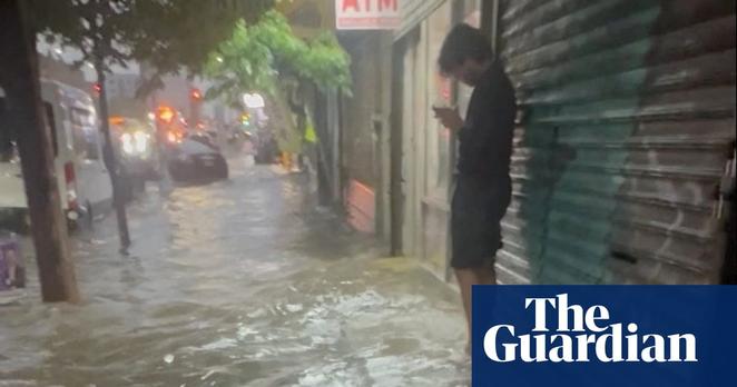
HONOLULU — "The worst #flooding to hit Hawaii in two decades swept homes off their foundations, floated cars out of driveways and left floors, walls and counters covered in thick, reddish volcanic mud.

"Crews continued to assess the destruction Monday, but authorities said hundreds of homes had been damaged, along with some schools and a hospital.

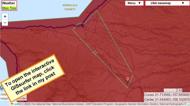
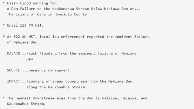
"No deaths have been reported, but more than 230 people had to be rescued. Rain continued to the southeastern part of the state and a section of the #BigIsland was under a #FlashFlood warning.

"Gov. Josh Green said the cost of the storm could top $1 billion, including damage to airports, schools, roads, homes and a Maui hospital in Kula. He called it the state’s most serious since flooding since 2004, when floods in Manoa inundated homes and a University of Hawaii library.

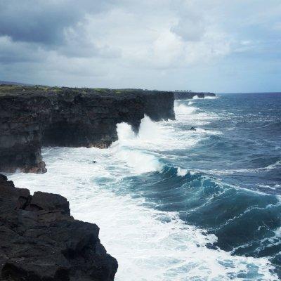
"On Oahu's North Shore, famed for big wave surfing, the waters rose quickly after midnight Friday as heavy rains fell on soil already saturated by downpours from a winter storm a week earlier. Raging waters lifted homes and cars. The storm prompted evaluation orders for 5,500 people north of Honolulu — though they were later lifted — and more than 230 people were rescued from the rising waters.

"Some residents fled on surfboards as water reached waist or chest high.

"Farms around the state reported more than $9.4 million worth of damage as of Monday, according to a survey conducted by Agriculture Stewardship Hawaii, the Hawaii Farm Bureau and other organizations. Oahu farmers reported more than $2.7 million in crop damage.
Winter storm systems brought severe deluges

"Officials blamed some of the devastation on the sheer amount of rain that fell in a short amount of time.

"Parts of Oahu received 8 to 12 inches (20 to 30 centimeters), the National Weather Service said. That was on top of another recent storm that had dumped vast amounts days earlier. Kaala, the island’s highest peak, got nearly 16 inches (40 centimeters) late last week, on top of 26.6 inches (67.6 centimeters) between March 10 and 16.

"Winter storm systems known as '#Kona lows,' which feature southerly or southwesterly winds that bring in moisture-laden air, have been responsible for the deluges in the past two weeks. The intensity and frequency of heavy rains in Hawaii have increased amid human-caused #GlobalWarming, experts say.

"The worst of the storms appeared to be over by Sunday afternoon."

Read more:
https://www.kiro7.com/news/heres-what-know/HLBMHPBESQ3W7IEY663UG4LVU4/

#KonaStorm #ClimateChange #ClimateCatastrophe

This website is unavailable in your location. – KIRO 7 News Seattle

KIRO 7 News Seattle

Flash flood warning - Hawaii

Wahiawa Dam on Oahu is in imminent danger of failing due to heavy rain over last few days.

For the warning from NOAA, open the map, click inside the outlined area and follow the link.
#HIwx #Flood #FlashFlood

Open GISsurfer map:
https://mappingsupport.com/p2/gissurfer.php?center=21.539227,-158.110565&zoom=12&basemap=USA_basemap&overlay=State_boundary,Weather_watch_warning&data=https://mappingsupport.com/p2/special_maps/disaster/USA_weather.txt||21.497495,-158.049016

🌟 𝐈𝐧𝐭𝐫𝐨𝐝𝐮𝐜𝐢𝐧𝐠 [Google Research’s] 𝐆𝐫𝐨𝐮𝐧𝐝𝐬𝐨𝐮𝐫𝐜𝐞 - 𝐀𝐧 𝐨𝐩𝐞𝐧 𝐬𝐨𝐮𝐫𝐜𝐞 𝐝𝐚𝐭𝐚𝐬𝐞𝐭 𝐨𝐟 𝐡𝐢𝐬𝐭𝐨𝐫𝐢𝐜 𝐟𝐥𝐨𝐨𝐝 𝐞𝐯𝐞𝐧𝐭𝐬 𝐟𝐫𝐨𝐦 𝐧𝐞𝐰𝐬 𝐚𝐫𝐭𝐢𝐜𝐥𝐞𝐬.
--
https://doi.org/10.31223/X5RR2K / https://eartharxiv.org/repository/view/12083/ <-- shared paper
--
https://zenodo.org/records/18647054 <-- shared link to associated dataset
--
https://sites.research.google/gr/floodforecasting/ <-- shared link to Google Research flood forecasting effort entry page
--
#GoogleResearch #Google #Gemini #AI #ClimateTech #MachineLearning #DataScience #FloodForecasting #Sustainability #TechForGood #aggregation #curated #newsarticles #news #media #article #harvesting #reports #reporting #global #world #historic #naturalhazards #naturaldisaster #floods #flooding #flashflood #water #hydrology #extremeweather #climatechange #GDACS #Groundsource #GIS #spatial #mapping #spatialanalysis #spatiotemporal #geographic #openaccess #openscience #opendata #floodevents #LLM #gemini #largelanguagemodel #deeplearning #AI #precision #metrics #historicresource #model #modeling #forecasting #opensource

When the Sky Breaks: Arizona Hail and Louisiana Floods, or How I May Have Cheated Death Twice More on a Greyhound Bus

I realize now, looking back at my original plot armor post, that I made a promise I somehow failed to keep. I told you there were more tornado encounters to share, specifically mentioning a third one, and then I just left you hanging like a cliffhanger in a television show that gets canceled before the next season. So here I am, making good on that promise, though I have to warn you upfront that these next two encounters exist in a strange gray area between definite tornado stories and maybe […]

https://jaimedavid.blog/2026/02/15/14/27/50/analysis/jaimedavid327/9919/when-the-sky-breaks-arizona-hail-and-louisiana-floods-or-how-i-may-have-cheated-death-twice-more-on-a-greyhound-bus/

February 7, 2026 #FlashFlood #Syria The city of Jisr al-Shughur, Idlib Province, was hit by a flash flood following intense rainfall. Floodwaters inundated streets and low-lying areas, causing difficulties for local residents and transportation. GLOBAL CLIMATE CHANGE (channel) t.me/GCC_report

📌 #aid #flashflood Building bridges in #yemen

José Salema, Country Director of #Dorcas Yemen, clearly remembers the moment he was asked to provide support to a remote village: "Everything was underwater. The harvest was lost, wells contaminated, worst of all, people could not reach the hospital" (..) "we asked the people, ‘What do you need to prevent this from happening again?’ The answer was surprisingly simple: a bridge"

#press #news #emergencyresponse

📑 Dorcas

https://dorcas.org/building-bridges-in-yemen/

Building bridges in Yemen - Dorcas

José Salema, Country Director of Dorcas Yemen, clearly remembers the moment he was asked to provide support to a remote village. ‘It was after a devastating flood,’ he says. ‘Everything was underwater. The harvest was lost, the wells were contaminated and diseases broke out. Worst of all, people could not reach the hospital. A mother […]

Dorcas

Flash flood reports for Santa Barbara County. #weather #flashflood #SantaBarbara #CAwx

NWS Los Angeles/Oxnard (LOX)
loxchat IEMBot RSS Feed - Last 6 Hours

1 W Refugio State Beach [Santa Barbara Co, CA] Law Enforcement reports Flash Flood at 10:51 AM PST -- Hard closure of northbound and southbound Hwy 101 due to significant flooding and mudflows, extending from junction of SR1/Hwy 101 to Winchester Road in Goleta (approximately 27 mile stretch).
Jan 3 2026 at 4:37 pm EST

Refugio State Beach [Santa Barbara Co, CA] Law Enforcement reports Flash Flood at 11:23 AM PST -- Junction of Refugio Road and Calle Real completely flooded with major debris on roadways . Vehicle caught in flooded roadway. Emergency officials in progress with rescue operations.
Jan 3 2026 at 2:53 pm EST

4 E Gaviota [Santa Barbara Co, CA] Dept of Highways reports Flash Flood at 9:45 AM PST -- Full closure of southbound 101 freeway due to a mudslide and flooding covering all lanes. CHP report quote: flood really bad.
Jan 3 2026 at 1:05 pm EST
https://ucweather.org/iemstmrptca.php

Union City, CA Weather - California Storm Reports

A personal weather station in Union City, CA providing current weather conditions for the Flight 93 Memorial, Union Landing Shopping Center, and Old Alvarado. Area forecasts, watches, warnings, advisories, and more.