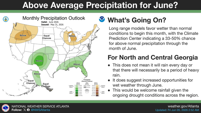
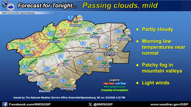
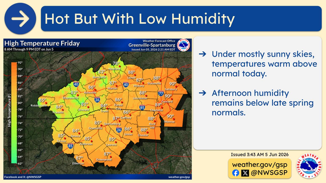
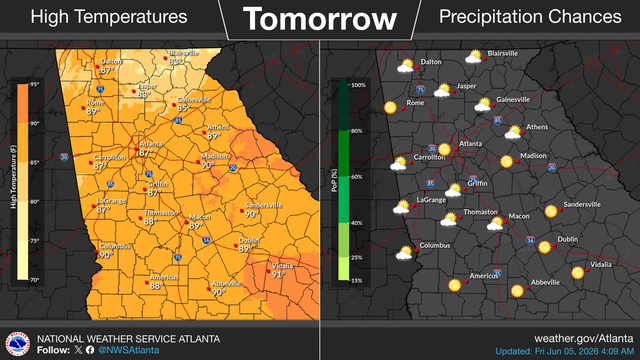
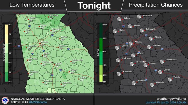
Increased fire danger through this evening for areas along and north of I-20. 🔥 While moisture will begin to increase through the day it will do so slowly. Drier air still in place + very dry vegetation will result in continued elevated fire danger. #gawx https://x.com/NWSAtlanta/status/2038232204170637777
#GSP #SCwx #GAwx
Not as windy as Saturday but critical RH remains today.
#GSP #SCwx #GAwx
A Special Weather Statement for Increased Fire Danger is in effect from 11 AM through 8 PM for the entire area.
#GAwx
Cool temperatures again today to finish up the weekend. A warming trend will kick in from Monday through the middle of next week, with a return to above normal temperatures.
#GAwx
Very dry fuels, low relative humidity and breezy winds will lead to fire danger concerns Sunday. Any fires that develop could spread rapidly, and outdoor burning is discouraged.
As a reminder, there is a Red Flag Warning in effect for all of North and Central Georgia from 8am - 8 pm today. Avoid any outdoor burning🔥 #gawx https://x.com/NWSAtlanta/status/2037862277198561408
As a reminder, there is a Red Flag Warning in effect for all of North and Central Georgia from 8am - 8 pm today. Avoid any outdoor burning🔥 #gawx https://x.com/NWSAtlanta/status/2037843821506011161
#GSP #SCwx #GAwx
Another day of low relative humidity and dry vegetation, but with lighter winds.
#GAwx
A cold front moving through Georgia this morning will cool temperatures back down to near normal for the weekend. A warming trend with a return to above normal temperatures will kick in from Monday through the middle of next week.
🚩 RED FLAG WARNING in effect Saturday, March 28. Critical fire weather is expected across most of Georgia. Low humidity and high wind gusts mean any fire that starts could spread out of control rapidly. Stay alert and report smoke or fire to local officials immediately. #gawx https://x.com/NWSAtlanta/status/2037612317907522030