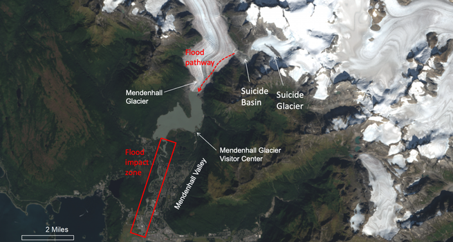
USGS Scientists Are Providing Critical Data To Support Emergency Response Efforts As Glacier Flooding Affects Juneau, Alaska.
--
https://www.linkedin.com/posts/usgs_usgs-scientists-are-providing-critical-data-activity-7361514160343408640-HMuf <-- shared #USGS LinkedIn post
--
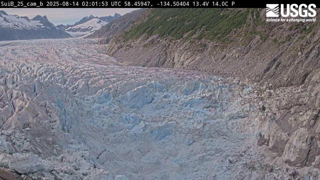
https://apps.usgs.gov/hivis/camera/AK_Glacial_Lake_near_Nugget_LOOKING_UPSTREAM_GLACIER_VIEW <-- views at USGS HIVES website
--
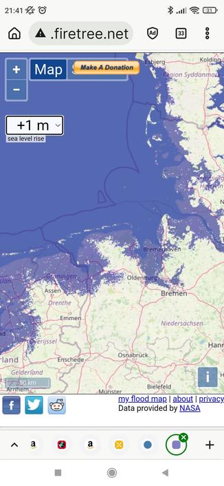
https://www.juneauflood.com/#/home <-- Juneau Glacial Flood Dashboard, University of Alaska, SE
--
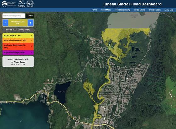
https://www.juneauflood.com/#/flood-map <-- Juneau Glacial Flood Dashboard / Flood Map
--
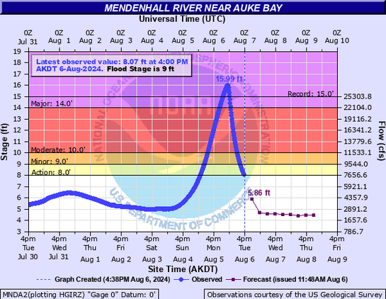
https://www.weather.gov/ajk/suicideBasin <-- National Weather Service (NWS) monitoring and current conditions
--
#GIS #spatial #monitoring #GLOF #Alaska #climatechange #glacier #melting #Juneau #floodmaps #forecasting #innundation #glacial #outburstfloods #SuicideBasin #Mendenhall #Lake #Valley #engineering #mitigation #HESCO #risk #hazard #engineeringgeology #cost #impacts #economics #residential #naturaldisaster #infrastructure #residential #homes #fedscience #fedservice #opendata #fedopendata #publicsafety #publicgood #water #hydrology #flood #flooding
@USGS @nws
--
https://www.linkedin.com/posts/usgs_usgs-scientists-are-providing-critical-data-activity-7361514160343408640-HMuf <-- shared #USGS LinkedIn post
--
https://apps.usgs.gov/hivis/camera/AK_Glacial_Lake_near_Nugget_LOOKING_UPSTREAM_GLACIER_VIEW <-- views at USGS HIVES website
--
https://www.juneauflood.com/#/home <-- Juneau Glacial Flood Dashboard, University of Alaska, SE
--
https://www.juneauflood.com/#/flood-map <-- Juneau Glacial Flood Dashboard / Flood Map
--
https://www.weather.gov/ajk/suicideBasin <-- National Weather Service (NWS) monitoring and current conditions
--
#GIS #spatial #monitoring #GLOF #Alaska #climatechange #glacier #melting #Juneau #floodmaps #forecasting #innundation #glacial #outburstfloods #SuicideBasin #Mendenhall #Lake #Valley #engineering #mitigation #HESCO #risk #hazard #engineeringgeology #cost #impacts #economics #residential #naturaldisaster #infrastructure #residential #homes #fedscience #fedservice #opendata #fedopendata #publicsafety #publicgood #water #hydrology #flood #flooding
@USGS @nws