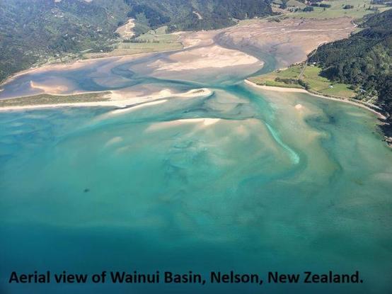
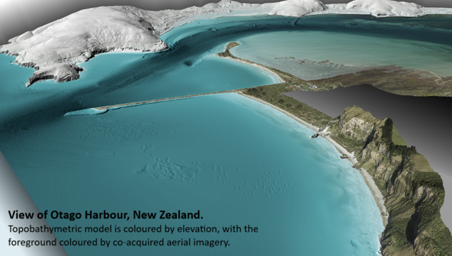
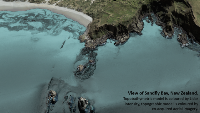
The Art Of Mapping The Edge
How surveying challenging terrain will protect New Zealand’s coastal frontiers
--
https://www.hydro-international.com/content/article/the-art-of-mapping-the-edge <-- shared technical article 🔗
--
https://www.linz.govt.nz/products-services/data/3d-coastal-mapping <-- NZ 3D Coastal Mapping Programme home page
--
#bathymetry #topobathy #NV5 #oceanmapping #LINZ #newzealand #geospatial #hydrography #hydrographicsurveys #oceanography #arcgisbathymetry #arcgismaritime #3D #coast #coastal #coastline #naturalresources #ToitūTeWhenua #LandInformationNew Zealand #risk #hazard #infrastructure #resilience #planning #spatialanalysis #spatiotemporal #GIS #spatial #mapping #survey #publicgood #3DCoastalMappingProgramme #remotesensing #earthobservation #terrain #marine #elevation #depth #model #modeling
@LandInformationNewZealand