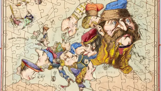
Rêver les cartes : rencontre avec Cristina Ion et Julie Garel-Grislin
#OndesPubliques #Cartographie #Mapstodon
Rêver les cartes : rencontre avec Cristina Ion et Julie Garel-Grislin
Rêver les cartes : rencontre avec Cristina Ion et Julie Garel-Grislin
#OndesPubliques #Cartographie #Mapstodon
Rêver les cartes : rencontre avec Cristina Ion et Julie Garel-Grislin

Because today is the June #solstice, here is my 2020 animated map of this solstice’s day-night cycle rendered using the #CahillConcialdi map projection, which is my most favorite.
Grab the file here: https://commons.wikimedia.org/wiki/File:Cahill%E2%80%93Concialdi_projection_(Natural_Earth_I)_day-night_animation_at_June_solstice.gif


Does anyone know where I can get this map as a poster? Asking for a friend. That friend is @Lam.
No suggesting places that it "might" be available. No suggestions to print it myself. But if you know of somewhere already selling prints, let us know.
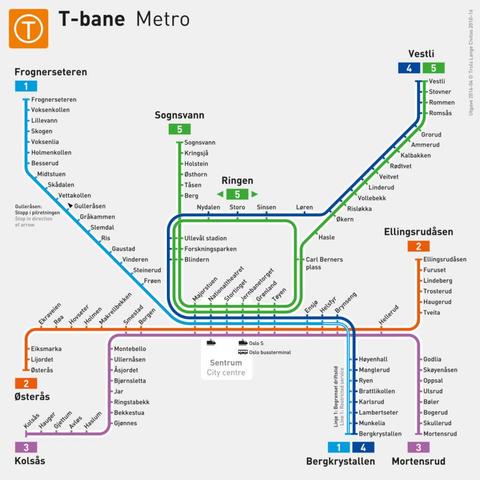
#oslo #allheimen #ruter #metro #tbane #publictransport #transit #maps #mapstodon #askfedi
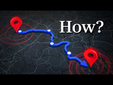
This #Veritasium video is a damned good intro on routing algorithms starting with Dijkstra’s seminal shortest path algorithm. The visuals are impressive and they make extensive use of #OpenStreetMap data.
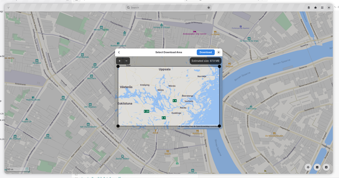
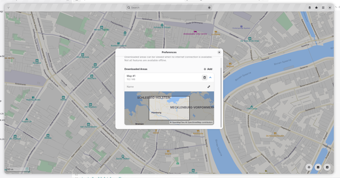
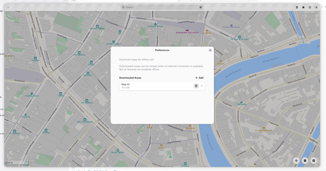
Thanks to hard work by @flyingpimonster Maps now supports downloading map areas for offline use!
This has been a long-awaited feature and will finally be available in GNOME 51.
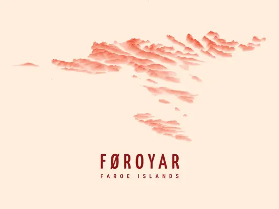
I wanted to explore the topographic relief cartographic style that I did for Santorini, Greece, last year¹ and tried it on the Faroe Islands 🇫🇴.
One new thing is that I worked with @mapterhorn terrain tiles instead of processing the raw NASADEM data.
Feedback and comments are requested! 🙏