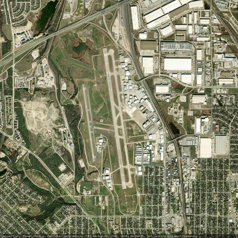
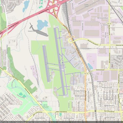
The latest paper from #JCAA is out! Červík, T, Waersegers, Y, Zischg, AP and Lieskovský, T. 2026. GIS-Based Throwshed Analysis for Conflict #Archaeology. Journal of Computer Applications in Archaeology, 9(1): 198–224. DOI: doi.org/10.5334/jcaa... #OpenAcess #DigitalArchaeology #GIS
But is it useful?: The Cloud-Native Geospatial Forum proposes #usefulness as a better measure than openness for #dataQuality, with a 5-dimension, 4-star framework that goes beyond familiar schemes like #FAIR and 5-star Open Data. It’s an interesting read and a good...
https://spatialists.ch/posts/2026/05/31-but-is-it-useful/ #GIS #GISchat #geospatial #SwissGIS
But is it useful? – Spatialists – geospatial news

The Cloud-Native Geospatial Forum proposes #usefulness as a better measure than openness for #dataQuality, with a 5-dimension, 4-star framework that goes beyond familiar schemes like #FAIR and 5-star Open Data. It’s an interesting read and a good occasion to re-evaluate common notions of data quality and #openness.

Spatialists – geospatial news
The legacy of Dijkstra: Edsger Dijkstra’s landmark shortest-path algorithm has shaped how we navigate the world, from early GIS to today’s wayfinding apps. A new Veritasium video traces that legacy and reveals how techniques like Nested Dissection and Contraction...
https://spatialists.ch/posts/2026/05/31-the-legacy-of-dijkstra/ #GIS #GISchat #geospatial #SwissGIS
The legacy of Dijkstra – Spatialists – geospatial news

Edsger Dijkstra’s landmark shortest-path algorithm has shaped how we navigate the world, from early GIS to today’s wayfinding apps. A new Veritasium video traces that legacy and reveals how techniques like Nested Dissection and Contraction Hierarchies deliver routing results in microseconds.

Spatialists – geospatial news

🚀 QGIS2VectorTiles v2.9 is out!

🔥 Following the addition of support in @openlayers, popups and style inspection, we are moving forward:

🧩 Added support for label largest part only.
💪 Limited maximum tile zoom to 16 (tiles only, not styling) to improve export speed and efficiency.
🛠️ Improved labeling visibility range handling and resolved related styling issues.

❤️‍🔥 Please rate and boost to support #FOSS

🔗 https://gallpeters.github.io/QGIS2VectorTiles/

#opensource #maplibre #vectortile #qgis #gdal #gis #openlayers

Q(GIS)&A: QGIS im Organisationsbetrieb 💪

⚡️ QGIS ist schnell eingerichtet – aber wie skaliert man es für Teams?

Unser neuer Blogbeitrag zeigt die Bordmittel:
🔧 Profile für verschiedene Nutzergruppen
📦 Plugin-Repositories zentral verwalten
🎨 Einheitliche Styles automatisch laden
🗂️ Drucklayout-Vorlagen im Team nutzen
🔌 Eigene Plugins für org.-spezifische Workflows

👉 https://www.wheregroup.com/ueber-uns/blog/qgis-im-organisationsbetrieb-profile-plugins-und-stylevorlagen-einsetzen

#QGIS #GIS #OpenSource #Geodaten