J9C   

@J9C@mapstodon.space
226 Followers
246 Following
736 Posts
Marine Biologist | GIS Analyst | Humanitarian Mapper
Technical Account: Toots are mine.
Accessibility A11y: Toot + image + Alt text = Boost
Interests: #STEM #remotesensing #lidar #geology #python #EarthObservation #marinebiology #starwars #humantarianmapping #horses
Header: Landsat 8 image of the Appalachian region
Avatar: Map pin in a circle with a map background
Social Account: @EquineJ9
PronounsShe / Her
OSMhttps://www.openstreetmap.org/user/Codesurfer

ICYMI: In September 2024, The Carpentries submitted a proposal for 1.5 million USD to the U.S. National Science Foundation (NSF) Pathways to Enable Open-Source Ecosystems (POSE) Program, and were extremely pleased to learn that the proposal was recommended for funding.

However, we have had to rescind our proposal because it was flagged for DEI content, namely, for “the retention of underrepresented students, which has a limitation or preference in outreach, recruitment, participation that is not aligned to NSF priorities.”

Since we are no longer in the running for this funding, we are actively seeking donors and a cohort of funders who align with our mission and core values and want to support our work.

Find out in this blog post announcement how you can help us by making a recurring donation, or reaching out to potential donors on our behalf, or connecting us with potential donors and program officers, or collaborating with us to apply for grants, and many other ways you can support our mission: https://carpentries.org/blog/2025/06/announcing-withdrawal-of-nsf-pose-proposal/

Announcing Withdrawal of NSF Pathways to Enable Open-Source Ecosystems Proposal

In September 2024, The Carpentries submitted a proposal to the U.S. National Science Foundation (NSF) Pathways to Enable Open-Source Ecosystems (POSE) Program. This project would position The Carpentries as a leading open source ecosystem and further solidify our independence as a 501(c)(3) nonprofit organisation. Developing a proposal of this magnitude (1.5 million USD) involved a significant amount of preparation, from conceptualisation of the idea to navigating the complex submission process. It was the first time The Carpentries did it on our own, with our Associate Director, Erin Becker, leading as principal investigator.

The Carpentries

MapLibre is at #sotmus this year with two sessions:

📍 June 19, 1 - 2PM, Workshop: Make your own basemap w/ MapLibre + Planetiler (Foundry Shop 6)
📍 June 20, 10:45 - 11AM , State of MapLibre talk (BU Auditorium)

Come say hi!

#maplibre #foss4g #openstreetmap

Do you already contribute to @openstreetmap? You can start contributing to OpenHistoricalMap too in just a few clicks, without having to juggle yet another password for yet another mapping site. Once you have a taste of OSM #SingleSignOn via #OAuth2, you’ll never look back.

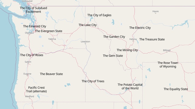
Does your city/state/country have a well established nickname? Make sure it is added to OpenStreetMap using the nickname tag!

It's quite fun to see everything rendered in a less "official" fashion.

#nicknames #OpenStreetMap

https://overpass-ultra.us/#map&query=gist:1d3d4d0698f7163abdeea59846a6e2c1

State of the Map US is next week and instead of finishing my slides I am making fun buttons. Come find me at the conference and you too can have a fun button!

#sotmus #openstreetmap

Has anyone used #easymap or knows someone who has? A friend would be interested in having a short interview with someone who uses of used the software.
https://www.easymap.one/

#GIS #gischat #gistribe #QGIS #arcgis #esri

Home

Business Mapping aus einer Hand. Ob schlanke easymap office-Lösung oder easymap enterprise als individuelles GIS: Geomarketing mit easymap macht Ihr Business besser.

easymap.one
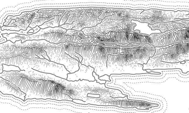
Some work in progress this evening. Slowly putting together this plan-oblique view of Isle Royale. Next up I need to finish tidying the joins between rivers and lakes. Then I can start putting in some other points of interest. #IsleRoyale #NationalPark

A visualisation of the wine regions of New Zealand three ways.

#rayshader adventures, an #rstats tale

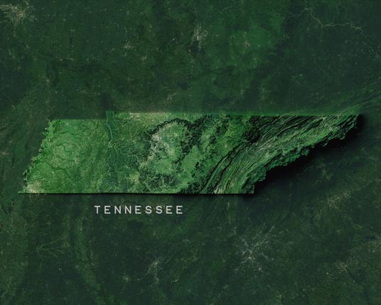
Tennessee - The Volunteer State

Made with #QGIS and #Blender

#Cartography #Maps #GisChat

×

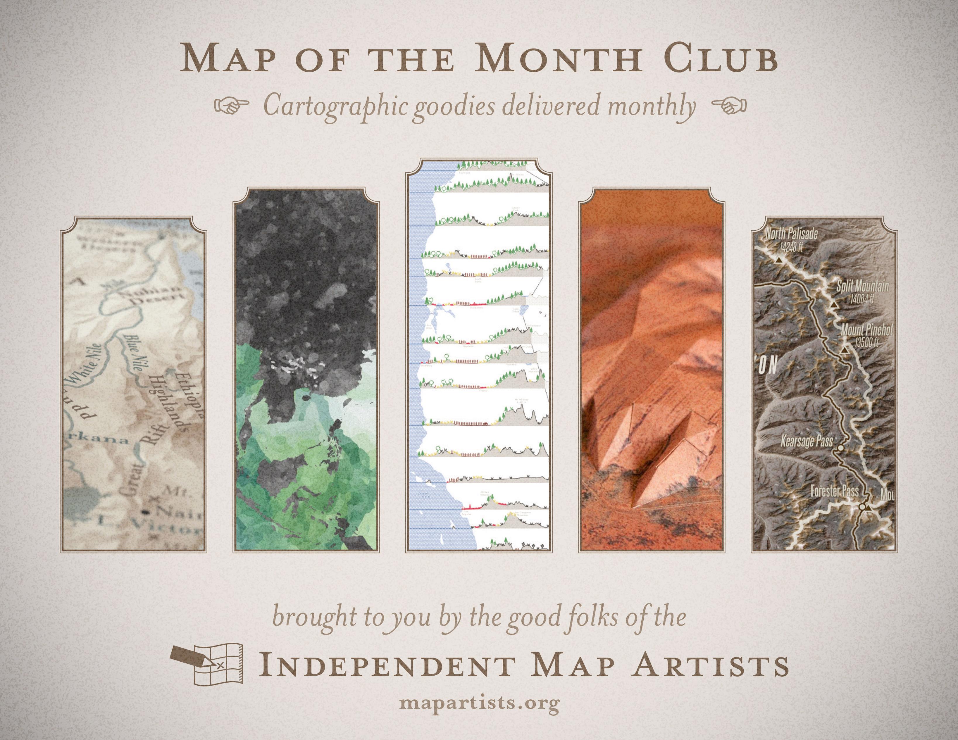
Last call for the #Map of the Month subscription by the Independent Map Artists (closes June 15).

https://somethingaboutmaps.bigcartel.com/product/map-of-the-month-subscription

For $40/month, we’ll send you a whole variety of fun and beautiful mappy goods, all while your support helps independent artists. And it makes us happy to know our goods are out there in peoples' homes.

Please share around to make sure no one misses out!

@pinakographos looks cool, I like the textures on the surface of the #map
@YetiSkotch Thanks! Which one of the maps do you mean?
@pinakographos the Rightmost one, the dark mountain #topographic textures. And the second from the left, the green colored #ocean texture with waves looks cool, though I assume this is an artistic choice with no information content for the map?

@YetiSkotch Ahh, yes. The second from the left is by David Medeiros, a lovely piece in the Waterman Butterfly projection with a watercolor-inspired texture. https://www.etsy.com/listing/645318657/watercolor-world-map-poster-cahill-map. On the right is a piece by Patrycja Krajczynska with a dramatic shaded relief texture. https://www.etsy.com/listing/1812699716/the-john-muir-trail-map-us-mountains

I'm looking forward to getting these wonderful works sent out once the subscription period concludes!