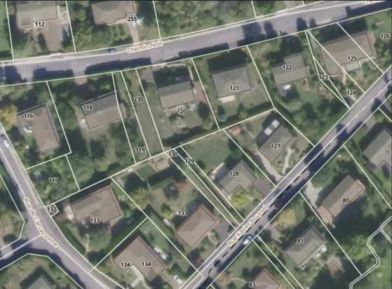
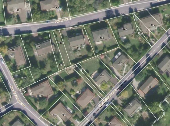
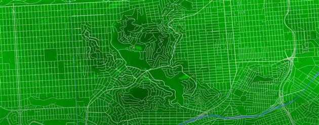
Slightly rude..? --

It's not hard:

Prefer traditional? -- #Shapefile is your best bet 👍

Into #cloudnative and MDS etc? -- Go with Cloud-Optimized Shapefile #CoSHP ✌️

Also: I *made* quite some careers 😊 #gischat

✨ Le plan cadastral millésime décembre 2025 est disponible !

Formats disponibles : #DXF / #EDIGEO (DGFiP) · #GeoJSON · #Shapefile · Tuiles vectorielles #MBTiles · #Geoparquet

🆕 À retenir :

🔹 des mises à jour trimestrielles (mars, juin, septembre, décembre)
🔹 des données plus lisibles et cohérentes dans le temps
🔹 une publication après consolidation et traitement, pour garantir la qualité

➡️ https://cadastre.data.gouv.fr

#viewinline: A new no-fuss way to visualize your vector data and rasters right in the #terminal: viewinline is a lightweight #Python utility by @Keiko_geo that renders #GeoTIFF-s, #GeoPackage-s, #GeoJSON-s, and #Shapefile-s instantly in #iterm2 (and other compatible terminals).
https://spatialists.ch/posts/2025/11/04-viewinline/ #GIS #GISchat #geospatial #SwissGIS
viewinline – Spatialists – geospatial news

A new no-fuss way to visualize your vector data and rasters right in the #terminal: viewinline is a lightweight #Python utility by Keiko Nomura that renders #GeoTIFF-s, #GeoPackage-s, #GeoJSON-s, and #Shapefile-s instantly in #iterm2 (and other compatible terminals).

Spatialists – geospatial news
Geo Cloud Converter: Maphub.co launches #GeoCloudConverter, a browser-based #WASM tool that transforms common geospatial file types — #GeoJSON, #Shapefile, #KML, #GPX, CSV, #GeoPackage, or #GeoTIFF – into modern, #cloudnative formats like #GeoParquet, #FlatGeobuf,...
https://spatialists.ch/posts/2025/10/28-geo-cloud-converter/ #GIS #GISchat #geospatial #SwissGIS
Geo Cloud Converter – Spatialists – geospatial news

Maphub.co launches #GeoCloudConverter, a browser-based #WASM tool that transforms common geospatial file types — #GeoJSON, #Shapefile, #KML, #GPX, CSV, #GeoPackage, or #GeoTIFF – into modern, #cloudnative formats like #GeoParquet, #FlatGeobuf, #PMTiles, or Cloud-Optimized GeoTIFF (#COG). The tool performs all processing locally in your browser for quick, private conversions up to 1 GB.

Spatialists – geospatial news

Assassination Coordinates #etc #video #sanfrancisco #shapefile #animation Animation that zooms from a global map to the streets of San Francisco using five different shapefiles.

https://fed.brid.gy/r/https://ithoughthecamewithyou.com/post/assassination-coordinates

シェープファイルのつらみ - Qiita

背景 自治体が公開しているオープンデータの中には、シェープファイル形式で配布されているものが多くあります。 ところが、実際に利用しようとすると仕様上の不備により扱いづらいケースが少なくありません。 その問題点を指摘したところ、多くの反応が寄せられました。 行政のオープン...

Qiita

Je tente ma chance : quelqu'un sait où et comment me procurer en carte géoréférencée (si possible en shapefile) des départements français en 1848 (ou en tout cas avant 1860)?

Je cherche à faire des cartes sur QGIS pour ma thèse mais je me heurte un peu aux absences de données historiques utilisables. J'ai moyennement envie de tracer des polygones moi-même...

#histodons #SIG #cartographie #qgis #shapefile

Still Shapefile Like It’s 1999?

Nostalgia’s great but cutting-edge technology’s better.

#esri #shapefile #FuruhashiLab #古橋研究室 #AoyamaGSC #青学 #GEOlab #PoliMI

@aboutgeo Went with clusters in the pmtiles in the end. Here are the gory details: https://github.com/healthyregions/overture-poi-extract/blob/v0.0.1/extract_pois.py#L142 Ultimately, we needed to create #geojson #pmtiles or #shapefile extracts from the #overturemaps "places" theme for groups of categories, filtered just to the US. But I built it so random geoms can be passed in, or you can just provide a state, county, tract, etc. ID and that boundary will be used as a filter.
overture-poi-extract/extract_pois.py at v0.0.1 · healthyregions/overture-poi-extract

A simple script for creating geojson, shp, and pmtiles extracts from the Overture Maps POI dataset. - healthyregions/overture-poi-extract

GitHub