Here's today's forecast map and today's high temperature map. Check out the NWS site for more National Forecast Maps www.weather.gov/forecastmaps #weather #wx #TheOutPost #Forecast #precipitation #Temperature
Here's today's forecast map and today's high temperature map. Check out the NWS site for more National Forecast Maps https://www.weather.gov/forecastmaps
#weather #wx #Forecast #precipitation #Temperature
Here's today's forecast map and today's high temperature map. Check out the NWS site for more National Forecast Maps https://www.weather.gov/forecastmaps
#weather #wx #Forecast #precipitation #Temperature
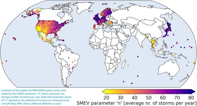
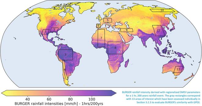
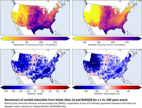
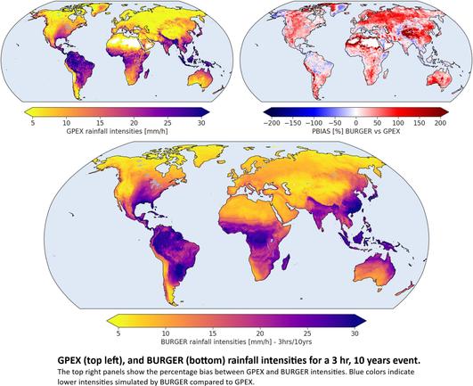
BURGER - A Bottom-Up Regionalization Approach for Global Sub-Daily Intensity-Duration-Frequency Data
--
https://doi.org/10.1029/2024WR039773 <-- shared paper
--
https://zenodo.org/records/15473689 <-- shared dataset
--
"KEY POINTS
โ€ข BURGER is the first global IDF data set derived from observations of sub-daily rainfall
โ€ข Sub-daily rainfall intensities are computed with the Simplified Metastatistical Extreme Value (SMEV) approach for a range of return periods
โ€ข BURGER intensities compare well with expected intensities, indicated by an interquartile range of the percentage bias between โˆ’5% and 5%..โ€
#GIS #spatial #data #mapping #global #exteremeweather #precipitation #rainfall #gauge #intensity #model #modeling #spatialanalysis #spatiotemporal #BURGER #geostatistics #spatialstatistics # statistics #GSDR #IDF #remotesensing #earthobservation #machinelearning #AI #weather #climate #prediction #usecase #flood #risk #hazard #SMEV #accuracy #metrology
Here's today's forecast map and today's high temperature map. Check out the NWS site for more National Forecast Maps www.weather.gov/forecastmaps #weather #wx #TheOutPost #Forecast #precipitation #Temperature
Here's today's forecast map and today's high temperature map. Check out the NWS site for more National Forecast Maps https://www.weather.gov/forecastmaps
#weather #wx #Forecast #precipitation #Temperature