Congressional hearing highlights military’s reliance on NOAA weather data

https://fed.brid.gy/r/https://spacenews.com/congressional-hearing-highlights-militarys-reliance-on-noaa-data/

Congressional hearing highlights military’s reliance on NOAA weather data

Congressional hearing highlights military's reliance on NOAA weather data

SpaceNews
National Environmental Satellite, Data, and Information Service (NESDIS), NOAA
--
https://www.nesdis.noaa.gov/ <-- portal link
--
““NOAA's National Environmental Satellite, Data, and Information Service (NESDIS), provides secure and timely access to global environmental data and information from satellites and other sources to promote and protect the nation's security, environment, economy, and quality of life..."
#GIS #spatial #mapping #remotesensing #opendata #satellite #global #NESDIS #NOAA #project2025 #USA #protection #security #environment, #economy #qualityoflife #spatialanalysis #spatiotemporal #climate #weather #ocean #coast #coastal #extremeweather #climatechange #metrology #geointelligence #transportation #infrastructure #marine #monitoring #commercial #weather #forecasting #naturaldisaster #risk #hazard #manufacturing #farming #construction #farming #agriculture #foodsecurity #watersecurity
@NOAA @nws @FEMA @NESDIS
National Environmental Satellite, Data, and Information Service

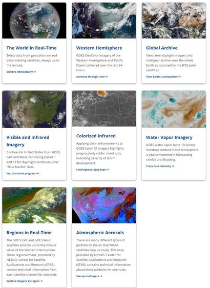
Here at the National Environmental Satellite, Data, and Information Service (NESDIS) we provide secure and timely access to global environmental data and information from satellites and other sources to promote and protect the Nation's security, environment, economy, and quality of life.

National Environmental Satellite, Data, and Information Service

@sad_electronics

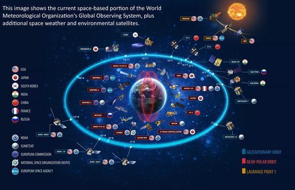
Here's a #NOAA page about their 17 satellites in operation. #NESDIS is the program.

https://www.nesdis.noaa.gov/current-satellite-missions/currently-flying

and it appears that the #RTLSDR blog has a bunch of current, active coverage of what people are seeing from those birds

https://www.rtl-sdr.com/tag/noaa/

I am not sure what hashtags people use so I'm trying a few :)

#wx #wxsat

Currently Flying

NOAA owns 9 satellites, which includes 4 geostationary (GOES-14, -15, -16 and -17), 4 polar-orbiting (NOAA-15, -18, -19 and -20), and the DSCOVR.

National Environmental Satellite, Data, and Information Service
🌗 部門圖像: 東北 - NOAA / NESDIS / STAR
➤ GOES-18交錯測試已結束,GOES-West數據現在由運營的GOES-17衛星提供。
https://www.star.nesdis.noaa.gov/GOES/sector.php?sat=G16&sector=ne
本文介紹了美國國家海洋和大氣管理局(NOAA)的衛星數據,其中包括GOES-18和GOES-17衛星的數據。GOES-18交錯測試已經結束,GOES-West數據現在由運營的GOES-17衛星提供。GOES-18預計在2023年1月成為運營中的GOES-West衛星。本文還列出了各種衛星數據的通道和RGB圖像。
+ 這是一個很好的介紹NOAA衛星數據的文章。
+ 很有用的信息,尤其是關於GOES-18和GOES-17衛星的數據。
#NOAA #NESDIS #STAR #GOES-18 #GOES-17 #衛星數據 #圖像
Sector Images: Northeast - NOAA / NESDIS / STAR

Near real-time publication of GOES-East and GOES-West images from NOAA/NESDIS/STAR

GOES Image Viewer - NOAA/NESDIS/STAR website
NOAA satellites helped save 397 lives in 2022

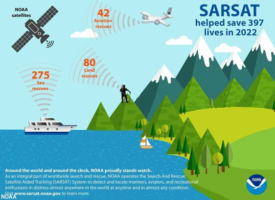
NOAA satellites, which are crucial in weather and climate forecasts, helped rescue 397 people from potentially life-threatening situations throughout the U.S. and its surrounding waters in 2022. NOAA’s polar-orbiting and geostationary satellites are part of the global Search and Rescue Satellite Aided Tracking system, or CO