Daniel Coe’s Astonishing River Cartography
--
https://orionmagazine.org/article/daniel-coe-river-cartography/ <-- shared media article
--
https://dancoecarto.com/work <-- his website
--
[those in the spatial hydrology ‘world’ have long been incredibly impressed by Dan Coe’s imagery and cartography, here is a wonderful article on cartography & science with his visual arts quality]
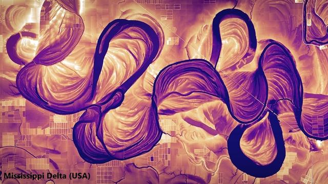
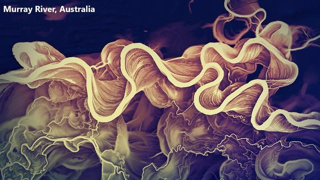
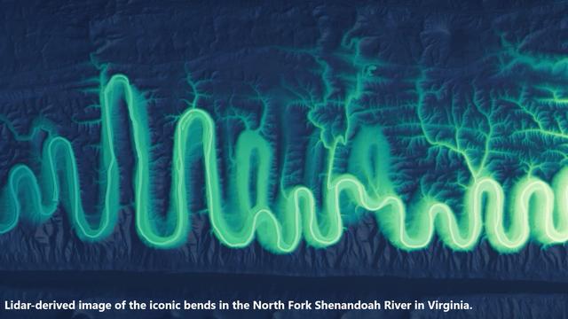
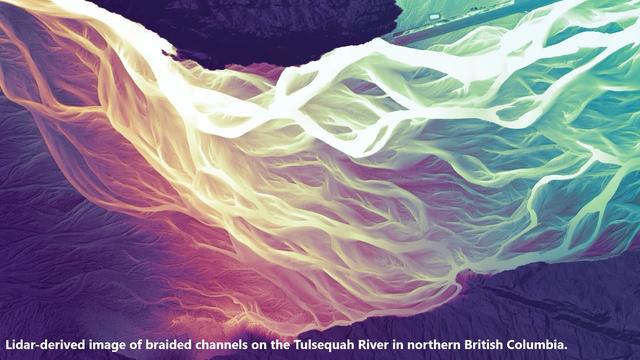
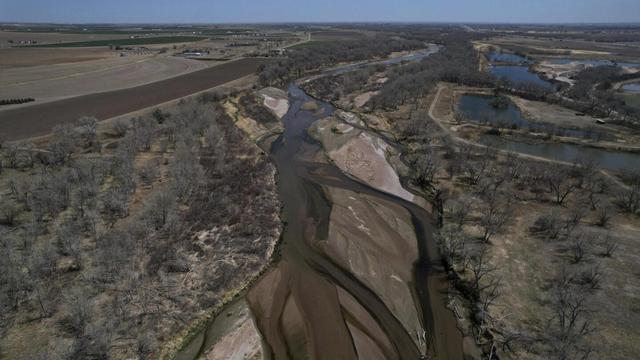
“Cartographer Daniel Coe uses relative elevation data, primarily from plane-mounted lasers called lidar, to visualize Earth’s natural features, like rivers and floodplains. His stunning river maps reveal stories hidden in historical sediment and past channels carved by the water, as it twists and turns through both landscape and time…”
#GIS #spatial #mapping #DanielCoe #cartography #hydrospatial #river #riverine #imagery #representation #map #representation #science #remotesensing #LiDAR #sedimentation #flooding #riverchannel #change #spatiotemporal #gischat
#DanielCoe #fluvial #geomorphology
--
https://orionmagazine.org/article/daniel-coe-river-cartography/ <-- shared media article
--
https://dancoecarto.com/work <-- his website
--
[those in the spatial hydrology ‘world’ have long been incredibly impressed by Dan Coe’s imagery and cartography, here is a wonderful article on cartography & science with his visual arts quality]
“Cartographer Daniel Coe uses relative elevation data, primarily from plane-mounted lasers called lidar, to visualize Earth’s natural features, like rivers and floodplains. His stunning river maps reveal stories hidden in historical sediment and past channels carved by the water, as it twists and turns through both landscape and time…”
#GIS #spatial #mapping #DanielCoe #cartography #hydrospatial #river #riverine #imagery #representation #map #representation #science #remotesensing #LiDAR #sedimentation #flooding #riverchannel #change #spatiotemporal #gischat
#DanielCoe #fluvial #geomorphology