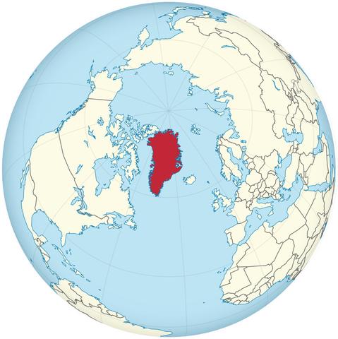
Mercator Misconceptions - Clever Map Shows the True Size of Countries [Especially In High Latitudes]
--
https://www.visualcapitalist.com/mercator-map-true-size-of-countries/ <-- shared technical article
--
https://equal-earth.com/ <-- shared Equal Earth map projection details [the poster’s recommended global projection for many use cases]
--
[note the ‘true’ size of high latitude landmasses like Greenland and Canada (and Russia as well); note also that the Mercator Projection was not / is not a ‘tool of colonialism’, geopolitics or the like, it was/is ‘simply’ a very clever projection to aid in marine navigation]
#GIS #spatial #mapping #projection #Greenland #Canada #Russia #size #landarea #projection #mapprojection #JustSayNoToGallPeters #equalarea #Mercator #marine #nautical #navigation #spheroid #globe #area #shape #direction #equalearth #Africa #rhomb #rhomblines
--
https://www.visualcapitalist.com/mercator-map-true-size-of-countries/ <-- shared technical article
--
https://equal-earth.com/ <-- shared Equal Earth map projection details [the poster’s recommended global projection for many use cases]
--
[note the ‘true’ size of high latitude landmasses like Greenland and Canada (and Russia as well); note also that the Mercator Projection was not / is not a ‘tool of colonialism’, geopolitics or the like, it was/is ‘simply’ a very clever projection to aid in marine navigation]
#GIS #spatial #mapping #projection #Greenland #Canada #Russia #size #landarea #projection #mapprojection #JustSayNoToGallPeters #equalarea #Mercator #marine #nautical #navigation #spheroid #globe #area #shape #direction #equalearth #Africa #rhomb #rhomblines