Create a Catchment Map in QGIS in 10 Minutes
https://videos.qwast-gis.com/w/mYgwkxJrX2LRR2CMYERxSd
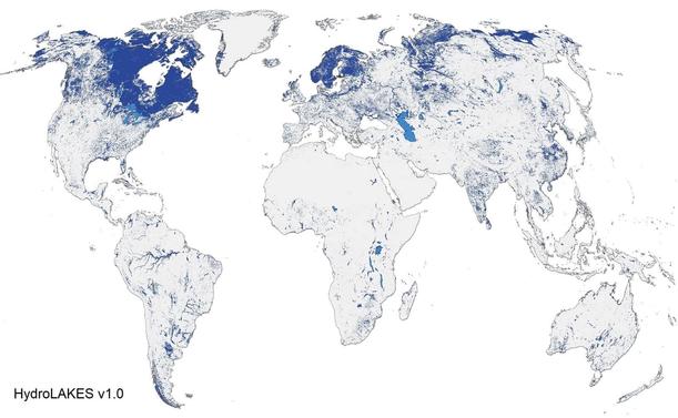
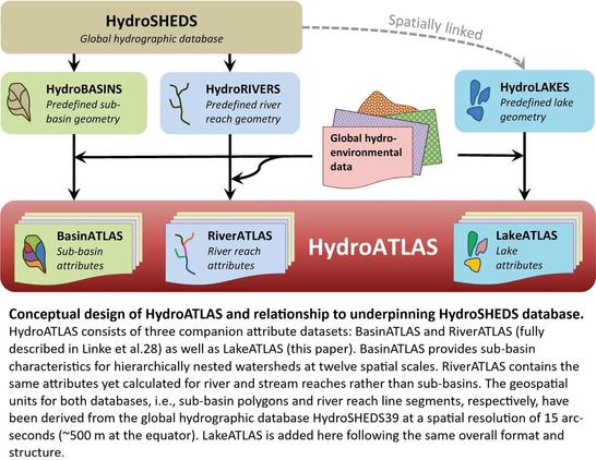
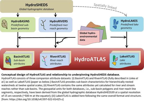
HydroATLAS offers a global compendium of hydro-environmental characteristics for all sub-basins of HydroBASINS, all river reaches of HydroRIVERS, and all lake polygons of HydroLAKES.