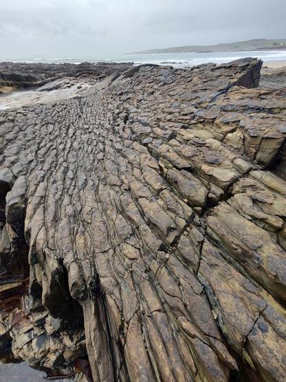
GaryLucas rock formations.
#speirgorm #spéirgorm #coast #corkCoast #coCork #westCork #WildAtlanticWay #ireland #irish #courtmacsherry #kinsale #mastodaoine #geology #Anticline #syncline
GaryLucas rock formations.
#speirgorm #spéirgorm #coast #corkCoast #coCork #westCork #WildAtlanticWay #ireland #irish #courtmacsherry #kinsale #mastodaoine #geology #Anticline #syncline
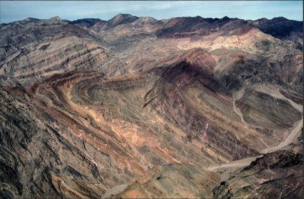
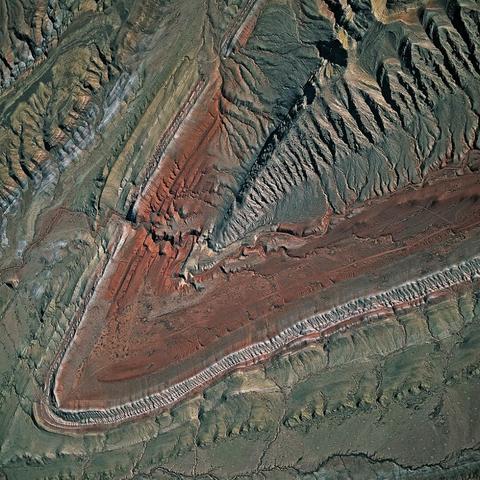
Titus Canyon, Death Valley
Titus Canyon is a narrow, winding, one-way, 4-wheel drive road that cuts through the Grapevine Mountains of Death Valley starting in Nevada off of Highway 194, and coming out in Death Valley, California. See the map at the link below. Note: the Titus Canyon road and parking lot at west end are currently closed. Check the park web site before you go: https://www.nps.gov/deva/planyourvisit/conditions.htm
Most of the rocks that make up the range are over half a billion years old - a very thick sequence of limestone/carbonate rocks formed at the edge of a warm tropical sea - the Bonanza King formation. Later, the sea regressed and the rocks were subjected to compressional forces with the formation of a subduction zone at the margin of California over 200 million years ago. The rocks were uplifted, faulted, folded, and in certain parts turned upside down. See the folds in the aerial below.
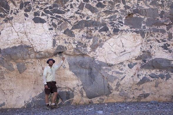
Another cool part of Titus Canyon is the famous Megabreccia. A breccia is a sedimentary rock composed of angular fragments of rock cemented in a fine-grained matrix. The picture is below. Geologist Shawn Willsey does a great job of showing these fantastic features in the quick video below.
The wild and bizarre rocks of Titus Canyon in Death Valley explained by a geologist: https://youtu.be/Om4sSy96dA0
Refer to the map here: http://digital-desert.com/death-valley/geology/titus-canyon.html#google_vignette
#DeathValley #TitusCanyon #Anticline #RecumbantFold #BonanzaKingFormation #geology #Science
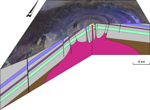
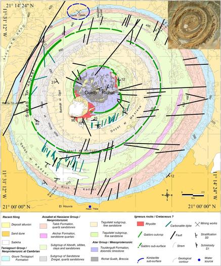
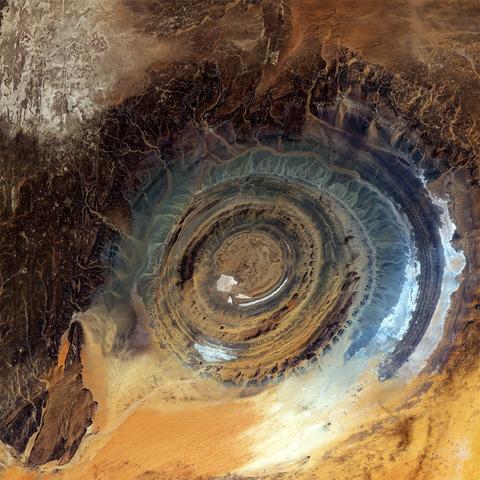
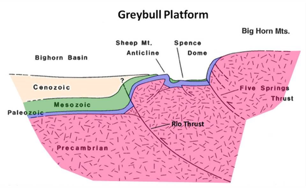
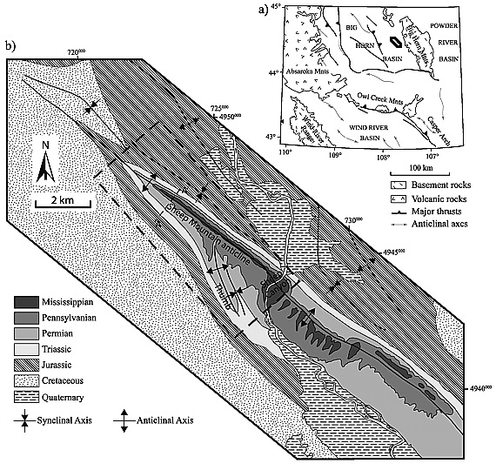
Sheep Mountain Anticline (Expand for all the geology goodness below)
During the Laramide orogeny (mountain building event) from 70 to 50 million years ago, crystalline basement rocks were faulted, uplifted, and folded. A very large 15-mile long concave fold called the Sheep Mountain Anticline was created. An anticline occurs when horizontal lying rocks have been folded downward and the oldest lie in the axis of the fold. Anticlines are good for trapping oil, and there is an oil and gas field in the vicinity.
Erosion has caused the oldest sandstone at the center of the anticline to be exposed in the mountain, surrounded by younger rock on both sides. This anticline is northwest-southeast trending, and plunges at both ends. There are other folds in the area, including synclines which fold upward on on both sides. Of note is the Bighorn River which has managed to cut a channel right through Sheep Mountain. Rivers can do this because their erosion keeps up with the uplift of the mountain.
Wyoming has seriously wild geology. Pinging @BoxcarMurphy
Aerial picture from: https://the-earth-story.com/post/620950885392121857/sheep-mountain-wyoming-a-classic-plunging
Cross-section from: https://www.geowyo.com/ancient-river-channel--sheep-mountain.html
Geology map from: https://agupubs.onlinelibrary.wiley.com/doi/full/10.1029/2010JB007650
#SheepMountainAnticline #anticline #syncline #LaramideOrogeny #BighornRiver #Wyoming #geology #ScienceMastodon
Listen to Anticline/Syncline on Resonate
Listen to Anticline/Syncline on Resonate


