@mfuhrmann Hm? Erst mal die Gebäude; auch den Übergang. Dann
#IndoorMapping der Stockwerke, Räume und Stützen. Gehen indoor da auch Tische? Die Regionen erst mal.
Weiter als
#MicroMapping für die Geleise und Modellgebäude?! Da in
#OpenStreetMap alles geht, geht auch alles in Miniatur. Was zeigen die 2D/3D Renderer da noch alles an? Terrain ist bei OSM ja noch mangelnd. Wie gehen in "echt" Tunnel und Berge? Selbst wenn 3D die height-tags berücksichtigt werden.
Die Standard-
#VectorTiles reichen jedenfalls nicht. Aber man kann ja Zusätzliche parallel generieren.
Das
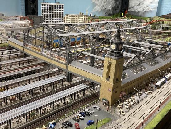
#MiWuLa wäre eine Schweine-Arbeit! Wenn sie helfen, mit Plänen und Dateien, wird es 50% leichter. Hat schon mal jemand von
#OSM mit denen gesprochen? Einfach mal fragen ...
Einige Teile sind ja 1:1 nach gebaut, also in OSM schon vorhanden. Könnte man kopieren.
Es gibt 3D Renderer, wo Autos fahren. Züge noch nicht, gell? Dafür FOSS-Bahn-Spiele. Und das dann in der VR-Brille - wild zu einem virtuellen Rundgang. Träum ...