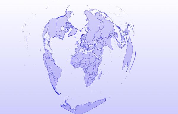
Today’s #30DayMapChallenge is all about projections.
Here’s the world through a heart-shaped projection, giving the map a creative twist the farther out you look.
Today’s #30DayMapChallenge is all about projections.
Here’s the world through a heart-shaped projection, giving the map a creative twist the farther out you look.
#30DayMapChallenge Day 19: Projections 🍊🌍
Ever tried peeling an orange and laying it flat? It cracks apart, just like the Earth when we project it onto a map.
So today I made a world map out of orange peel, styled in a polar stereographic projection. Made in #QGIS with #NaturalEarth data.

National Geographic has been using the Winkel-Tripel projection since 1998, and the Robinson projection for quite some time before that. You'll find those or Plate-Carrée, Hobo-Dyer, or (heaven forbid) Gall-Peters in more classrooms than Mercator. Unless you have a time machine. This Equal Area projection just seems like a modified Robinson projection. I'm going to say it… they're cowards. Be brave! Promote a truly beautiful projection. the Waterman Butterfly!
I bet most people can't even tell the difference between Robinson, Winkel-Tripel and Equal Area at a glance.
https://youtu.be/WHHciXeDM_A
https://www.reuters.com/world/africa/african-union-urges-adoption-world-map-showing-continents-true-size-2025-08-14/

Of course, we cartographers will never stop sharing this clip from the West Wing on occasions such as these:
"Why are we changing maps?"
https://www.youtube.com/watch?v=eLqC3FNNOaI
#PetersProjection #GallPetersProjection #GallPeters #Mercator #MercatorProjection #MapProjections #maps #cartography #CorrectTheMap

More about the #CorrectTheMap campaign is here: https://correctthemap.org/ and you can learn more about the #EqualEarthProjection here: https://equal-earth.com/equal-earth-projection.html
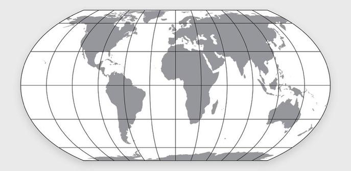
Map projections in the news! And we cartographers are all relieved that it's not the Gall-Peters Projection again. The newer Equal Earth Projection is a much better alternative to Mercator.
Via Reuters: "African Union urges adoption of world map showing continent's true size"
#maps #cartography #Africa #Mercator #EqualEarth #EqualEarthProjection #MapProjections #AfricanUnion
Kurzer SZ-Artikel über Kartenprojektionen, Vorteile, Nachteile und alte Gewohnheiten:
"Weltkarten verzerren Afrikas wahre Größe: Dagegen wehrt es sich jetzt" https://www.sueddeutsche.de/projekte/geschenk/einloesen?token=879b9a37-bb8d-4ee1-8649-0dcb4ae702dd
(Geschenk-Link)

@cjmoorehead Somebody needs to ask #TimWalz his favorite map projection.

