Back to topic.
Modelling has changed and improved a lot. Mostly due to more powerful computers allowing more brute force analysis. The math tools really haven't changed that much. Early commercial modelling included programs like #Surfer decades ago and used #Kriging, (#Gaussian peocess regression) of geostatistical data. Most current geospatial modelling uses this technique, often enhanced with #BayesianDataAnalysis (read the book by that name). So now the table is mostly set. 5/
QGIS Processing Toolbox tool for Variogram Modeling and Ordinary Kriging using GSTools
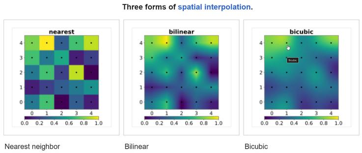
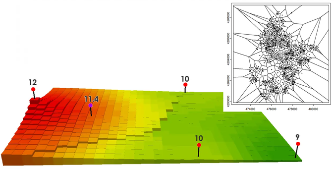
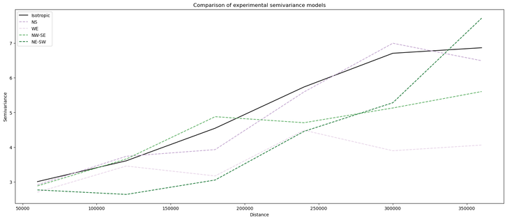
This tool automates variogram modeling and kriging within QGIS, providing a user-friendly interface for spatial interpolation.
#qgis #geostatistics #kriging #prediction #variogram #python #gstools #gstat
https://github.com/geosaber/geostat
GitHub - geosaber/geostat: QGIS Processing Toolbox tool for Variogram Modeling and Ordinary Kriging using GSTools

QGIS Processing Toolbox tool for Variogram Modeling and Ordinary Kriging using GSTools - geosaber/geostat

GitHub

"Antenna optimization using machine learning with reduced-dimensionality surrogates"

https://www.nature.com/articles/s41598-024-72478-w

#antenna #ML #particleSwarmOptimizer #PSO #kriging

Antenna optimization using machine learning with reduced-dimensionality surrogates - Scientific Reports

In modern times, antenna design has become more demanding than ever. The escalating requirements for performance and functionality drive the development of intricately structured antennas, where parameters must be meticulously adjusted to achieve peak performance. Often, global adjustments to geometry are necessary for optimal results. However, direct manipulation of antenna responses evaluated with full-wave electromagnetic (EM) simulation models using conventional nature-inspired methods entails significant computational costs. Alternatively, surrogate-based techniques show promise but are impeded by dimensionality-related challenges and nonlinearity of antenna outputs. This study introduces an innovative technique for swiftly optimizing antennas. It leverages a machine learning framework with an infill criterion employing predicted enhancement of the merit function, utilizing a particle swarm optimizer as the primary search engine, and employs kriging for constructing the underlying surrogate model. The surrogate model operates within a reduced-dimensionality domain, guided by directions corresponding to maximum antenna response variability identified through fast global sensitivity analysis, tailored explicitly for domain determination. Operating within this reduced domain enables building dependable metamodels at a significantly lower computational cost. To address accuracy loss resulting from dimensionality reduction, the global optimization phase is supplemented by local sensitivity-based parameter adjustment. Extensive comparative experiments involving various planar antennas demonstrate the competitive operation of the presented technique over machine learning algorithms operating in full-dimensionality space and direct EM-driven bio-inspired optimization techniques.

Nature
Tobler's First Law Of Geography
--
https://en.wikipedia.org/wiki/Tobler%27s_first_law_of_geography <-- link to wiki page
--
“The First Law of Geography, according to Waldo Tobler, is: "… everything is related to everything else, but near things are more related than distant things."..."
#GIS #spatial #mapping #geography #spatialanalysis #tobler #firstlawofgeography #distance #weighting #model #modeling #IDW #kriging #interpolation #extrapolation #spatialdependence #autocorrleation #algorithm #gischat #relationships #frictionofdistance #cost #economics #distancedecayeffect #fundamentalprinciples #causality
Tobler's first law of geography - Wikipedia

@marie_ahoi I did my dissertation using spatial data but it involved mortality and in the US that's outside of IRB (for this analysis anyway). For our large study of #COPD ( #COPDGene ) though the participants are present and protected by #HIPPA so - higher standard. I think that going forward we'll pull all of the shape files, do all of our #kriging and other work before we even think about merging the spatial identifiers. Now what does THAT grant look like??!

New release of #pyinterpolate! Version 0.3.5, and:

- the package is computationally stable (no more `LinAlgErrors` in #Kriging system, or even if they are raised, the users will know what went wrong),
- a lot of optimization,
- emphasis put on directional variograms.

#spatial #gis #python #opensource #openscience #datascience

The following steps: directional Poisson Kriging and more tutorials in the documentation.