The Growing Threat of Flooding on Transportation Infrastructure Across Texas Through 2100
--
https://doi.org/10.1029/2026EF008207 <--shared paper
--
H/T @Rakibul Ahasan
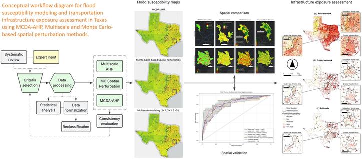
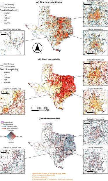
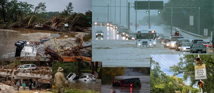
“[The researchers] modeled flood susceptibility across Texas at 30 m resolution and projected how it shifts through 2100. The headline is not just that flood risk grows, but that it moves, into places current planning and regulatory maps are not watching. The July 2025 Kerrville flooding sat squarely inside the kind of inland hazard expansion this model projects.
KEY TAKEAWAYS:
● 95% of new flood exposure by 2100 is inland, away from the coast, shifting the resilience problem into interior river basins that planning has historically deprioritized.
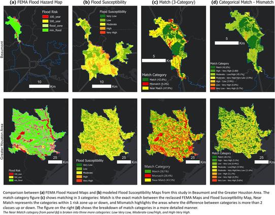
● Where [they] benchmarked against FEMA's National Flood Hazard Layer, the model flags substantial hidden risk in rapidly urbanizing peri-urban areas, most notably in Greater Houston.
● Climate change alone expands the flood-susceptible footprint by 10–12% by 2100, before any new road or land-use development, so this is a conservative floor, not a ceiling.
● Half the state's roads and rail and 80% of its bridges already sit in flood-susceptible zones today.
● [They] accounted for both factor-importance and spatial-scale uncertainty, using a Monte Carlo weight-perturbation ensemble and multiscale analysis across nested neighborhoods.
The practical takeaway: this is a statewide screening layer, not a replacement for site-level hydraulic studies. It shows planners and policymakers where the gap between today's protection and tomorrow's risk is widest, and where unmapped peri-urban growth is walking into exposure that regulatory maps still call safe…”
#water #hydrology #hydrography #extremeweather #flood #flooding #Texas #TX #USA #transportation #infrastructure #humanimpacts #risk #hazard #cost #economics #floodsusceptibility #GIS #spatial #mapping #raster #elevation #modeling #model #spatialanalysis #planning #regulation #warning #Kerrville #hazardmapping #floodexposure #inland #coast #urban #urbanisation #development #growth #Houston #lowlying #climatechange #landuse #development #geostatstics #MonteCarlo #regionalscreening #naturalhazard #infrastructureresilience #floodmapping #hydrogeomorphology #geomorphometry #aginginfrastructure