Oh nun kann auch #osmand 3D Gebäude 
https://osmand.net/blog/osmand-android-5-3-released/#3d-buildings
Zwar nur LOD1 aber immerhin!
Researchers created the GlobalBuildingAtlas, a high-resolution #3Dmap of all buildings worldwide. 🌍 The data enables more acurate #urbanplanning, #disastermanagement and #infrastructuredevelopment: http://go.tum.de/160500
📷Earth System Science Data

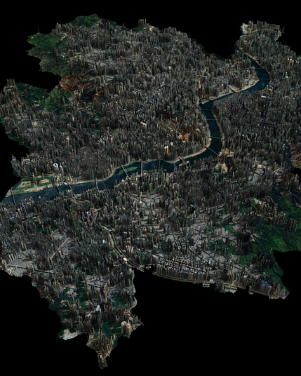
Aerialod insomniac night is soooo back! 🇰🇷
Getting ready for #30DayMapChallenge!
#QGIS #3Dmap #Aerialod #OpenStreetMap
🌍 Globe View is live!
See your train (and ferry) trips from a whole new angle – on an interactive 3D globe.
Zoom, rotate, explore your routes across continents and coastlines. A fresh perspective on your travels.
#viaduct #GlobeView #3DMap #TrainTravel #MyTrainMap
See your train (and ferry) trips from a whole new angle – on an interactive 3D globe.
Zoom, rotate, explore your routes across continents and coastlines. A fresh perspective on your travels.
#viaduct #GlobeView #3DMap #TrainTravel #MyTrainMap


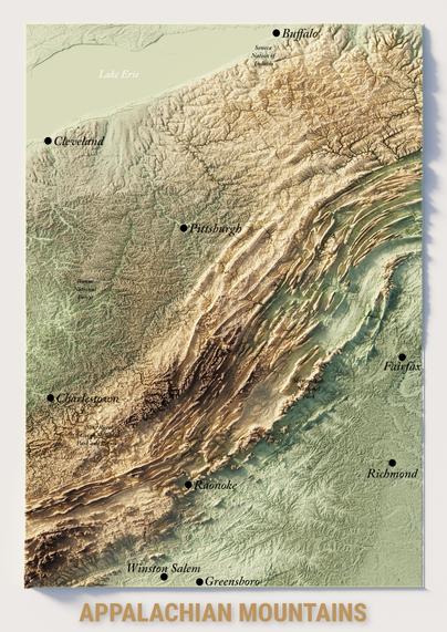
United States: the annotated version of Appalachian mountains :)
#Map #Mapping #3Dmap #Blender #BlenderMap #USA #Appalachian #Carte #Cartographie #3D #QGIS #SRTM #Beauty #Landscape
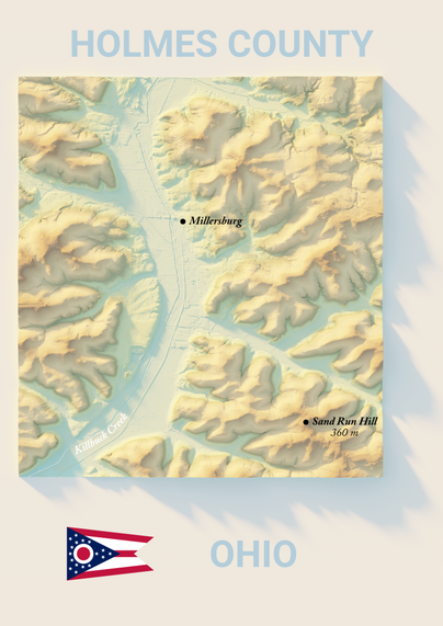
Other map, but still Millersburg :) This time, we are (really) in Ohio. Very different landscape 🌏
Datas are not as clean as the precedent map but it's still quite good 📍
#Map #3DMap #Ohio #USA
#Blender #QGIS #BlenderMap
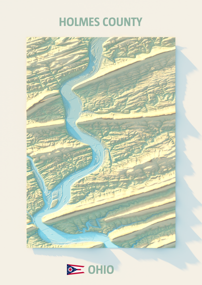
#blender3d #cartographie #mapping #carto #colors
😀 Quite happy with this color ramp for a 3D map. Here, we have a terrain in Ohio, in Holmes County. Very surprising landscape ⛰️
🙂 Assez content de ce dégradé de couleurs pour une carte 3D. Ici, nous avons un terrain dans l’Ohio, dans le comté de Holmes. Paysage très surprenant 🌎
#Map #3DMap #Ohio #USA #Blender #QGIS #BlenderMap #blender3d #cartographie #mapping #carto #map #colors
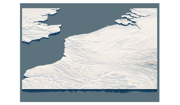
Une carte du sud de la Bretagne, avec un effet relief grâce à Blender 🗺️
A map of southern Brittany, with a relief effect thanks to Blender
Projet en cours. Mauvaise projection, mais c'est pas grave, on va refaire 🗺️
Cesium’s New 3D Map of the Moon Will Help Plan Future NASA Missions https://petapixel.com/2024/08/08/cesiums-new-3d-map-of-the-moon-will-help-plan-future-nasa-missions/ #Technology #science #Space #3dmap #News #moon #NASA #lro #3d
