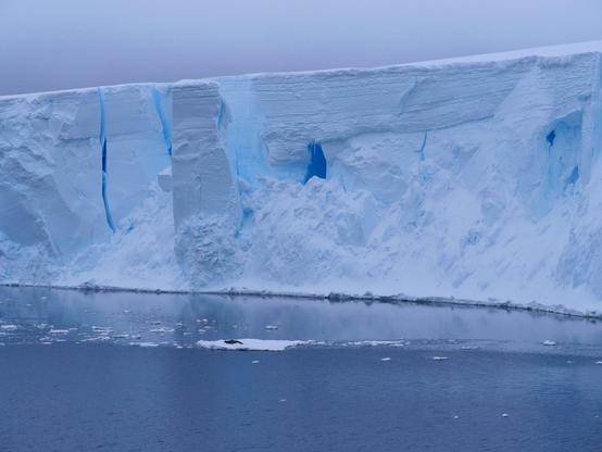
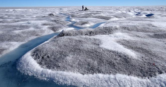
Here is a link to a thread I posted previously summarising some key findings from research conducted by the International Thwaites Glacier Collaboration.
https://fediscience.org/@PoLaRobs/115441900033252024
#WorldDayOfGlaciers
#Glacier
#sealevel
Visual poetry: Footsteps and tyretracks (at about 03:20)

When the Shoulders Of Giants are too high, scientists overlook observations on the ground. In this case, satellite-derived gravity models and altimeters, and the computer simulations they got fed into, mis-measure and miscalculate coastal land elevation and sea level.
https://www.nature.com/articles/s41586-026-10196-1
The 2 sea level models most commonly used for hazard evaluation underestimate MOST local sea levels by one to several metres, the rest of the coasts are experiencing less than half a meter more than the models told us, and then there are regions where sea level is lower than in the common models. These regions are in the #Arctic and #Antarctic. And in the Mediterranean, go figure! (So yay, your coasts are higher than previously thought, dear Greece and Italy, but increasing destruction during flooding in winter storms makes up for this.)
This mis-informs policy makers and engineers wrt adaptation – and its funding. Money is especially relevant because the biggest under-estimate is in SE-Asia.
Interestingly, the North American #Atlantic coast shows zero discrepancy. But I reckon, this is due to the model used ( 🙈 ) for the comparison, and how this model has a completeness-bias toward the N-Am East Coast.
Whoops‼️Most sea level calculations are flawed, and our coastal population centers may be more screwed than thought…
“…more than 99% of the evaluated impact assessments handled sea-level and land elevation data inadequately, thereby misjudging sea level relative to coastal elevation. Based on our literature evaluation, 90% of the hazard assessments assume coastal sea levels based on geoid models, rather than using actual sea-level measurements. Our meta-analyses on global scale show that measured coastal sea level is higher than assumed in most hazard assessments…” #SeaLevel #Environment #ClimateChange #GlobalWarming #ClimateCrisis #ClimateEmergency #CoastalLiving #migration
Committee on Earth Observation Satellites (CEOS) - Fleet - 2026 🛰️
#Atmospheric/oceanIndicators #ClimateIndicators #EarthInformationCenter #EarthScience #Oceans #Orbit #Satellite #SeaLevel
⏩ 2 new pictures and 2 new videos from NASA (SVS) https://commons.wikimedia.org/wiki/Special:ListFiles?limit=6&user=OptimusPrimeBot&ilshowall=1&offset=20260303125705
10) In a devastating climate milestone, Svalbard lost 1% of its total glacial ice during a single record-shattering heatwave in 2024. The Norwegian archipelago is warming faster than nearly anywhere on Earth. Scientists warn these extreme melt events are accelerating, with alarming consequences for global sea levels and fragile Arctic ecosystems.
#Svalbard #ClimateChange #GlacialMelt #Heatwave #ArcticWarming #SeaLevel #Norway #ClimateEmergency #Rorshok #ArcticUpdate